Plizio Visual Lab
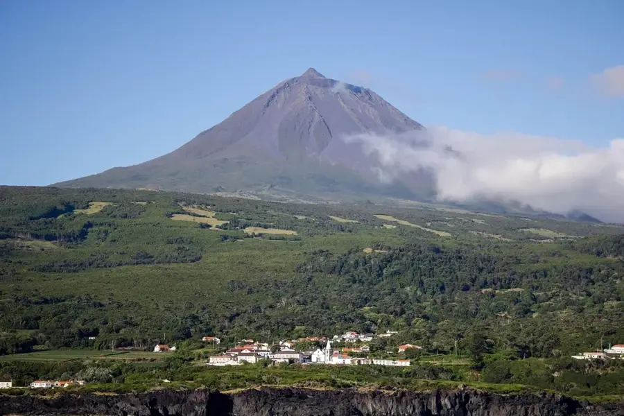
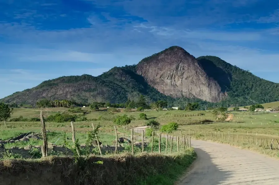
Pico de São Pedro

Pico de São Pedro is one of the first distinctive mountain shapes you see when approaching the capital, São Tomé, from the interior of the island. It belongs to the Mé-Zóchi district and marks the beginning of the central mountain massif. Although not among the highest peaks, its proximity to the urban zone and its visible presence are significant. The mountain is of volcanic origin, formed by basaltic lava flows that are now covered by a thick layer of fertile soil. Its slopes are a mixture of dense forest, small agricultural plots, and the outskirts of villages. It acts as an important watershed, feeding several small streams that are important for the water supply of the surrounding areas. For the residents of the capital, it is a familiar sight and a symbol of the island's green, mountainous heart.
- Location: São Tomé & Príncipe
- Top sights: Caminho Novo, São Tomé and Príncipe · Bombom, São Tomé and Príncipe · Almeirim, São Tomé and Principe
- Nearby: Quinta da Favorita (4 km)
Best time to visit & climate
The most pleasant time to visit is Jul–Sep.
| Jan | Feb | Mar | Apr | May | Jun | Jul | Aug | Sep | Oct | Nov | Dec | |
|---|---|---|---|---|---|---|---|---|---|---|---|---|
| Avg °C | 27 | 28 | 28 | 28 | 27 | 26 | 25 | 25 | 26 | 26 | 27 | 27 |
| Rain mm | 125 | 115 | 162 | 176 | 129 | 44 | 23 | 19 | 35 | 100 | 142 | 130 |
📋 Practical info
Geography
Facts
- Considered the 'gateway' to the central highlands of São Tomé.
- Named after Saint Peter, an important saint in Catholicism.
- The slopes are relatively easy to access and are used for hiking.
- The forests are rich in edible wild plants and fruits.
- The mountain influences the local weather by 'catching' rain clouds.
- From its summit, there is a good view of the city and the airport.
- The geological structure consists of layers of basalt and pyroclasts.
Explore nearby
Notable places around
Route planner — Car & Motorhome
Where do you start? We build the route here, with stops and country notes along the way.
© OpenStreetMap contributors · OpenRouteService
Sights in the town Pico de São Pedro (3)
Sights nearby
Frequently asked questions
How do you reach Pico de São Pedro?
Is the trail to the summit marked?
Are there any dangerous wild animals?
Can you camp there?
Is Pico de São Pedro accessible in winter?
Pico de São Pedro: where is it located?
Pico de São Pedro: what is there to see?
Pico de São Pedro: when is the best time to visit?
Pico de São Pedro: why is it worth visiting?

Nearby cities


Nature
More places