Plizio Visual Lab
Enewetak

ℹ️Practical info — Enewetak
▾
🌤 Weather — 5 days
📍 Nearby
Sights nearby
💡 Tips
- Bring all necessary supplies, as local shops have very limited stock.
- Drinking water is primarily from rain catchment; conserving water is essential.
- Respect the restricted areas and remnants of past testing facilities.
- Sun protection is crucial due to the intense equatorial sun.
- Arrange your transportation well in advance, as flights or boats are infrequent.
🍽 Food
Freshly caught reef fish prepared in local homes or small eateries.
The safest and most refreshing drink available on the island.
A traditional staple food, often chewed for its sweet juice.
🛍 Shopping · 🧘 Quiet spots
Available at the small community store; stock depends on recent supply ships.
Sometimes offered by residents, featuring woven palm fronds.
A vast and quiet lagoon with clear waters, convenient for reflective walks.
Unspoiled sandy stretches first-rate for solitude, though swimming might be restricted in some areas.
Water temperature…
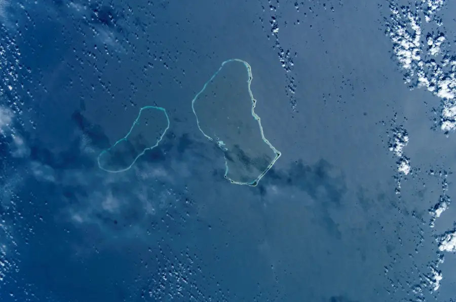
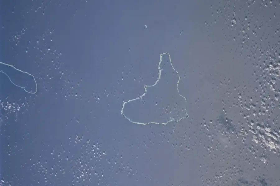
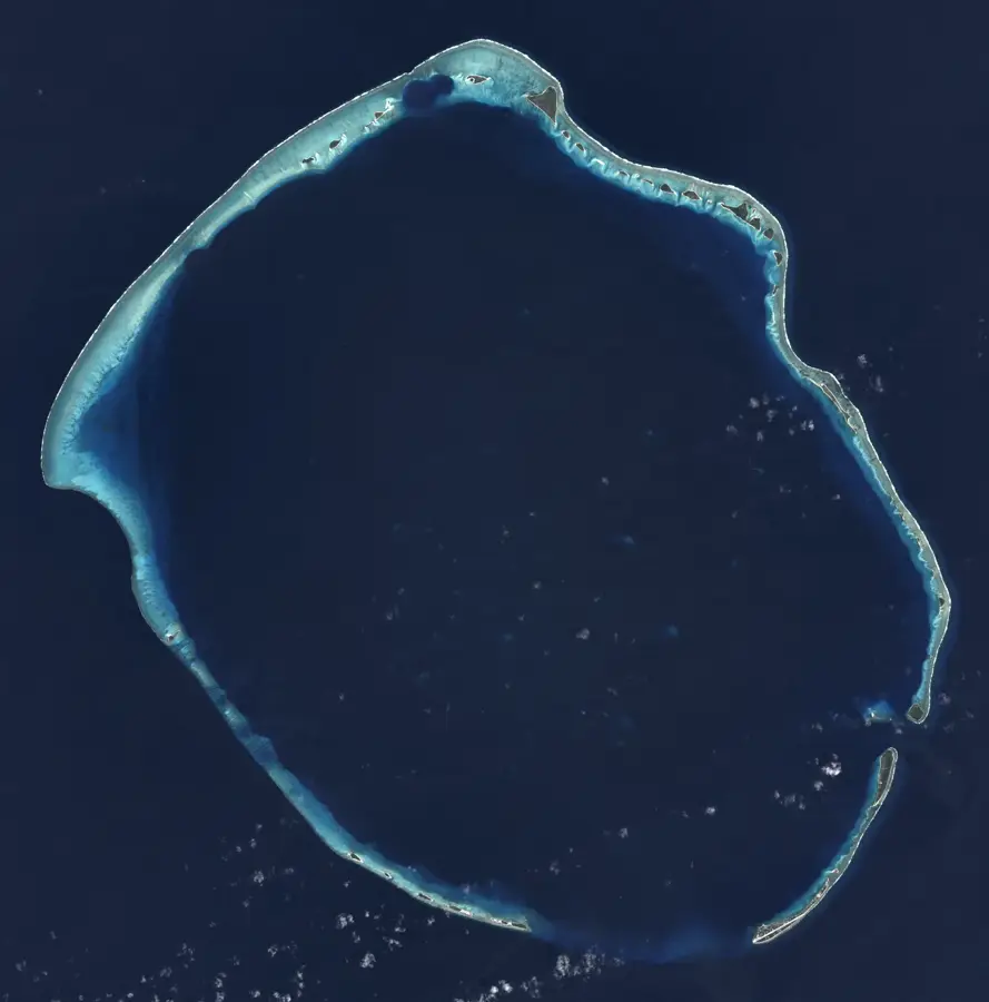
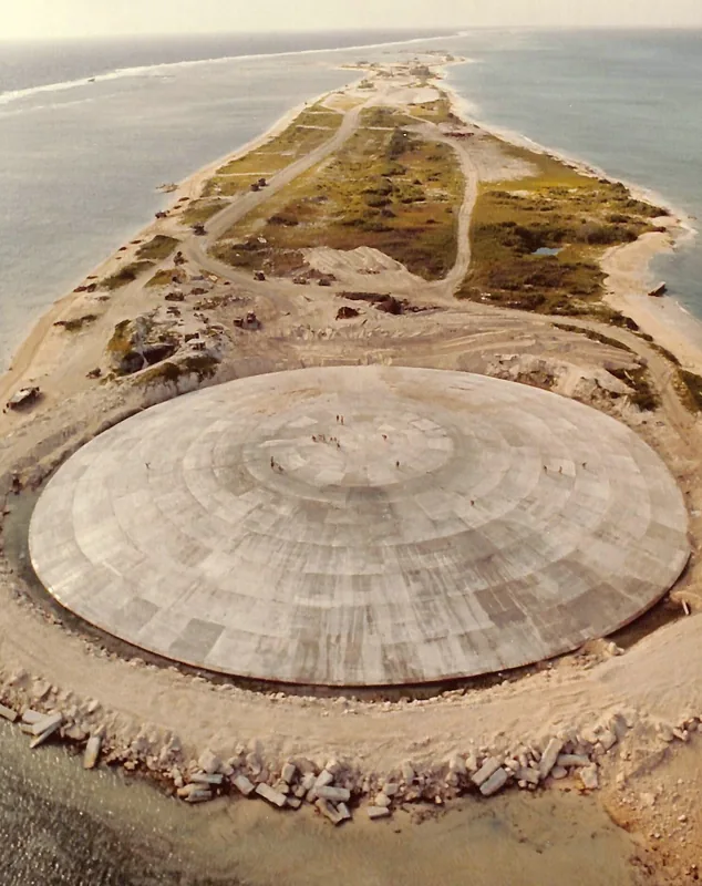
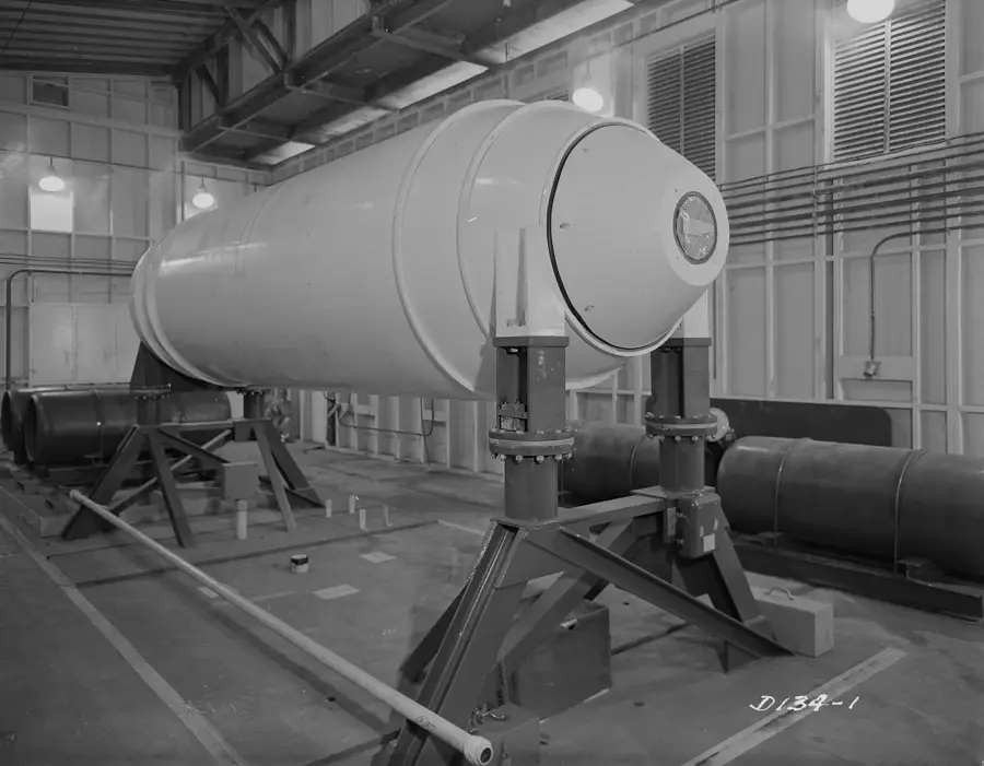
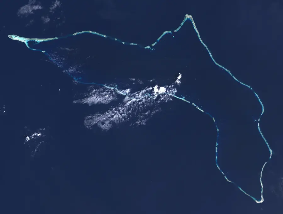
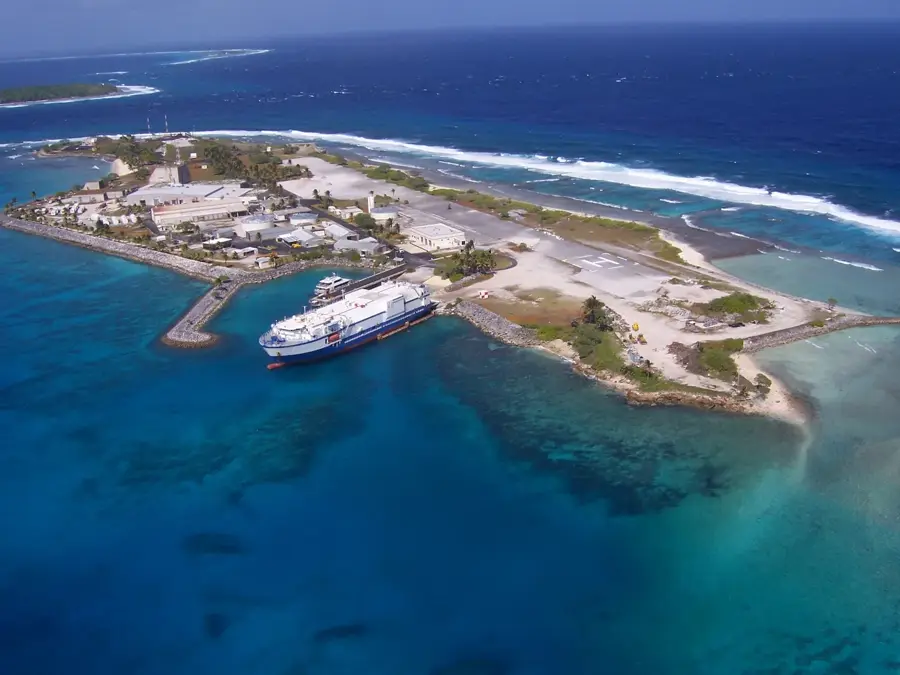
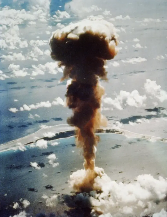
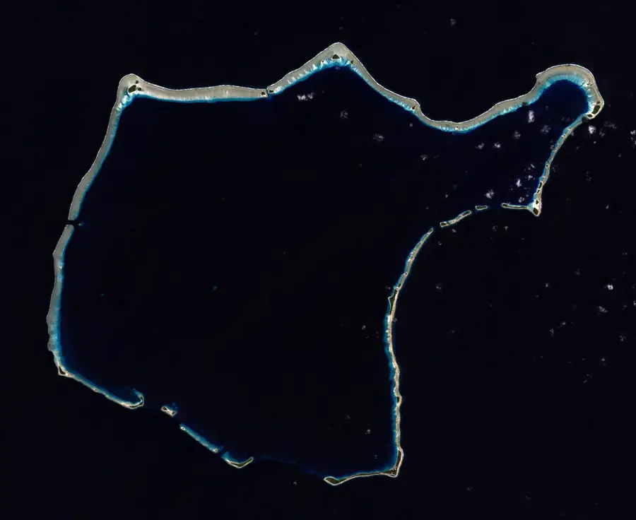
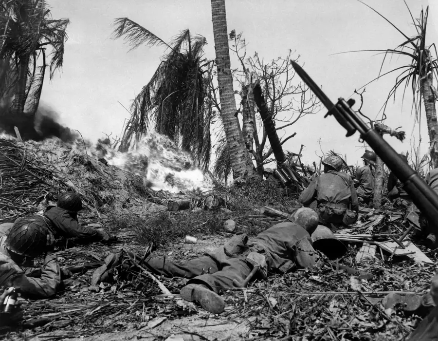
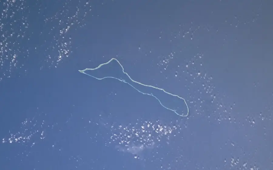
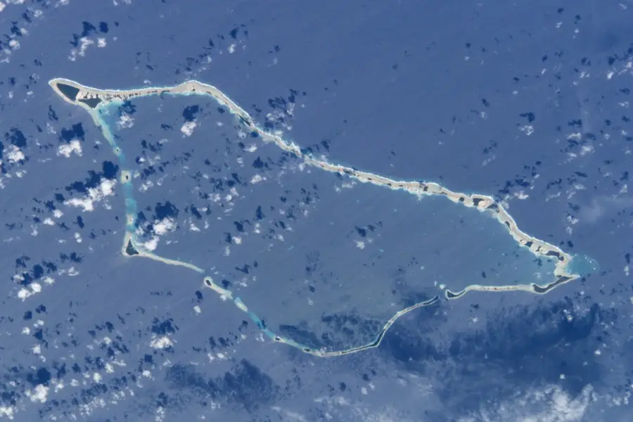
Enewetak is a remote coral atoll in the Ralik Chain of the Marshall Islands, etched into global history as a primary site for U.S. nuclear testing. Between 1948 and 1958, the atoll witnessed 43 nuclear detonations, which fundamentally altered its physical structure and displaced its native inhabitants for decades. The most significant landmark from this period is the Runit Dome (also known as the Cactus Crater), a massive concrete sarcophagus built to contain radioactive soil and debris on Runit Island. Following extensive decontamination efforts by the U.S. government, resettlement began in 1980, with people returning to the safer southern islands of the atoll. Today, the small community lives in a resilient settlement, relying on fishing and subsistence farming while facing the dual challenges of lingering radiological concerns and rising sea levels. Enewetak remains a powerful symbol of Cold War environmental impact and the ongoing struggle for island sovereignty and climate justice in the Pacific.
Best time to visit & climate
The most pleasant time to visit is Jan–Mar.
| Jan | Feb | Mar | Apr | May | Jun | Jul | Aug | Sep | Oct | Nov | Dec | |
|---|---|---|---|---|---|---|---|---|---|---|---|---|
| Avg °C | 27 | 27 | 27 | 28 | 28 | 28 | 28 | 28 | 28 | 28 | 28 | 28 |
| Rain mm | 34 | 32 | 36 | 62 | 75 | 75 | 126 | 162 | 161 | 200 | 121 | 54 |
Geography
Facts
- Consists of 40 small islets
- Lagoon area of approx. 1,000 km²
- Site of 43 nuclear weapon tests
- First hydrogen bomb test (1952)
- Runit Dome stores radioactive debris
- Population is about 300 people
Explore nearby
Notable places around
Route planner — Car & Motorhome
Where do you start? We build the route here, with stops and country notes along the way.
© OpenStreetMap contributors · OpenRouteService
Sights in the town Enewetak (1)
Frequently asked questions
Can Enewetak be visited?
What is Enewetak known for?
Are there tourist facilities?
Is it safe there?
Is a stay for travelers possible?
Enewetak: where is it located?
Enewetak: when is the best time to visit?
Enewetak: why is it worth visiting?

Nearby cities


History & landmarks
Nature

More places