Plizio Visual Lab
Namu Atoll
Weather…
Water temperature…
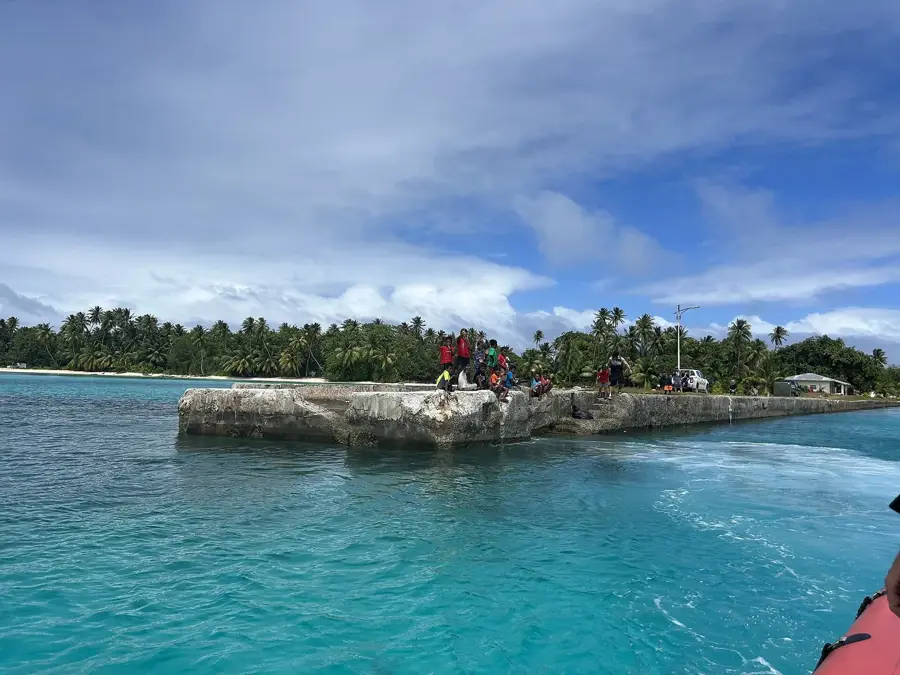
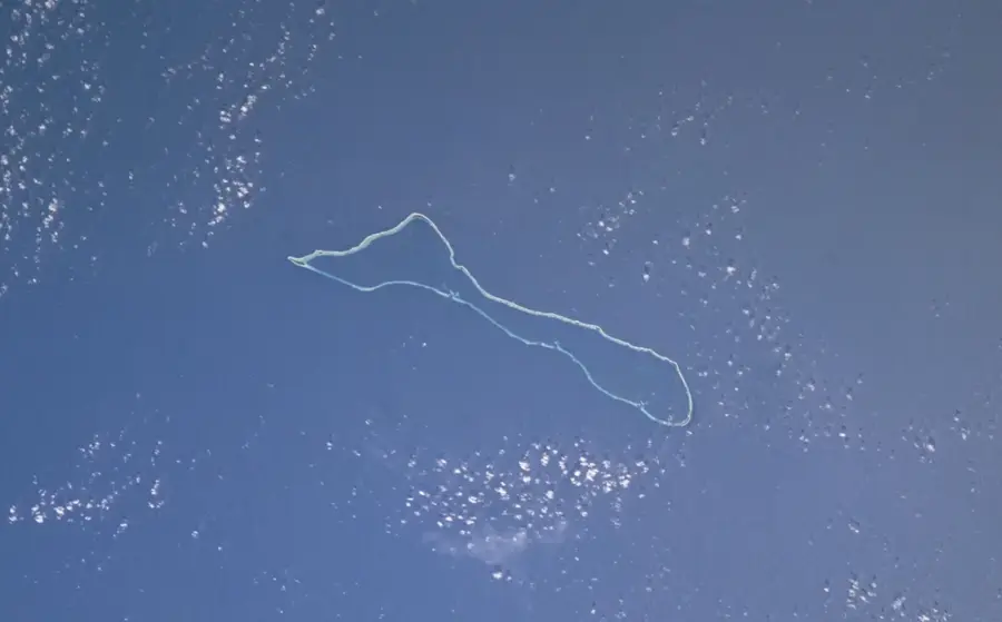
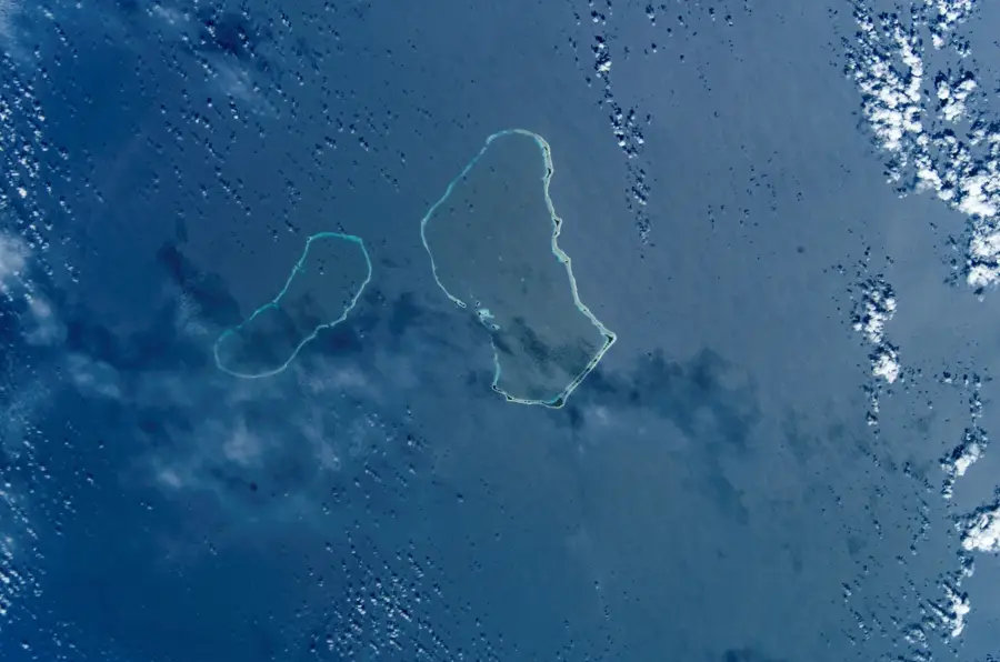
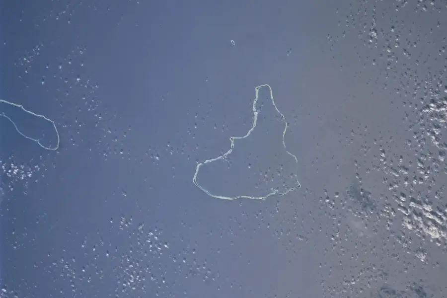
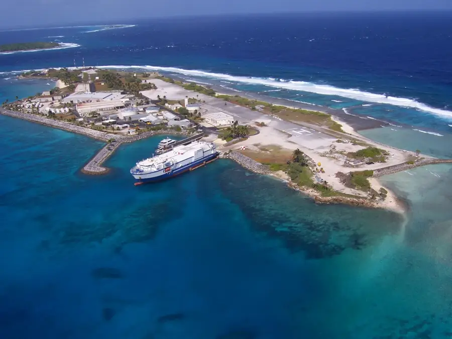
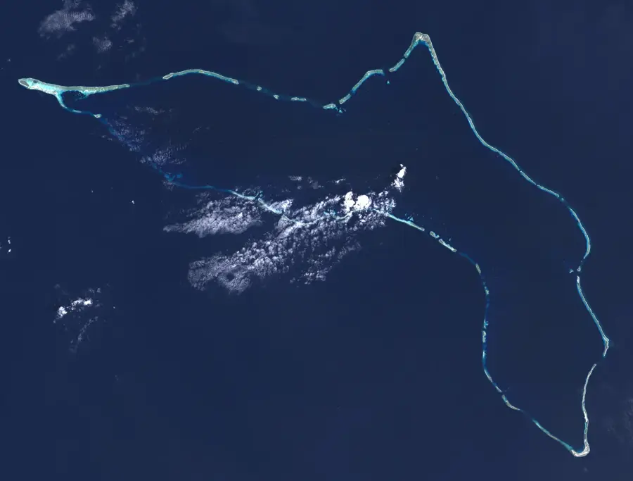
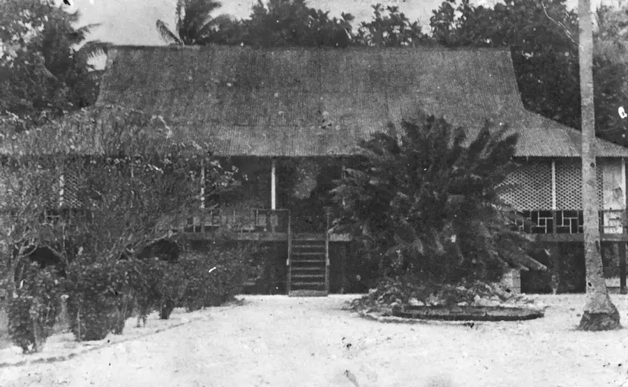
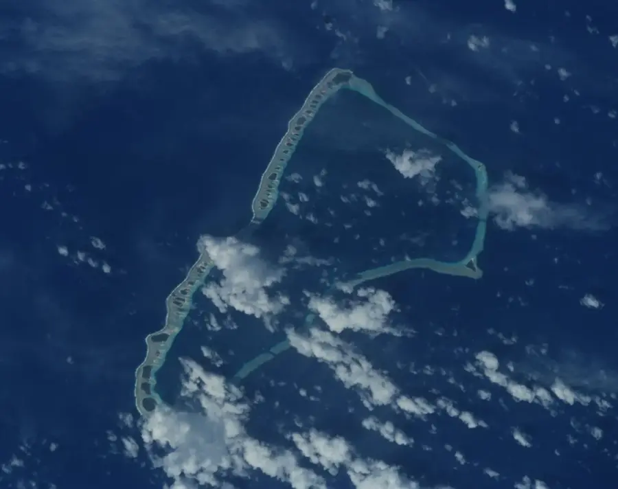
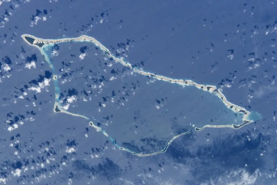
Namu Atoll is a remarkable coral formation in the Ralik Chain of the Marshall Islands, consisting of 54 distinct islets surrounding a massive 397-square-kilometer lagoon. The atoll's geography is defined by several deep-water passes that connect the tranquil interior waters with the powerful Pacific Ocean, creating a nutrient-rich environment for spectacular coral reefs. This marine biodiversity makes Namu a vital habitat for various species of sharks, rays, and sea turtles. The local population is primarily concentrated on a few larger islets, where copra production serves as the main economic activity alongside artisanal fishing. Namu has a storied history of traditional Marshallese voyaging, with the lagoon serving as a training ground for master navigators who used wave patterns and stars to cross the vast ocean. The remote nature of the atoll has preserved its pristine environment, offering a glimpse into the traditional Micronesian way of life. Today, Namu remains a sanctuary for Pacific wildlife and a testament to the resilience of island cultures living in harmony with the sea.
- Location: Marshall Islands
- Nearby: Namu (24 km)
Best time to visit & climate
The most pleasant time to visit is Jan–Mar.
| Jan | Feb | Mar | Apr | May | Jun | Jul | Aug | Sep | Oct | Nov | Dec | |
|---|---|---|---|---|---|---|---|---|---|---|---|---|
| Avg °C | 28 | 28 | 28 | 28 | 28 | 28 | 28 | 28 | 28 | 28 | 28 | 28 |
| Rain mm | 106 | 99 | 118 | 182 | 188 | 163 | 196 | 188 | 212 | 235 | 236 | 174 |
📋 Practical info
Geography
Facts
- land area: 6.3 km²
- number of islands: 54
- lagoon area: 397 km²
- maximum lagoon depth: 55 m
- population: approx. 760
- highest elevation: 2 m above sea level
Explore nearby
Notable places around
Route planner — Car & Motorhome
Where do you start? We build the route here, with stops and country notes along the way.
© OpenStreetMap contributors · OpenRouteService
Sights nearby
Frequently asked questions
What does Namu Atoll offer?
Are there shopping opportunities?
How is the beach?
What do you need for the journey?
Is there electricity?
Namu Atoll: where is it located?
Namu Atoll: when is the best time to visit?
Namu Atoll: why is it worth visiting?

Nearby cities


History & landmarks

Nature


More places