Plizio Visual Lab
Malibamat'so River
Weather…
Water temperature…
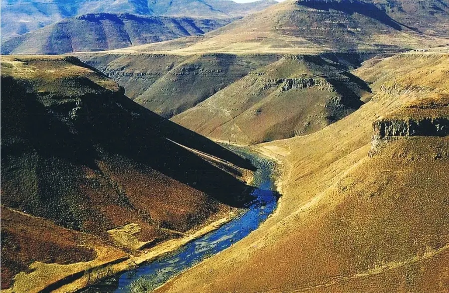
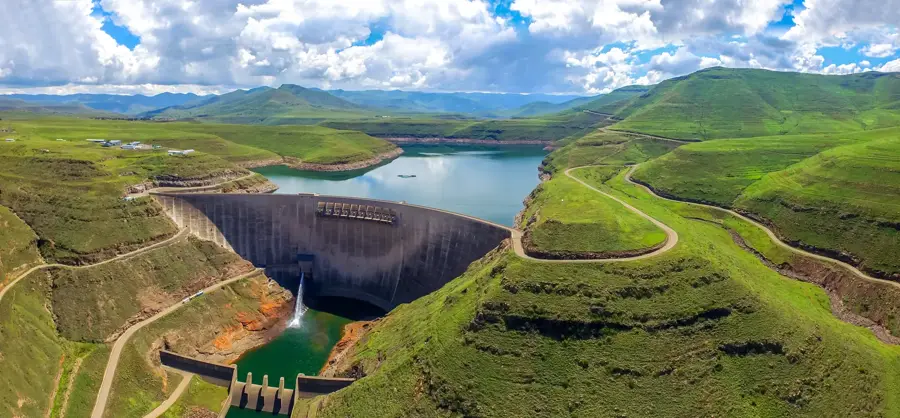
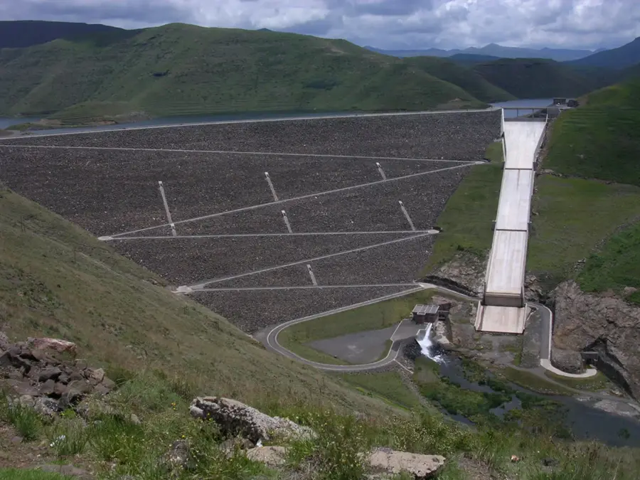
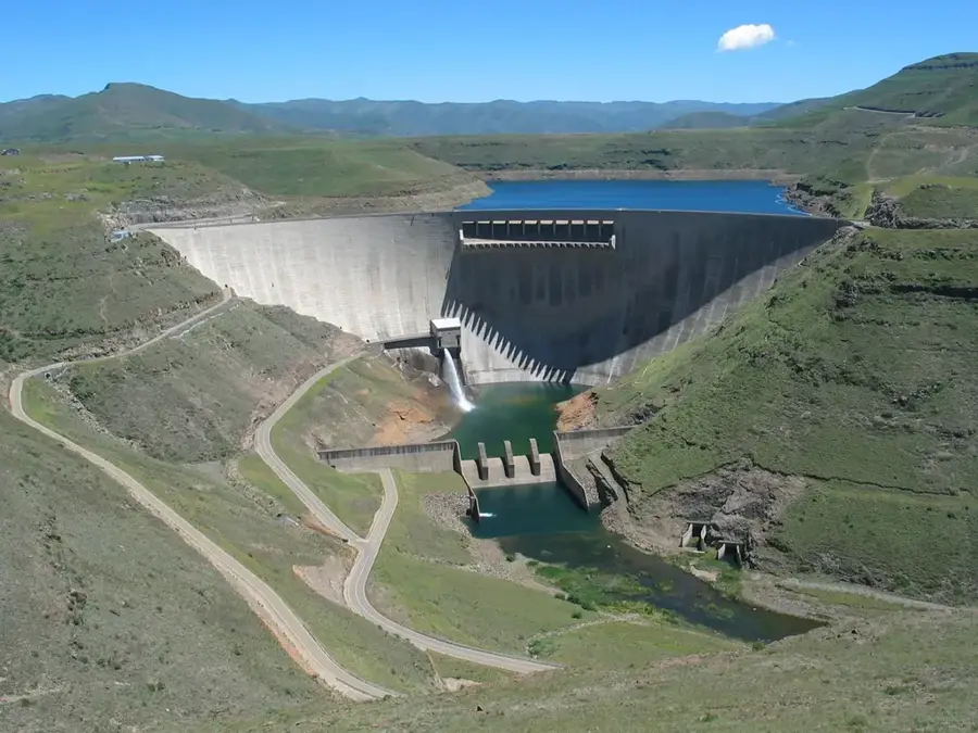
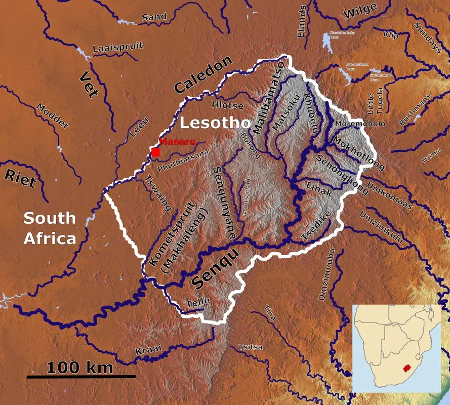
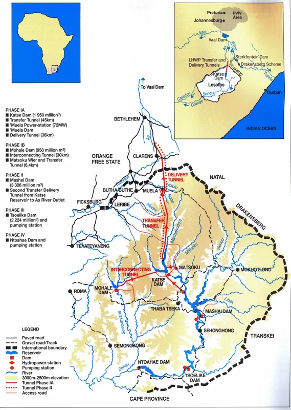
The Malibamat'so River is a major watercourse in northern Lesotho and a vital tributary of the Senqu (Orange) River. Originating on the slopes of the Maloti Mountains, it flows southward through deeply incised canyons. Today, the river is best known for its role in the Lesotho Highlands Water Project, as it feeds the Katse Dam, which forms the largest reservoir in the country. Before the dam's construction, the river was a wild, pristine waterway renowned for its trout populations and rugged natural beauty. Geologically, the Malibamat'so traverses thick layers of basalt rock, resulting in a spectacular topography of steep cliffs and narrow valleys. The river's water is of exceptional purity, representing a vital resource for hydroelectric power generation and regional water supply in South Africa. The river's surroundings host a variety of alpine plant species adapted to the extreme climatic conditions of the high-altitude highlands.
- Location: Lesotho
- Nearby: Katse (7 km)
Best time to visit & climate
The most pleasant time to visit is Sep–Nov.
| Jan | Feb | Mar | Apr | May | Jun | Jul | Aug | Sep | Oct | Nov | Dec | |
|---|---|---|---|---|---|---|---|---|---|---|---|---|
| Avg °C | 15 | 15 | 13 | 9 | 6 | 3 | 3 | 5 | 9 | 12 | 14 | 15 |
| Rain mm | 216 | 182 | 119 | 67 | 17 | 12 | 12 | 22 | 30 | 81 | 115 | 176 |
📋 Practical info
Geography
Facts
- The primary inflow for the Katse Reservoir, Lesotho's largest dam.
- Originates near Mont-aux-Sources in the rugged Maloti Mountains.
- The name translates from Sesotho roughly as 'place of salty waters'.
- The river's flow was significantly altered by the Katse Dam, completed in 1996.
- A notable habitat for introduced rainbow trout species.
- Carries water from the northern highlands southward to the Senqu River.
Explore nearby
Notable places around
Route planner — Car & Motorhome
Where do you start? We build the route here, with stops and country notes along the way.
© OpenStreetMap contributors · OpenRouteService
Sights nearby
Frequently asked questions
Can you go fishing in the Malibamat'so River?
What is the best way to reach the river?
What role does the river play for the Katse Dam?
When is the best time to visit the river valley?
Are there guided boat tours?
Malibamat'so River: where is it located?
Malibamat'so River: when is the best time to visit?
Malibamat'so River: why is it worth visiting?

Nearby cities

History & landmarks

Nature

More places