Plizio Visual Lab
Purmamarca
Weather…
Water temperature…
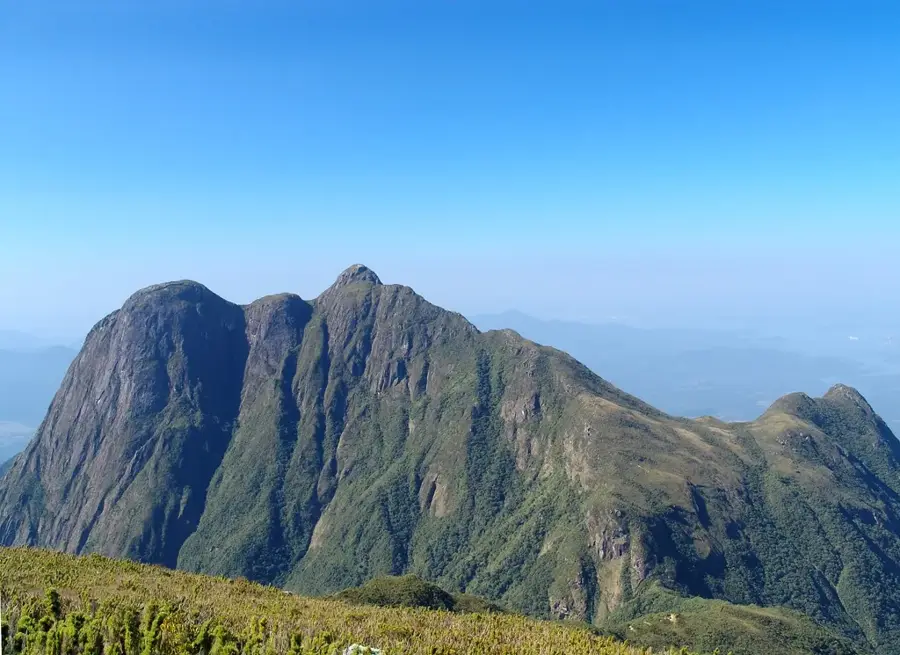
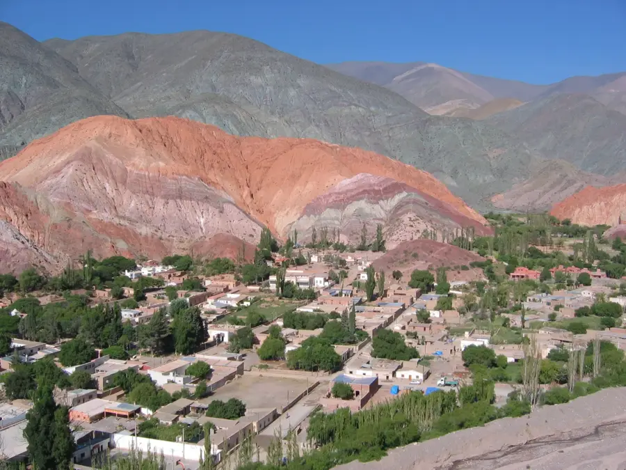
Purmamarca is located at an altitude of 2324 meters above sea level, at the southern entrance to the Quebrada de Humahuaca gorge. The settlement is characterized by low houses built of adobe and reinforced with cactus wood, alongside dusty streets. The village's biggest attraction is the Hill of Seven Colors (Cerro de los Siete Colores), whose rocks glow in different colors due to layers deposited over various geological eras. A short walking path, the Paseo de los Colorados, leads around the mountain, offering the best lighting conditions in the morning or late afternoon. The central square, Plaza 9 de Julio, hosts one of the most important artisan markets in the region. Here, locals sell traditional Andean textiles, weaves, ponchos made of llama wool, and ceramics. Next to the square stands the mid-17th century Santa Rosa de Lima church with its simple white facade, whose roof structure was made of cardon cactus wood. The village is a preserver of the traditional northern way of life, where the local community strictly protects the architectural heritage. Purmamarca lies along Route 52, which leads over the winding Cuesta de Lipán mountain pass to the Salinas Grandes salt flat. Due to the high-altitude air, visitors should acclimatize gradually and drink plenty of water. The winter months (June to August) are cold and dry, while the summer is rainier, making autumn and spring the most recommended times to explore the area.
- Location: Argentina
- Top sights: Cartel de Purmamarca · Cerro El Porito · Cerro de los 7 Colores
- Nearby: Palpalá (39 km)
Best time to visit & climate
The most pleasant time to visit is Sep–Nov.
| Jan | Feb | Mar | Apr | May | Jun | Jul | Aug | Sep | Oct | Nov | Dec | |
|---|---|---|---|---|---|---|---|---|---|---|---|---|
| Avg °C | 11 | 10 | 10 | 7 | 4 | 3 | 2 | 4 | 6 | 9 | 10 | 11 |
| Rain mm | 145 | 149 | 111 | 48 | 12 | 5 | 3 | 4 | 7 | 38 | 60 | 136 |
📋 Practical info
Geography
Facts
- Altitude 2324 meters
- Hill of Seven Colors
- Adobe architecture
- Artisan market
- Santa Rosa de Lima church
- Quebrada de Humahuaca entrance
- Paseo de los Colorados trail
- Entrance to Salinas Grandes
Explore nearby
Notable places around
Route planner — Car & Motorhome
Where do you start? We build the route here, with stops and country notes along the way.
© OpenStreetMap contributors · OpenRouteService
Sights in the town Purmamarca (8)
Sights nearby
Frequently asked questions
Purmamarca: where is it located?
Purmamarca: what is there to see?
Purmamarca: when is the best time to visit?
Purmamarca: why is it worth visiting?

Nearby cities