Plizio Visual Lab
Misere
ℹ️Practical info — Misere
▾
🌤 Weather — 5 days
📍 Nearby
Sights nearby
💡 Tips
- Visit the viewpoint at the Salazie Road junction for the best panorama over Eden Island.
- Ride bus route 14, which crosses the mountain pass and gives spectacular aerial views.
- Bring a light sweater; the elevation in Misere makes it noticeably cooler than the coast.
- Hike the mountain trails to see endemic flora and fauna away from the tourist beaches.
- Be very cautious when driving, as the roads are extremely steep and wind sharply.
🍽 Food
Local honey from mountain flowers, often sold directly from residents' houses.
A specialty from the nearby tea factory, widely available in local shops.
Spicy Creole snacks often sold at small stalls in the village center.
🛍 Shopping · 🧘 Quiet spots
Fresh cinnamon and cloves sourced from the surrounding forests.
Look for local varieties of fruit that are less common on the coast.
A peaceful spot to overlook the ocean and enjoy the mountain silence.
Secluded paths through the dense mountain forest, great for birdwatching.
Water temperature…
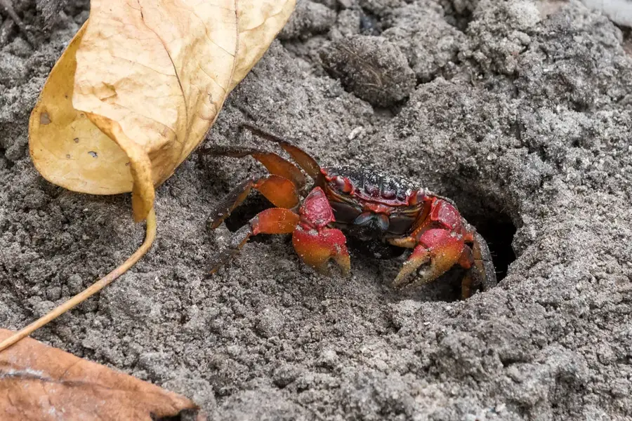
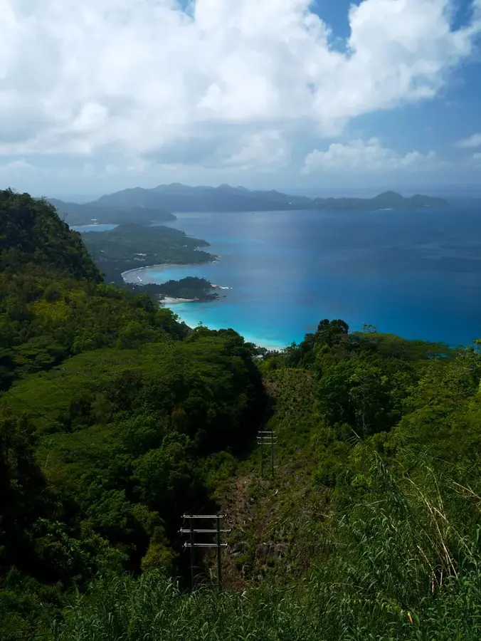
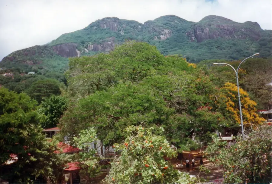
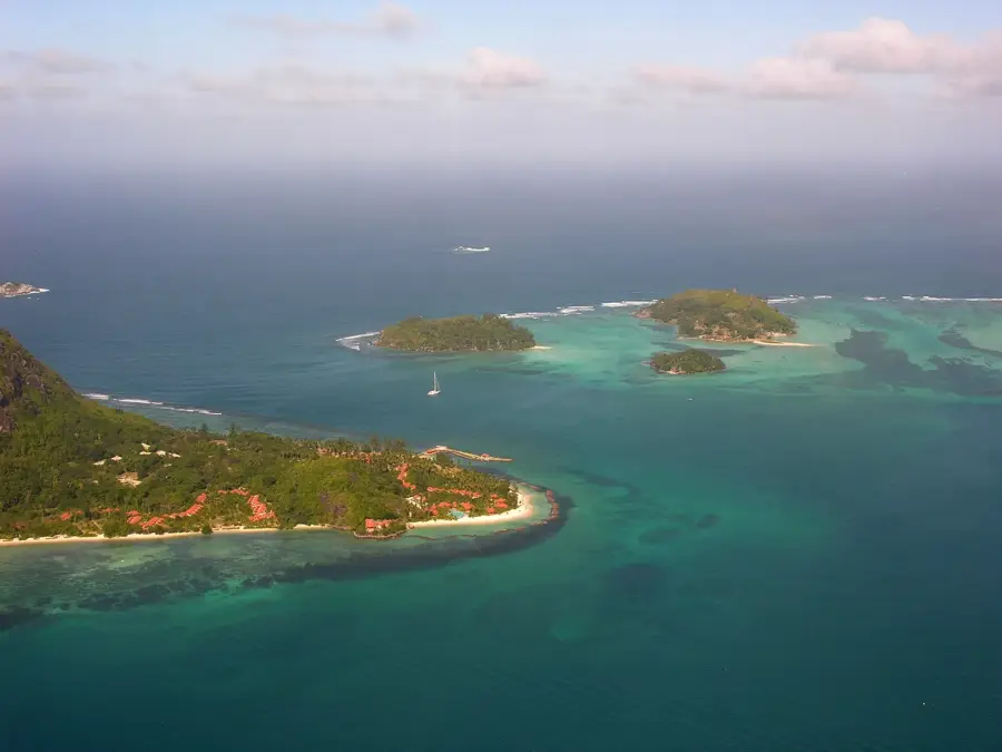
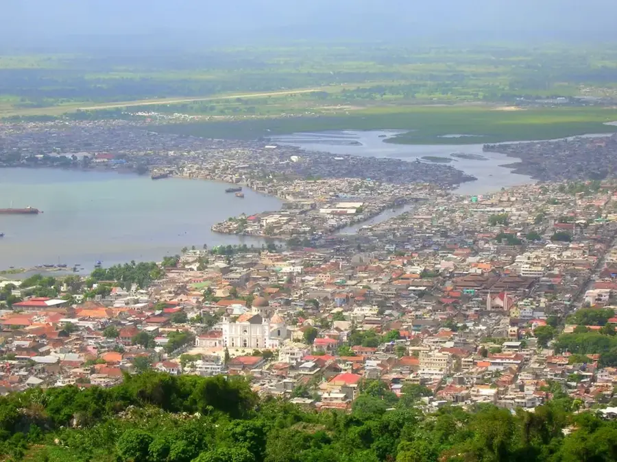
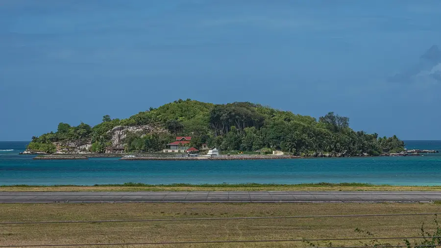
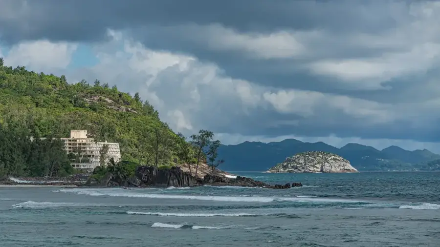
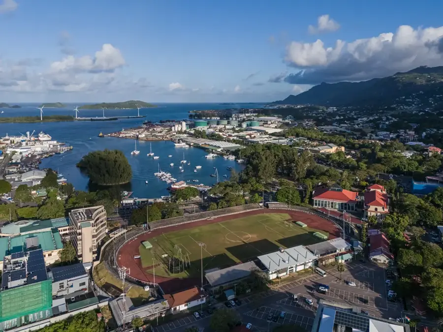
Misère lies on a mountain ridge in the central part of Mahé and features one of the most spectacular viewpoints on the island: from here one can see Victoria, the international airport, and the islands of Cerf, Ste. Anne, and Round. The somewhat gloomy-sounding name (French for "misery") recalls the difficult living conditions of the early settlers in this higher-lying region. Today Misère is a pleasant residential district with a cooler climate than the coast, temperatures are usually two to three degrees below those in Victoria. The main connecting road, Sans Souci Road, runs through Misère and links Victoria with Port Glaud across the mountainous interior. Characteristic are the dense forests of albizia, bilimbi, and cinnamon trees, as well as numerous springs, some of which contribute to the island's drinking water supply. The district also hosts a satellite tracking ground station once operated by NASA.
- Location: Seychelles
- Top sights: Fairview · La Misère Exotics Garden Centre · Eden Island viewpoint
- Nearby: Foret Noire (4 km)
- Population: ~4.140 (2025)
Best time to visit & climate
The most pleasant time to visit is Jun–Aug.
| Jan | Feb | Mar | Apr | May | Jun | Jul | Aug | Sep | Oct | Nov | Dec | |
|---|---|---|---|---|---|---|---|---|---|---|---|---|
| Avg °C | 27 | 28 | 28 | 29 | 28 | 27 | 26 | 26 | 27 | 27 | 27 | 27 |
| Rain mm | 207 | 109 | 106 | 115 | 94 | 80 | 55 | 62 | 108 | 117 | 124 | 164 |
Geography
Facts
- The former US satellite tracking station in Misere operated from 1963 to 1996.
- Misere sits on one of the highest navigable mountain passes on Mahé island.
- The village is a primary hub for the country's national telecommunications grid.
- Its elevation results in a climate that is noticeably cooler than the coastal plains.
- The area offers a direct line-of-sight view of the Seychelles International Airport.
- It is a prestigious residential area known for its dramatic hillside architecture.
Explore nearby
Notable places around
Route planner — Car & Motorhome
Where do you start? We build the route here, with stops and country notes along the way.
© OpenStreetMap contributors · OpenRouteService
Sights in the town Misere (10)
New Savy
Mountain on Mahé, 600 m high, with hiking trails and views.
Grand anse mahe waterfall
Waterfall on the south coast of Mahé, surrounded by dense forest.
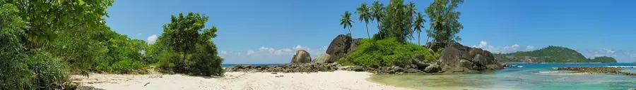
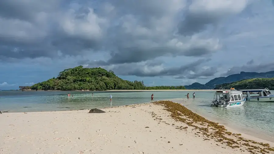
Grand'Anse Mahé Beach
Sandy beach on the south coast of Mahé, known for strong currents.
Anse Barbarons
Sandy beach on the west coast of Mahé, calm and suitable for swimming.
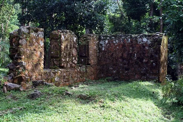
Venn's Town
Ruins of a former 19th-century mission station on Mahé.
Anse Tec-Tec
Small sandy beach on the west coast of Mahé, secluded and quiet.
Frequently asked questions
What makes Misere special?
How long does a trip to Misere take?
What is the best time of day for a visit?
Is it easy to visit with children?
Are there local specialties in Misere?
Misere: where is it located?
Misere: what is there to see?
Misere: when is the best time to visit?
Misere: why is it worth visiting?

Nearby cities


History & landmarks
More places