Plizio Visual Lab
Köýtendag Nature Reserve

Weather…
Water temperature…
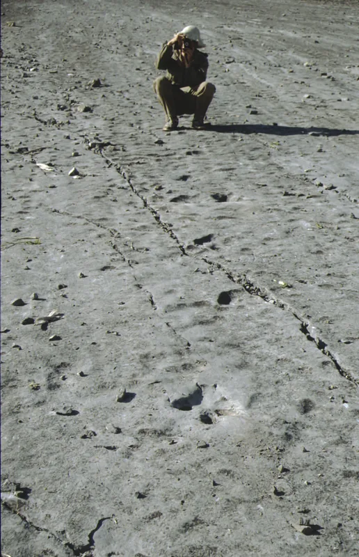
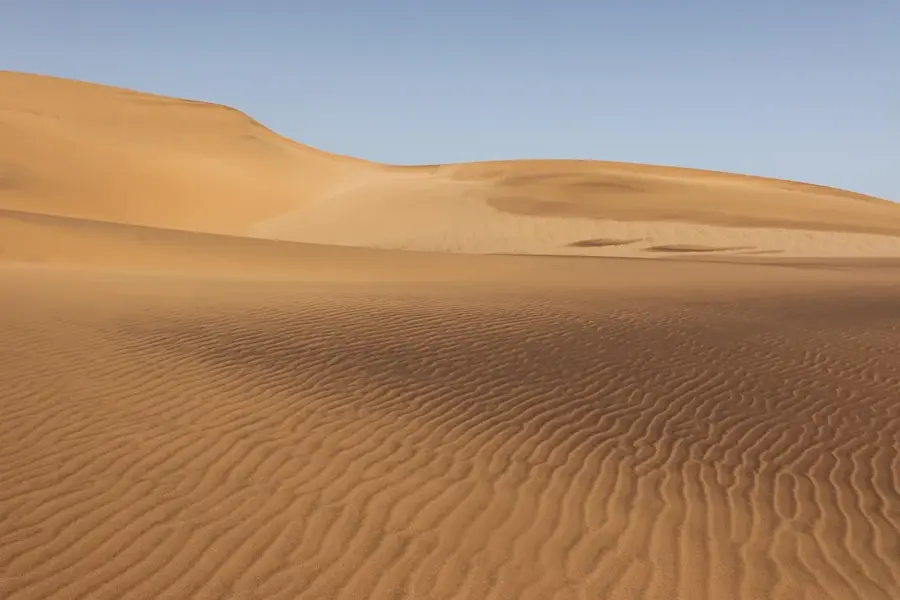
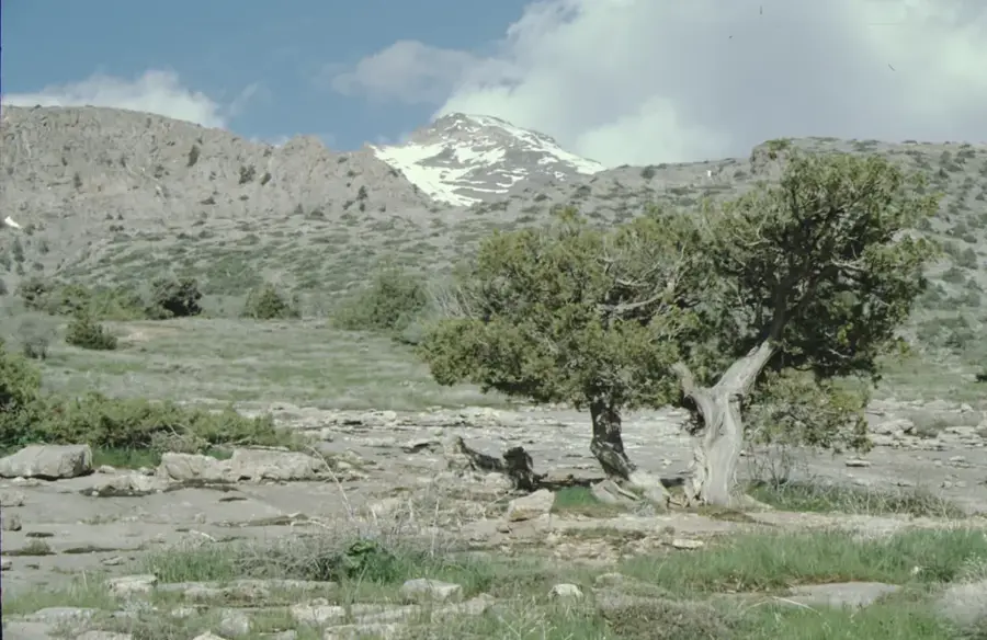
The Köýtendag Nature Reserve is located in the far southeast of Turkmenistan on the slopes of the Köýtendag Range, part of the Gissar mountain system. Established in 1986 and covering over 27,000 hectares, it encompasses the country's highest point, Mount Aýrybaba (3,139 m). The reserve is world-renowned for the 'Plateau of Dinosaurs,' a limestone stretch containing hundreds of fossilized dinosaur footprints from the Jurassic period, ranking among the most significant such sites globally. Beyond its paleontological treasures, the area features spectacular karst landscapes with deep canyons, waterfalls, and complex cave systems, such as the Karlyuk Cave. The flora and fauna exhibit high levels of endemism; it is home to the rare Markhor goat and the unique blind cave fish of Koytendag. Vertical vegetation zoning ranges from semi-deserts at the mountain base to alpine meadows in the summit regions. The reserve is currently on the UNESCO World Heritage tentative list due to its outstanding geological and biological importance.
- Location: Turkmenistan
- Nearby: Koytendag (6 km)
Best time to visit & climate
The most pleasant time to visit is May, Aug, Sep.
| Jan | Feb | Mar | Apr | May | Jun | Jul | Aug | Sep | Oct | Nov | Dec | |
|---|---|---|---|---|---|---|---|---|---|---|---|---|
| Avg °C | 2 | 4 | 10 | 16 | 22 | 27 | 29 | 27 | 22 | 15 | 8 | 3 |
| Rain mm | 27 | 34 | 33 | 29 | 12 | 2 | 0 | 0 | 0 | 5 | 23 | 23 |
📋 Practical info
Geography
Facts
- The reserve was officially established on July 11, 1986.
- Mount Aýrybaba reaches an elevation of 3,139 meters above sea level.
- More than 400 dinosaur footprints have been identified on the plateau.
- The Umbar-Dere canyon is famous for its 27-meter-high waterfall.
- The reserve's caves contain unique and pristine stalactite formations.
- The population of the rare Markhor goat is strictly protected here.
Explore nearby
Notable places around
Route planner — Car & Motorhome
Where do you start? We build the route here, with stops and country notes along the way.
© OpenStreetMap contributors · OpenRouteService
Sights in the town Köýtendag Nature Reserve (1)
Sights nearby
Frequently asked questions
What exactly is the Köýtendag Nature Reserve?
Can one visit the reserve freely?
When is the best time of year to travel?
Are there accommodations nearby?
What should one keep in mind when hiking?
Köýtendag Nature Reserve: where is it located?
Köýtendag Nature Reserve: when is the best time to visit?
Köýtendag Nature Reserve: why is it worth visiting?

Nearby cities

History & landmarks

Nature
More places