Plizio Visual Lab
Mangart
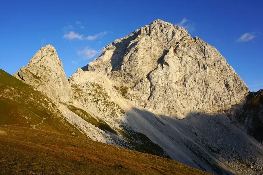
Mangart, rising to 2,679 meters, is one of the most prominent peaks in the Julian Alps, situated directly on the international border between Slovenia and Italy. It is characterized by its monumental north face, which is among the highest vertical rock walls in the Eastern Alps. The mountain is uniquely accessible via the Mangart Road, Slovenia's highest road, which reaches the Mangart Saddle at an elevation of 2,055 meters. This road was originally constructed in 1938 by the Italian military for strategic purposes and is now preserved as a technical monument. Geologically, Mangart is a classic limestone massif with layers steeply uplifted by tectonic activity. The mountain is celebrated for its exceptional biodiversity; the alpine meadows surrounding the peak host numerous endemic plant species native to the Julian Alps. Historically, the peak was a site of early scientific inquiry, with the first successful ascent recorded by Franz von Hohenwart in 1794. Because of its isolated and elevated position, the summit provides an unobstructed view reaching as far as the Hohe Tauern range in the north.
- Location: Slovenia
- Top sights: Picco di Mezzodì / Weissenfelser Mittagskogel / Poldnik (Kopa) · Mangart · Ponza Grande / Visoka Ponca
- Nearby: Vršič Pass (7 km)
Best time to visit & climate
The most pleasant time to visit is Jun–Aug.
| Jan | Feb | Mar | Apr | May | Jun | Jul | Aug | Sep | Oct | Nov | Dec | |
|---|---|---|---|---|---|---|---|---|---|---|---|---|
| Avg °C | -4 | -3 | 2 | 6 | 11 | 15 | 17 | 17 | 12 | 8 | 3 | -2 |
| Rain mm | 58 | 66 | 74 | 83 | 110 | 120 | 125 | 140 | 130 | 118 | 119 | 85 |
📋 Practical info
Geography
Facts
- The peak stands at 2,679 meters in elevation
- The Mangart Road reaches an altitude of 2,055 meters
- The first recorded ascent was by Franz von Hohenwart in 1794
- Ranked as the fourth-highest mountain in Slovenia
- The north face features a vertical drop of over 800 meters
- The summit is split by the Slovenian-Italian border
Explore nearby
Notable places around
Route planner — Car & Motorhome
Where do you start? We build the route here, with stops and country notes along the way.
© OpenStreetMap contributors · OpenRouteService
Sights in the town Mangart (3)
Sights nearby
Frequently asked questions
Can you drive up?
How difficult is the summit path?
Where is the mountain located?
What can you see from the saddle?
Is the road open in winter?
Mangart: where is it located?
Mangart: what is there to see?
Mangart: when is the best time to visit?
Mangart: why is it worth visiting?

Nearby cities

History & landmarks