Plizio Visual Lab
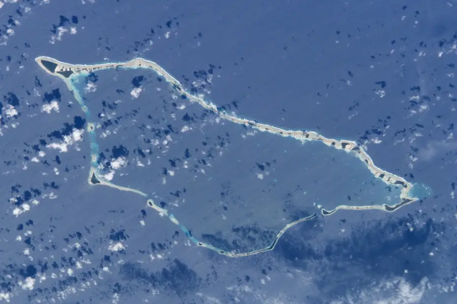
Wotje Atoll

Weather…
Water temperature…
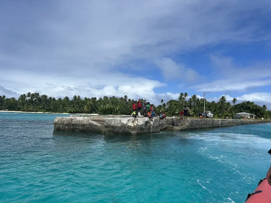
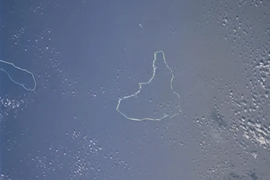
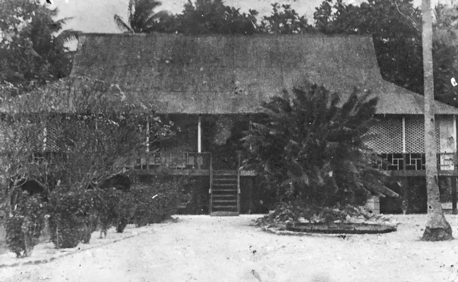
Wotje Atoll stands as one of the most significant natural formations within the Ratak Chain of the Marshall Islands. Its geography is defined by a massive central lagoon spanning 624 square kilometers, providing a calm sanctuary amidst the vast Pacific Ocean. The atoll is comprised of 75 individual islets, which together offer a modest land area covered in exceptionally lush tropical flora. The native Pandanus trees are a hallmark of Wotje’s landscape; these trees are deeply integrated into the local way of life, providing timber, fiber for weaving, and nutrient-rich fruit. The surrounding coral reefs are teeming with marine life, making the lagoon a vital nursery for various fish species and sea turtles. Wotje's environment is also characterized by its historical layers, with many inland areas still containing remnants of World War II infrastructure, now largely overgrown by the dense jungle. This blend of pristine marine ecology and resilient tropical forest makes the atoll a prime example of the Micronesian island ecosystem, where the balance between land and sea remains central to all life forms.
- Location: Marshall Islands
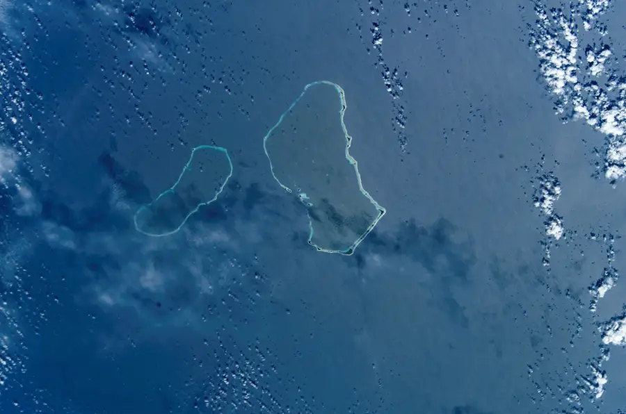
- Nearby: Wotje Atoll (24 km)
Best time to visit & climate
The most pleasant time to visit is Jan–Mar.
| Jan | Feb | Mar | Apr | May | Jun | Jul | Aug | Sep | Oct | Nov | Dec | |
|---|---|---|---|---|---|---|---|---|---|---|---|---|
| Avg °C | 28 | 27 | 27 | 28 | 28 | 28 | 28 | 28 | 28 | 28 | 28 | 28 |
| Rain mm | 56 | 48 | 76 | 101 | 114 | 128 | 154 | 176 | 171 | 212 | 174 | 92 |
📋 Practical info
Geography
Facts
- Land area: 8.3 km².
- Lagoon area: 624 km².
- Population: approximately 1,000.
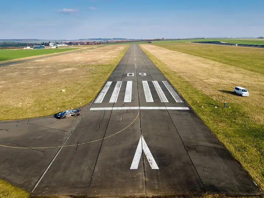
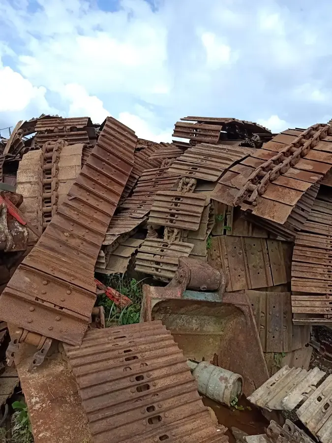
- WWII Japanese base: yes.
- Coral cover: 40%.
- Aircraft wrecks: several.
Explore nearby
Notable places around
Route planner — Car & Motorhome
Where do you start? We build the route here, with stops and country notes along the way.
© OpenStreetMap contributors · OpenRouteService
Sights nearby
Frequently asked questions
What is there to see at Wotje?
Can you dive the wrecks?
Do I need a guide for the wrecks?
How is the connectivity?
Are there hotels?
Wotje Atoll: where is it located?
Wotje Atoll: when is the best time to visit?
Wotje Atoll: why is it worth visiting?

Nearby cities


History & landmarks
Nature


More places