Plizio Visual Lab
Maloelap Atoll

Weather…
Water temperature…
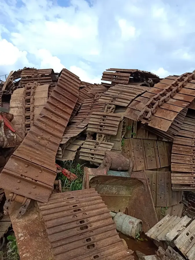
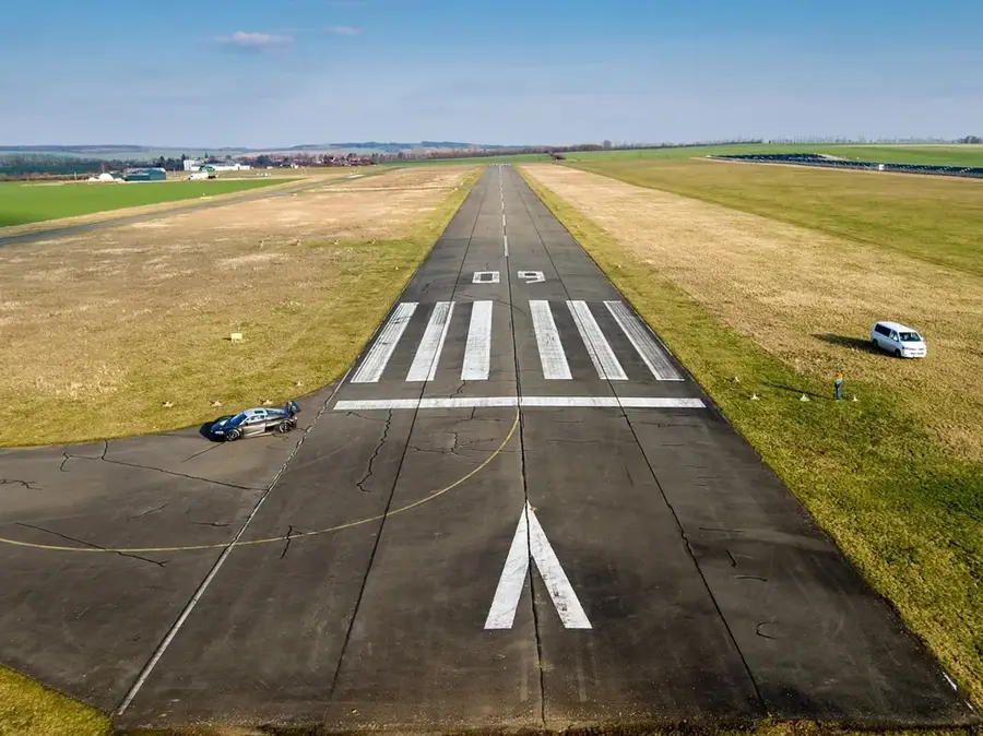
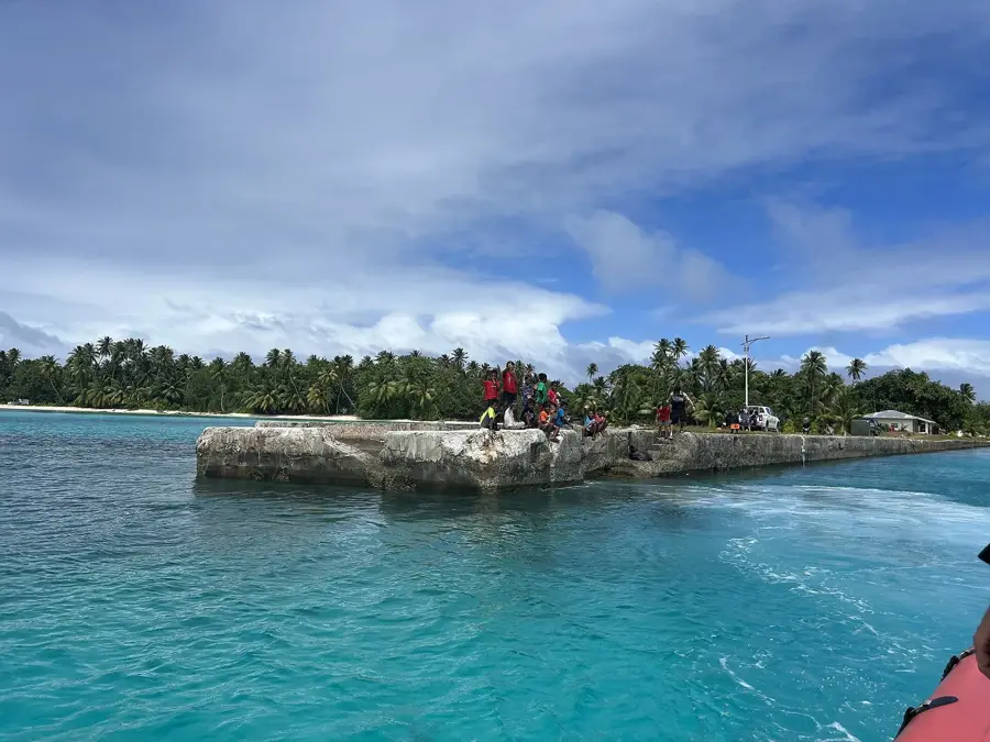
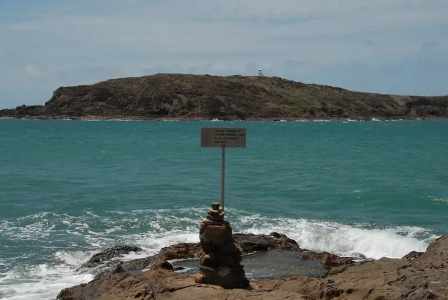
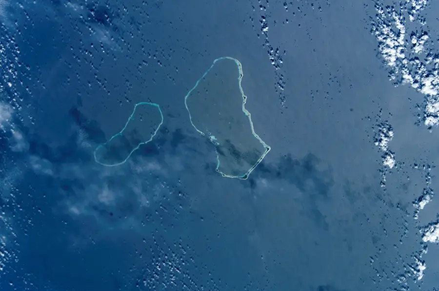
Maloelap Atoll is a massive coral formation in the Ratak Chain of the Marshall Islands, comprising 71 individual islets that encircle a vast 972-square-kilometer lagoon. With a circumference of approximately 130 kilometers, it stands as one of the larger atolls in the archipelago, offering a pristine environment for marine life and sea birds. The atoll is a significant nesting site for various tern species, which thrive in the undisturbed forested areas of the outer islands. Beyond its natural beauty, Maloelap holds substantial historical weight; the islet of Taroa was a major Japanese airbase during World War II, and today the landscape is dotted with well-preserved relics, including aircraft wrecks and bunkers. The local population maintains a traditional lifestyle centered on copra production and sustainable fishing. For those exploring the Marshall Islands, Maloelap provides a well-suited blend of tragic 20th-century history and timeless, panoramic Pacific ecology.
- Location: Marshall Islands
- Nearby: Maloelap (12 km)
Best time to visit & climate
The most pleasant time to visit is Jan–Mar.
| Jan | Feb | Mar | Apr | May | Jun | Jul | Aug | Sep | Oct | Nov | Dec | |
|---|---|---|---|---|---|---|---|---|---|---|---|---|
| Avg °C | 28 | 27 | 28 | 28 | 28 | 28 | 28 | 28 | 28 | 28 | 28 | 28 |
| Rain mm | 75 | 64 | 89 | 121 | 128 | 144 | 167 | 182 | 190 | 213 | 190 | 116 |
📋 Practical info
Geography
Facts
- land area: 9.8 km²
- number of islands: approx. 75
- lagoon length: 29 km
- maximum lagoon depth: 47 m
- population: approx. 600
- highest elevation: about 3 m above sea level
Explore nearby
Notable places around
Route planner — Car & Motorhome
Where do you start? We build the route here, with stops and country notes along the way.
© OpenStreetMap contributors · OpenRouteService
Sights nearby
Frequently asked questions
Why do tourists visit Maloelap?
Is the fishing good here?
How are the accommodations?
How are the people there?
What should you consider for the trip?
Maloelap Atoll: where is it located?
Maloelap Atoll: when is the best time to visit?
Maloelap Atoll: why is it worth visiting?

Nearby cities


History & landmarks


Nature


More places