Plizio Visual Lab
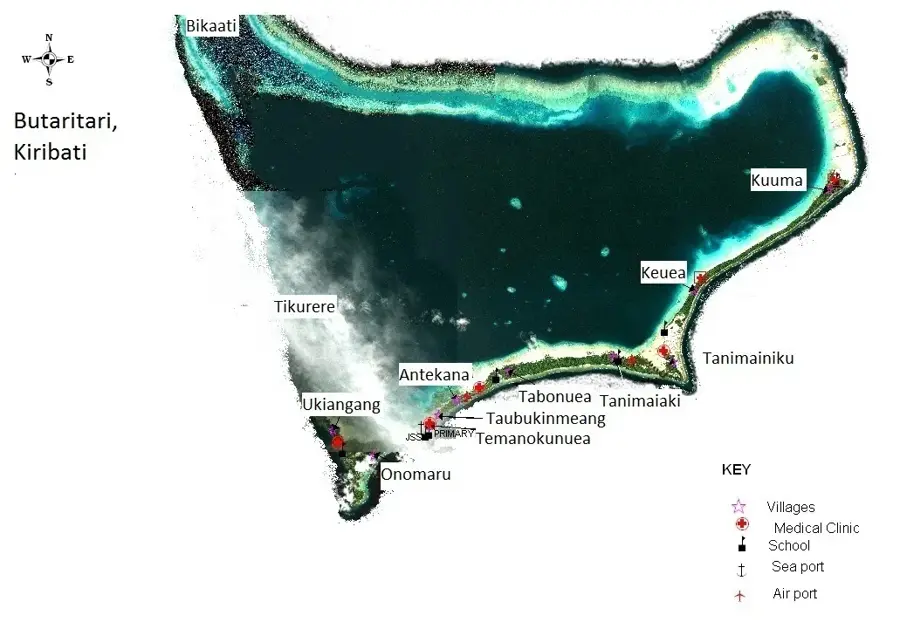
Butaritari
Weather…
Water temperature…
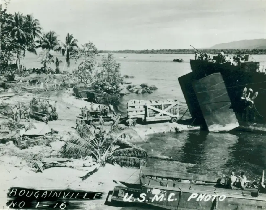
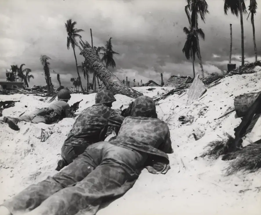
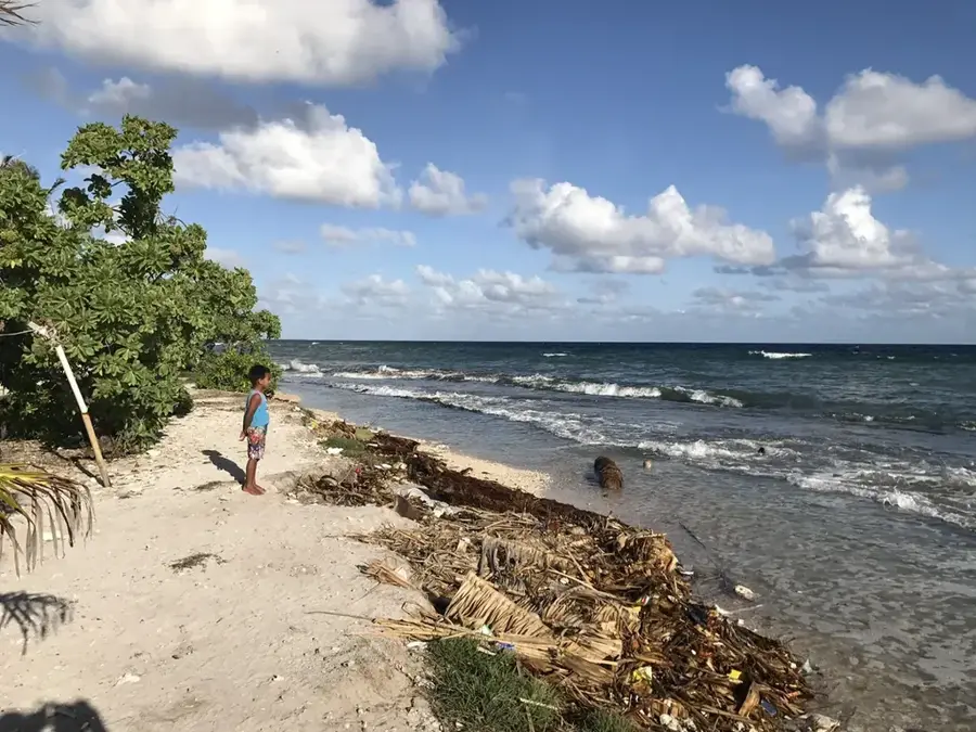
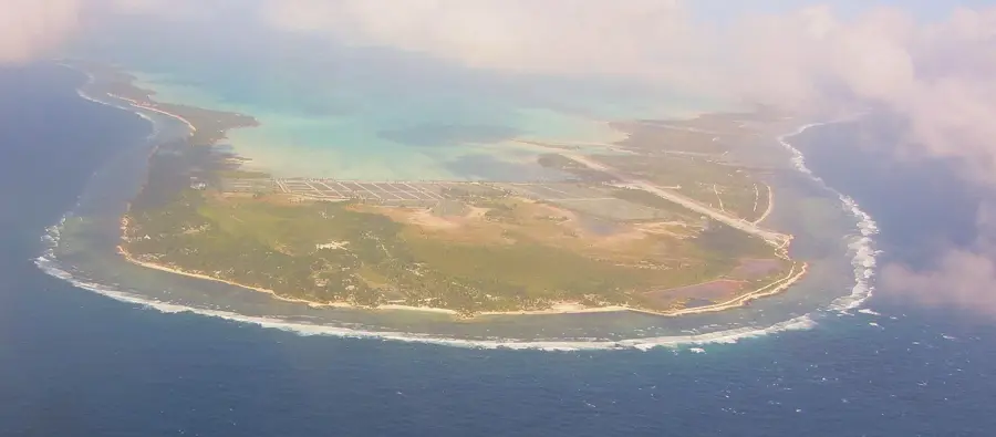
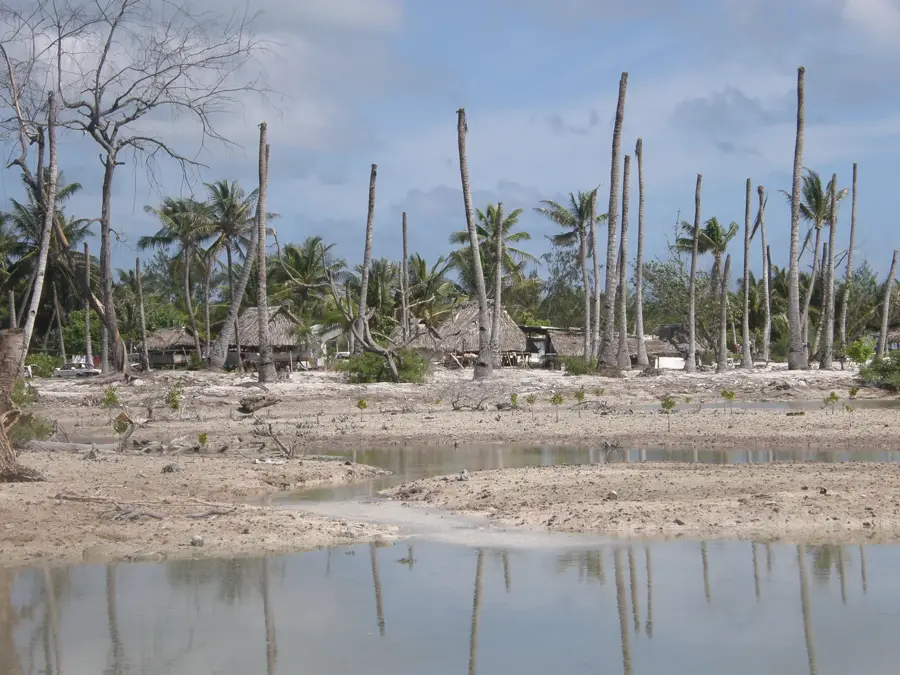
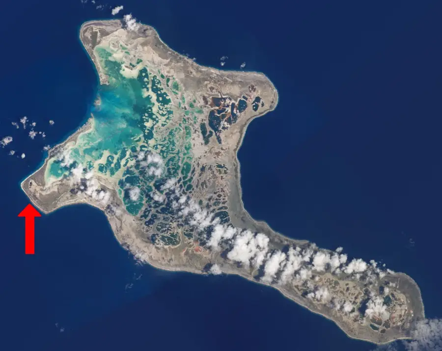
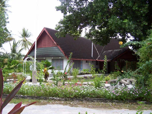
Butaritari stands out as the most fertile and lush atoll in Kiribati, earning it the reputation of the archipelago's greenest island. Unlike many of the drier atolls in the Gilbert group, Butaritari benefits from high annual rainfall, which supports a dense and diverse range of tropical vegetation. The island is particularly noted for its expansive mangrove forests along the lagoon side and its towering breadfruit trees, which produce fruit in such abundance that they are traded with neighboring islands. Historically, the atoll gained prominence during World War II as a strategic base and the site of intense military operations, including the famous Raid on Makin. Today, however, the pace of life is serene and traditional. The local population relies on the productive soil for growing taro and harvesting copra, maintaining a lifestyle deeply connected to the natural environment. For travelers, the atoll has a unique blend of historical intrigue, verdant landscapes, and pristine marine environments.
- Location: Kiribati
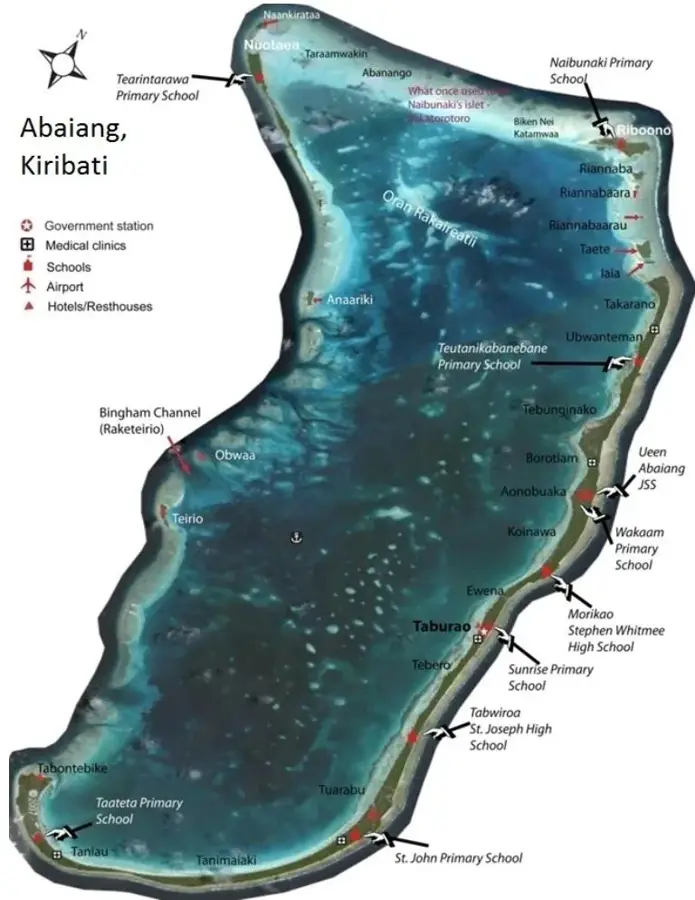
- Nearby: Butaritari Atoll (9 km)
Best time to visit & climate
The most pleasant time to visit is Sep–Nov.
| Jan | Feb | Mar | Apr | May | Jun | Jul | Aug | Sep | Oct | Nov | Dec | |
|---|---|---|---|---|---|---|---|---|---|---|---|---|
| Avg °C | 28 | 28 | 28 | 28 | 28 | 28 | 28 | 28 | 28 | 28 | 28 | 28 |
| Rain mm | 225 | 186 | 296 | 273 | 205 | 239 | 208 | 163 | 145 | 137 | 146 | 236 |
📋 Practical info
Geography
Facts
- Land area: 13.5 km²
- Lagoon area: 191 km²
- Population: 4,000 (2020)
- Mangrove area: 10 km²
- Highest elevation: 3 m
- Average temperature: 28 °C
Explore nearby
Notable places around
Route planner — Car & Motorhome
Where do you start? We build the route here, with stops and country notes along the way.
© OpenStreetMap contributors · OpenRouteService
Sights nearby
Frequently asked questions
Why is Butaritari called the 'Green Island'?
Are there historical sights?
How do you get to Butaritari?
Is the water safe to drink there?
What is the local specialty?
Butaritari: where is it located?
Butaritari: when is the best time to visit?
Butaritari: why is it worth visiting?

Nearby cities

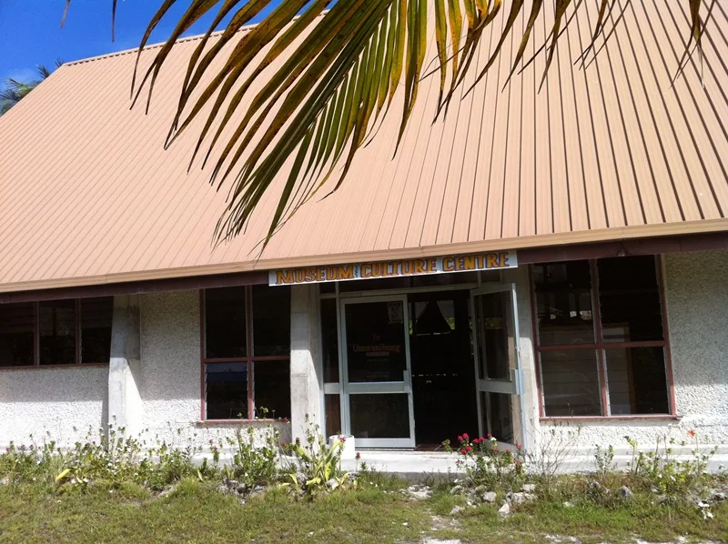


History & landmarks
Nature
More places