Plizio Visual Lab
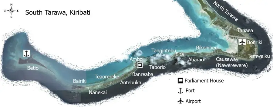
South Tarawa
ℹ️Practical info — South Tarawa
▾
🌤 Weather — 5 days
📍 Nearby
Sights nearby
💡 Tips
- Traffic on the single main road can be surprisingly heavy; use the local minibuses for cheap transport.
- Tap water is not safe to drink; always rely on thoroughly boiled or bottled water.
- The best time to visit historical WWII sites in Betio is early morning before the heat peaks.
- Bring Australian Dollars in cash; only a handful of hotels and larger stores accept credit cards.
- Dress modestly when walking through villages; swimming costumes are for the beach only.
🍽 Food
Grab excellent fresh tuna at small roadside eateries or the market in Bairiki.
Often found at local markets or larger gatherings; a very popular island feast dish.
Taro leaves baked with coconut cream, onions, and sometimes fish, wrapped in foil or banana leaves.
🛍 Shopping · 🧘 Quiet spots
A bustling place in the administrative center to buy fresh produce, local fish, and casual clothing.
Look for authentic woven fans, mats, and intricate coconut shell jewelry made by local artisans.
Stop by small stands along the causeways to buy local snacks, drinks, and sometimes fresh fish.
The open grassy grounds around the impressive parliament building in Ambo are quiet and scenic.
A quieter stretch of lagoon shoreline compared to Betio or Bairiki, well-suited for a peaceful sunset walk.
Water temperature…
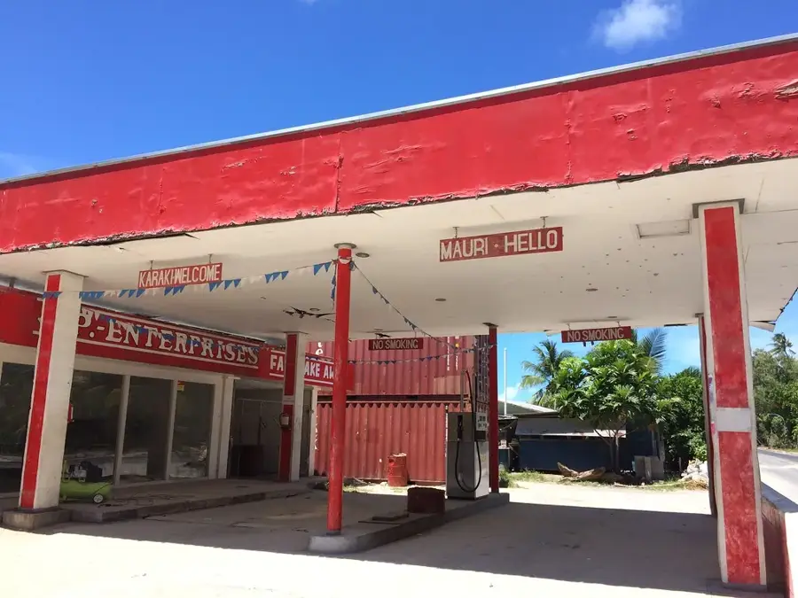
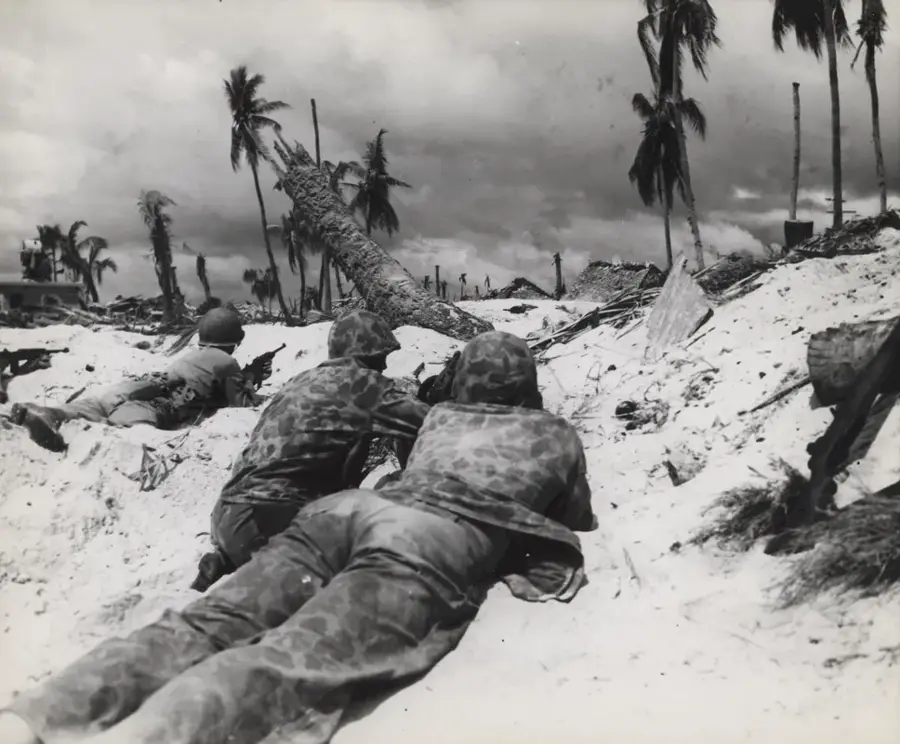
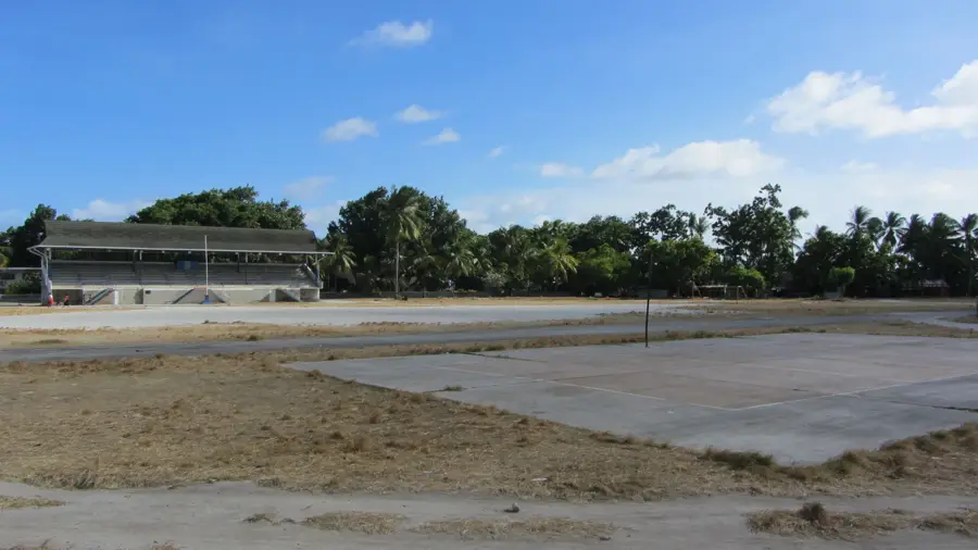
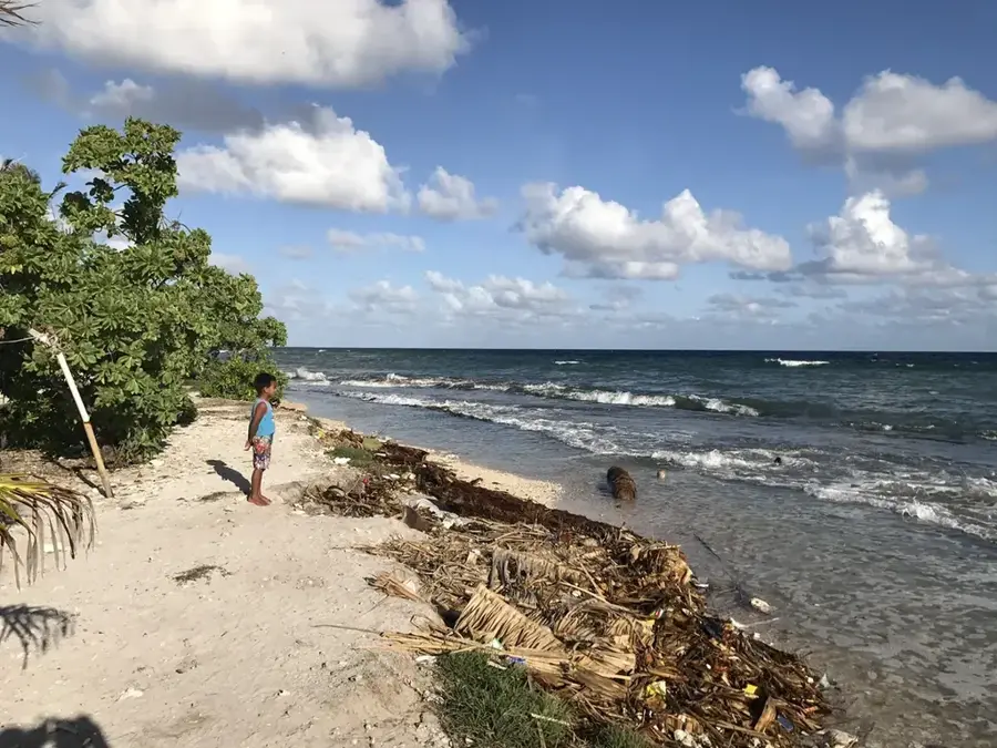
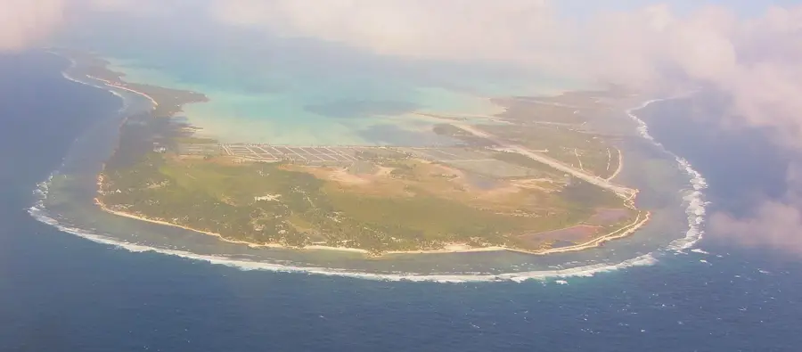
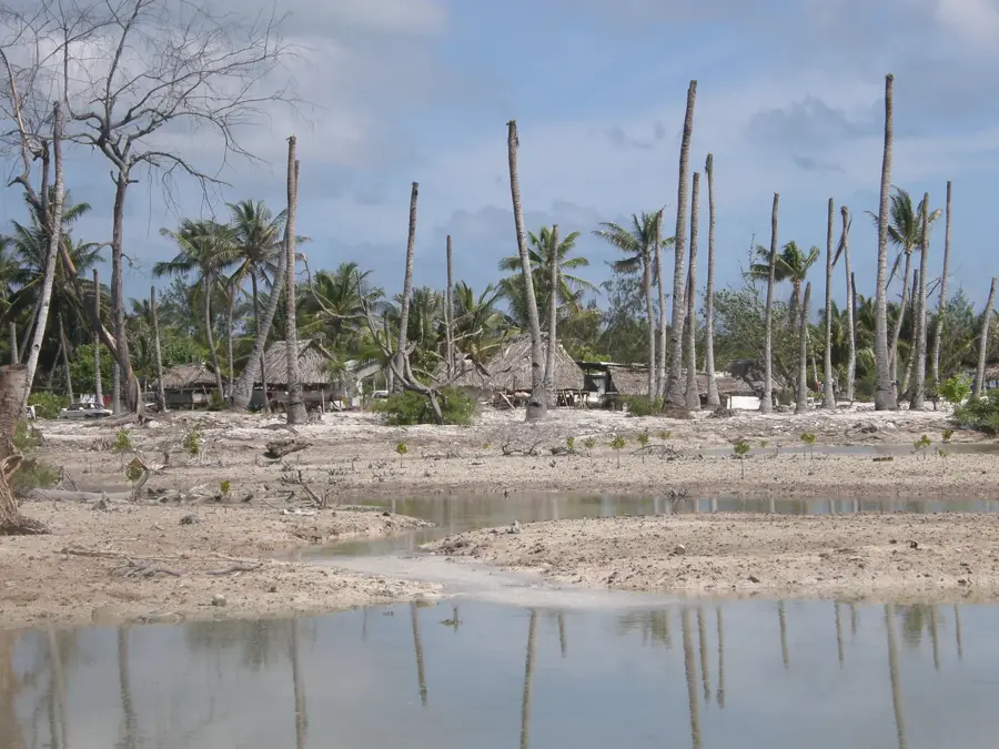
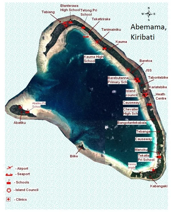
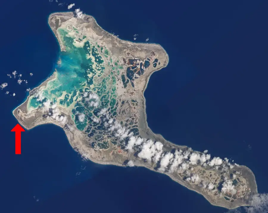
South Tarawa is the animated political and economic heart of Kiribati, located on the South Tarawa Atoll in the Gilbert Islands. The capital region consists of a string of narrow islets connected by a series of causeways, forming a continuous urban corridor. Home to over 60,000 residents, it is one of the most densely populated areas in the Pacific, which presents significant challenges for infrastructure and fresh water management. Key districts include Bairiki, the administrative center where government offices are located, and Betio, the nation's primary port and the site of the fierce Battle of Tarawa during World War II. Remnants of the war, including coastal guns and bunkers, are still visible today. South Tarawa serves as the primary hub for international travel and trade, while simultaneously standing as a global symbol of the existential threat posed by rising sea levels and climate change.
- Location: Kiribati
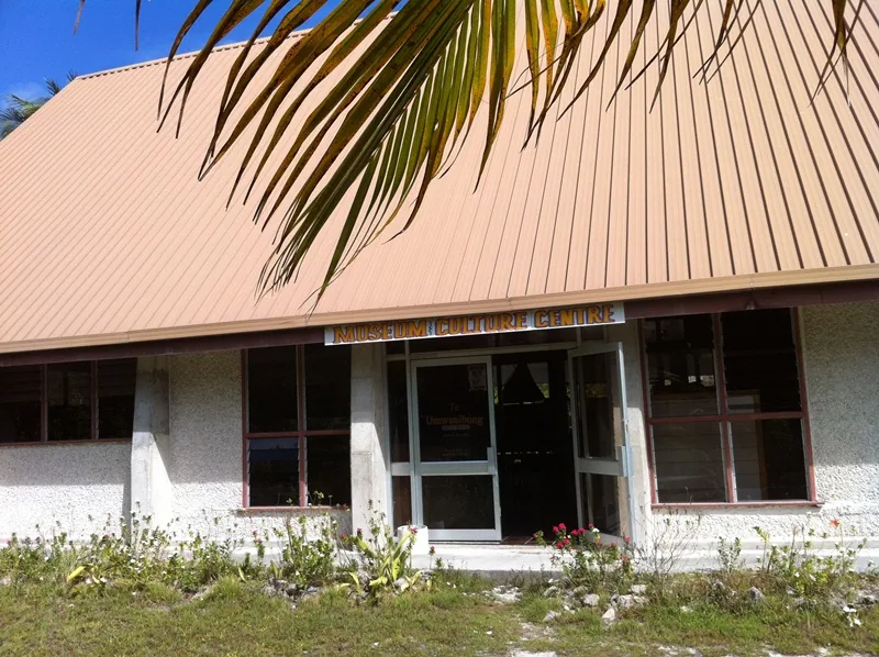
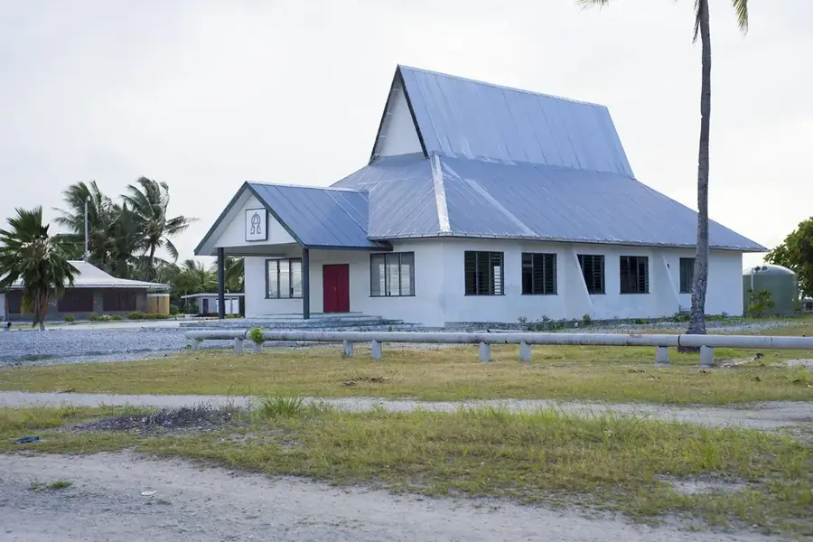
- Top sights: Catholic Church · Nanomalie · Latter Day Saints (Mormon)
- Nearby: Betio (6 km)
- Population: ~3.500
Best time to visit & climate
The most pleasant time to visit is Sep–Nov.
| Jan | Feb | Mar | Apr | May | Jun | Jul | Aug | Sep | Oct | Nov | Dec | |
|---|---|---|---|---|---|---|---|---|---|---|---|---|
| Avg °C | 28 | 28 | 28 | 28 | 28 | 28 | 28 | 28 | 28 | 28 | 28 | 28 |
| Rain mm | 212 | 157 | 220 | 171 | 103 | 136 | 119 | 107 | 92 | 95 | 95 | 208 |
Geography
Facts
- Population: approx. 50,000 (2020)
- Area: about 15 km²
- Highest elevation: 3 m above sea level
- Annual rainfall: 1,500 mm
- Founded: 1979 (Kiribati independence)
- Number of inhabited islets: 4
Explore nearby
Notable places around
Route planner — Car & Motorhome
Where do you start? We build the route here, with stops and country notes along the way.
© OpenStreetMap contributors · OpenRouteService
Sights in the town South Tarawa (3)
Frequently asked questions
How many days should one spend in South Tarawa?
What is the main mode of transport?
What food is typical for the region?
Is South Tarawa family-friendly?
How is the internet connection?
South Tarawa: where is it located?
South Tarawa: what is there to see?
South Tarawa: when is the best time to visit?
South Tarawa: why is it worth visiting?

Nearby cities


History & landmarks

Nature
More places