Plizio Visual Lab
Vranica
Weather…
Water temperature…
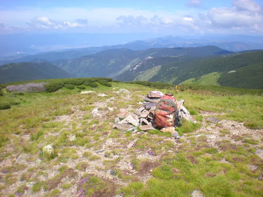
Vranica is a memorable high-mountain massif in Central Bosnia, situated between the towns of Gornji Vakuf and Fojnica. Its highest peak, Nadkrstac, rises to an impressive 2,112 meters, making it one of the most prominent ranges in the region. Geologically, Vranica stands out from the typical limestone Dinaric Alps as it is predominantly composed of Paleozoic schists and volcanic rocks, resulting in softer terrain contours and abundant surface water. The most famous natural landmark within the massif is Prokoško Lake, a glacial lake at 1,636 meters surrounded by traditional wooden shepherd huts known as 'katuni.' The flora of Vranica is exceptionally diverse, hosting numerous endemic plant species and providing a habitat for the rare Alpine salamander. Historically, the mountain was a center for mining, with gold, silver, and iron being extracted since the Middle Ages. Today, Vranica is a favored destination for hikers, ski tourers, and nature enthusiasts seeking the tranquility of its untouched alpine landscapes. Its combination of crystal-clear streams, dense forests, and expansive mountain pastures gives it a unique and enduring appeal.
- Location: Bosnia and Herzegovina
- Nearby: Fojnica (7 km)
Best time to visit & climate
The most pleasant time to visit is Jun–Aug.
| Jan | Feb | Mar | Apr | May | Jun | Jul | Aug | Sep | Oct | Nov | Dec | |
|---|---|---|---|---|---|---|---|---|---|---|---|---|
| Avg °C | -2 | -1 | 3 | 8 | 12 | 17 | 19 | 20 | 14 | 10 | 5 | 0 |
| Rain mm | 77 | 74 | 74 | 68 | 81 | 82 | 54 | 55 | 78 | 76 | 91 | 89 |
📋 Practical info
Geography
Facts
- Nadkrstac peak is the highest point of Vranica at 2,112 meters above sea level.
- Prokoško Lake is the habitat of the endemic Alpine newt (Triturus alpestris reiseri).
- The mountain range serves as a watershed between the Bosna and Vrbas rivers.
- Vranica contains some of the oldest gold mines in Bosnia, dating back to Roman times.
- There are over 10 peaks within the massif that exceed an altitude of 2,000 meters.
- The Prokoško Lake area was designated as a regional nature monument in 2005.
Explore nearby
Notable places around
Route planner — Car & Motorhome
Where do you start? We build the route here, with stops and country notes along the way.
© OpenStreetMap contributors · OpenRouteService
Sights in the town Vranica (1)
Sights nearby
Frequently asked questions
What is the highest peak of Vranica?
Which famous lake is in Vranica?
What rare animal lives in Prokoško Lake?
Where is the best place to start the hike?
What is the soil structure of Vranica?
Vranica: where is it located?
Vranica: when is the best time to visit?
Vranica: why is it worth visiting?
Nearby cities