Plizio Visual Lab
Atakpamé
ℹ️Practical info — Atakpamé
▾
🌤 Weather — 5 days
📍 Nearby
Sights nearby
💡 Tips
- Hire a local moto-taxi (zemidjan) to easily navigate the steep hills of the town.
- Enjoy the much cooler and refreshing climate compared to the coastal regions.
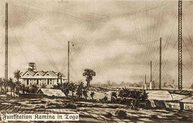
- Take a short trip to visit the ruins of the German radio station Kamina nearby.
- Always keep small change handy for purchasing items at the local market.
🍽 Food
Pounded yams served with rich stews, best tried at simple local eateries in the town center.
A popular afternoon snack readily available from street food vendors.
A traditional Togolese soup that is highly recommended at a local maquis.
🛍 Shopping · 🧘 Quiet spots
Colorful, traditional textiles can be bargained for at the bustling main market.
Pick up fresh mangoes and pineapples from the small roadside stalls scattered around.
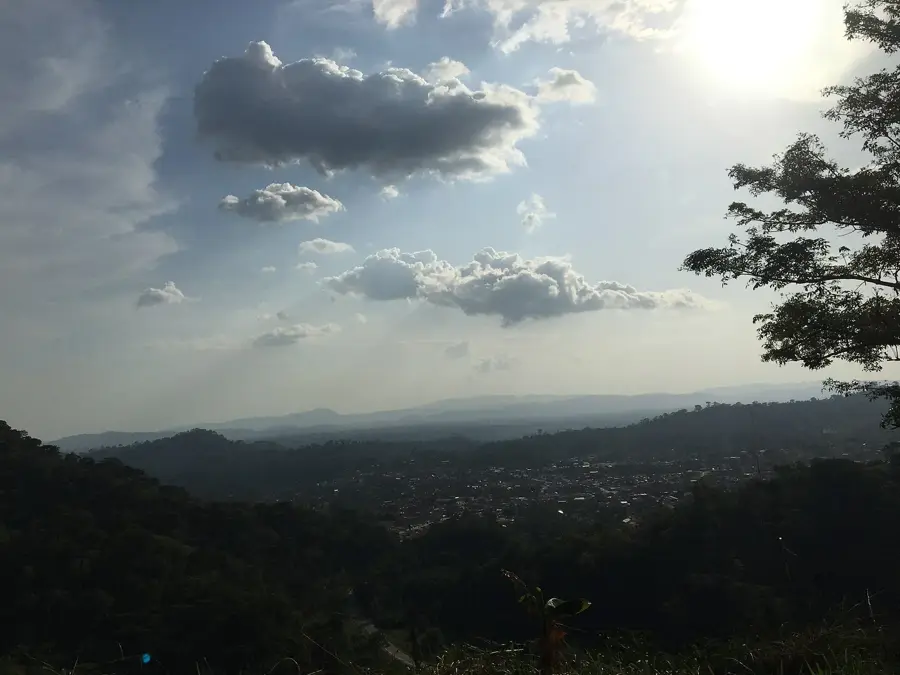
Hike the hills on the outskirts of town for a magnificent and peaceful panoramic view.
The grounds of the old radio station offer a quiet spot for a history-filled walk.
Water temperature…
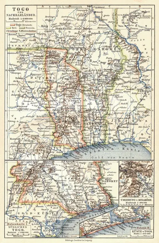
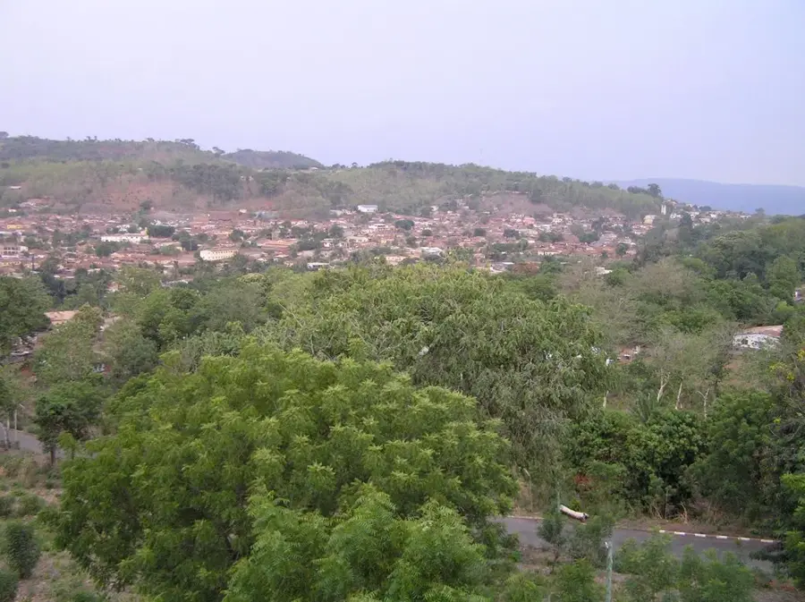
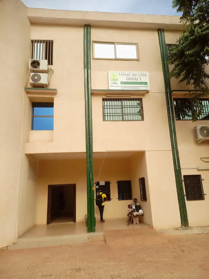
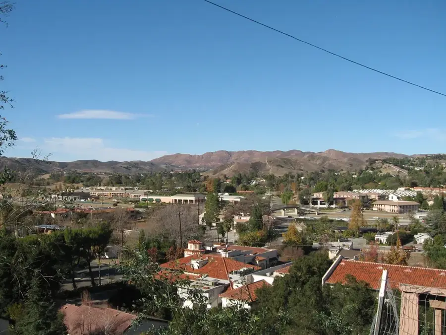
Atakpamé, the regional capital of the Plateaux Region in Togo, is a pretty city located among the undulating hills of the Atakora mountain range. Known affectionately as the 'City of Seven Hills,' its elevated position provides a cooler and more temperate climate than the humid coastal plains. Historically, Atakpamé held significant importance as a German colonial hub; the nearby Kamina wireless station, built between 1911 and 1914, was a marvel of early telecommunications, designed to link Berlin with German West Africa and South America. During the 19th century, the city also served as a fortified refuge during regional conflicts, a history reflected in its name. Today, Atakpamé is a bustling commercial center, primarily focused on the agricultural wealth of the Plateaux region. It is a major collection point for cotton, cocoa, coffee, and palm oil, which are transported down to the port of Lomé for export. The city's cultural identity is a lively blend of Ewe, Yoruba (Ana), and Fon influences, famously celebrated through the daring stilt dances performed during festivals. Architecturally, the city is a mix of weathered colonial buildings, red-roofed houses, and the prominent Holy Trinity Cathedral. Its location on the main North-South highway (N1) makes it a vital transit point for goods and passengers traveling between the coast and the Sahelian interior. Atakpamé's landscape is dotted with lush vegetation and small-scale farms, providing a scenic backdrop to its urban core. The city also acts as an administrative and educational anchor for central Togo, hosting several regional government offices and schools. For visitors, Atakpamé features a unique look into Togo's history and diverse folklore, maintaining a balance between its traditional roots and its role as a key player in the nation's contemporary economy.
- Location: Togo
- Top sights: ONG STADD · Cimetière · SOCIÉTÉ LE SAVOIR
- Nearby: Anié (28 km)
- Population: ~80.683 (2026)
Best time to visit & climate
The most pleasant time to visit is Jan, Nov, Dec.
| Jan | Feb | Mar | Apr | May | Jun | Jul | Aug | Sep | Oct | Nov | Dec | |
|---|---|---|---|---|---|---|---|---|---|---|---|---|
| Avg °C | 26 | 28 | 28 | 27 | 27 | 26 | 25 | 25 | 25 | 26 | 26 | 26 |
| Rain mm | 16 | 28 | 66 | 110 | 148 | 187 | 229 | 190 | 251 | 157 | 24 | 10 |
Geography
Facts
- Atakpamé is located at an altitude of approximately 400 meters (1,312 feet).
- It was a major strategic site for German Togoland during WWI.
- The city's economy is centered on the processing of cotton and cocoa.
- It is the fifth-largest city in Togo by population.
- The Kamina wireless station once had nine massive antenna towers.
- Atakpamé is known for the Téchabé stilt-dancing tradition.
- The city sits at the junction of Togo's main north-south trade route.
- The name Atakpamé means 'the place where the wall is' in local dialect.
Explore nearby
Notable places around
Route planner — Car & Motorhome
Where do you start? We build the route here, with stops and country notes along the way.
© OpenStreetMap contributors · OpenRouteService
Sights in the town Atakpamé (3)
Frequently asked questions
What makes Atakpamé special?
Are there sights in Atakpamé?
Is Atakpamé safe for tourists?
When is the best time to travel?
Are there ATMs available in the city?
Atakpamé: where is it located?
Atakpamé: what is there to see?
Atakpamé: when is the best time to visit?
Atakpamé: why is it worth visiting?

Nearby cities

History & landmarks
Nature
More places