Plizio Visual Lab
Majuro Atoll

Weather…
Water temperature…
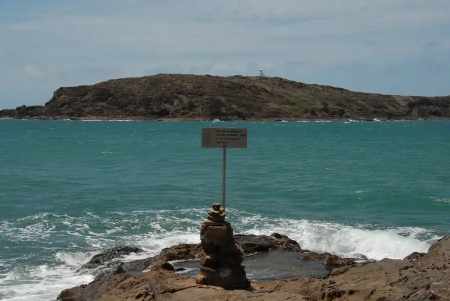
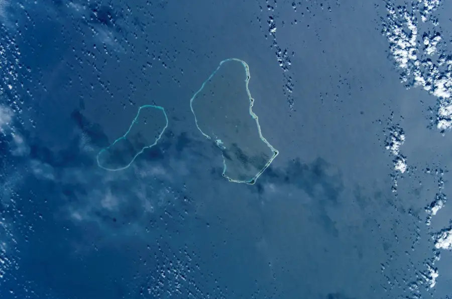
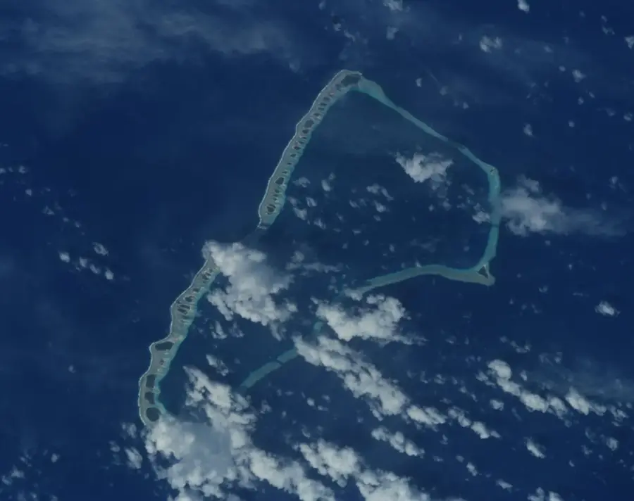
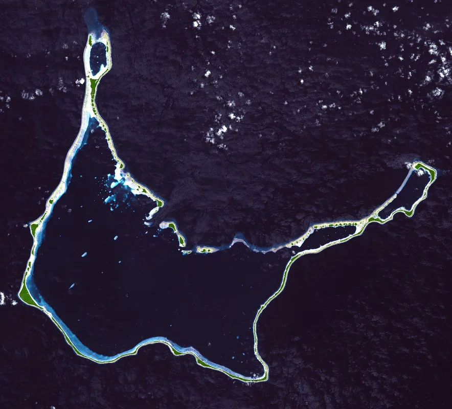
Majuro Atoll serves as the political and economic heart of the Marshall Islands, presenting a unique geographical profile consisting of 64 distinct islets arranged in a narrow loop. The most striking feature of the atoll is its immense central lagoon, which covers nearly 300 square kilometers, providing a sheltered environment for marine life and maritime activities. In contrast, the total land area is incredibly small, with the main island being so narrow in parts that the ocean and lagoon can be seen simultaneously from the road. The western end of the atoll, known as Laura, features the highest elevation at just 3 meters and is the primary agricultural area due to its superior soil quality and freshwater lens. Visitors can explore the delicate balance of life in this Pacific environment, where the threat of rising sea levels is a constant reality, shaping local culture and sustainability efforts.
- Location: Marshall Islands
- Nearby: Ajeltake (6 km)
Best time to visit & climate
The most pleasant time to visit is Jan–Mar.
| Jan | Feb | Mar | Apr | May | Jun | Jul | Aug | Sep | Oct | Nov | Dec | |
|---|---|---|---|---|---|---|---|---|---|---|---|---|
| Avg °C | 28 | 28 | 28 | 28 | 28 | 28 | 28 | 28 | 28 | 28 | 28 | 28 |
| Rain mm | 161 | 137 | 162 | 227 | 211 | 223 | 252 | 234 | 260 | 276 | 267 | 224 |
📋 Practical info
Geography
Facts
- Land area: 9.7 km².
- Lagoon area: 295 km².
- Number of islands: over 50.
- Coordinates: 7°N, 171°E.
- Annual erosion rate: 0.5 meters.
- Capital city: Delap-Uliga-Darrit.
Explore nearby
Notable places around
Route planner — Car & Motorhome
Where do you start? We build the route here, with stops and country notes along the way.
© OpenStreetMap contributors · OpenRouteService
Sights nearby
Frequently asked questions
What is Majuro as an atoll?
Is it good for surfing?
How many days should I plan?
Is there local cuisine?
How to get from island to island?
Majuro Atoll: where is it located?
Majuro Atoll: when is the best time to visit?
Majuro Atoll: why is it worth visiting?

Nearby cities


History & landmarks

Nature

More places