Plizio Visual Lab
Martin Brod Waterfalls
Weather…
Water temperature…
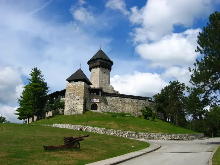
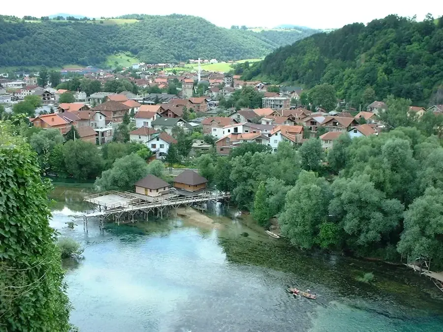
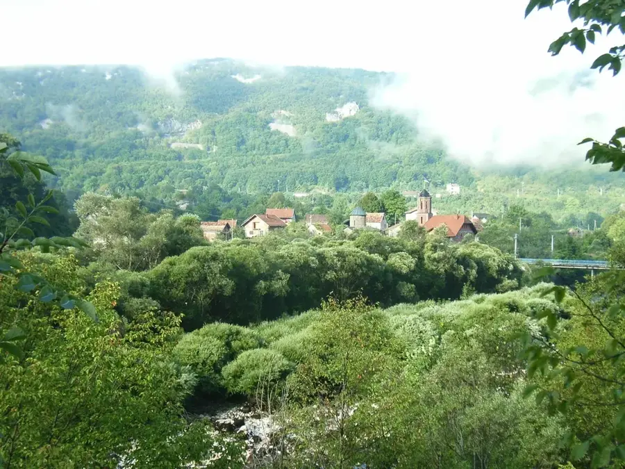
Martin Brod is an idyllic village situated within Una National Park at the confluence of the Unac and Una Rivers in western Bosnia and Herzegovina. The village hosts the largest complex of waterfalls in the entire Una valley, with the most magnificent being "Milančev buk," which stands 54 meters high. Across a distance of about 800 meters, a complex system of cascades, tufa barriers, and deep pools has been formed by the continuous deposition of travertine over millennia. The name of the village is tied to a local legend about a girl named Marta, who drowned in the river while attempting to cross it for love. Beyond its natural splendor, Martin Brod is renowned for its historic watermills and the 15th-century Orthodox Rmanj Monastery, which remains a vital spiritual center for the region. The area is a sanctuary for fly-fishing enthusiasts and nature lovers who value the untouched flora and fauna of the national park. Every year, the "Una Regatta" draws numerous water sports enthusiasts to the area to tackle the challenging rapids. Despite its remote location, Martin Brod stands as a symbol of the harmonious coexistence of humanity and nature.
- Location: Bosnia and Herzegovina
- Top sights: Manastir Rmanj · Bučnica · Pogledalo
- Nearby: Štrbački Buk (22 km)
Best time to visit & climate
The most pleasant time to visit is Jun–Aug.
| Jan | Feb | Mar | Apr | May | Jun | Jul | Aug | Sep | Oct | Nov | Dec | |
|---|---|---|---|---|---|---|---|---|---|---|---|---|
| Avg °C | -1 | 0 | 4 | 9 | 13 | 17 | 19 | 20 | 14 | 10 | 5 | 1 |
| Rain mm | 92 | 92 | 80 | 82 | 89 | 76 | 54 | 71 | 113 | 105 | 129 | 109 |
📋 Practical info
Geography
Facts
- Martin Brod is located at the confluence of the Unac and Una Rivers.
- The largest waterfall, Milančev buk, reaches a height of 54 meters.
- The village has been part of the Una National Park since its founding in 2008.
- The Orthodox Rmanj Monastery was first mentioned in historical records in 1443.
- The system of waterfalls extends over a total length of 800 meters.
- A significant site of travertine formations is located in the vicinity.
Explore nearby
Notable places around
Route planner — Car & Motorhome
Where do you start? We build the route here, with stops and country notes along the way.
© OpenStreetMap contributors · OpenRouteService
Sights in the town Martin Brod Waterfalls (4)
Sights nearby
Frequently asked questions
What awaits visitors in Martin Brod?
How much time should you plan for?
Is there an entry fee?
Can you stay overnight in Martin Brod?
Is fishing allowed?
Martin Brod Waterfalls: where is it located?
Martin Brod Waterfalls: what is there to see?
Martin Brod Waterfalls: when is the best time to visit?
Martin Brod Waterfalls: why is it worth visiting?
Nearby cities