Plizio Visual Lab
Zyuratkul
ℹ️Practical info — Zyuratkul
▾
🌤 Weather — 5 days
📍 Nearby
Sights nearby
Water temperature…
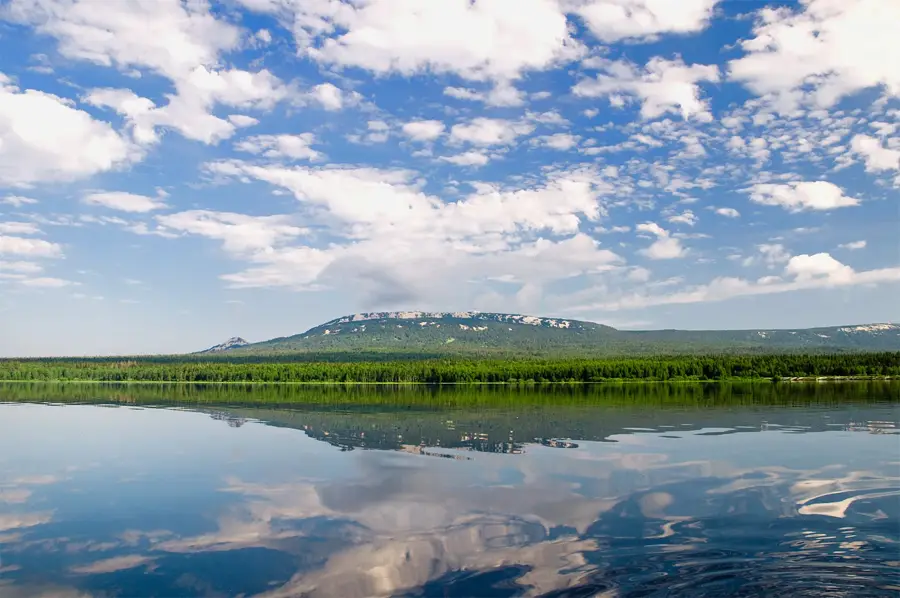
Zyuratkul is a gem in the Chelyabinsk Oblast and home to the highest lake in the Ural Mountains at 724 meters above sea level. The national park is a place of wild beauty, characterized by the Zyuratkul and Nurgush mountain ridges. Hikers especially appreciate the well-developed 'eco-path' leading to the summit, offering fantastic panoramic views of the lake's dark, heart-shaped water. A special experience is visiting the 'Solyathaya Shishka' moose farm, where orphaned moose calves are raised, and visitors can interact with these gentle giants. Archaeologically, the region gained fame through the discovery of a giant geoglyph in the shape of a moose, visible only from the air. The dense forests are home to bears, wolves, and rare bird species, making the park a paradise for nature photographers. The best way to get there is from Satka by car. The infrastructure in the park is rustic, with cozy wooden cabins and campsites. The best time to travel is summer for hiking or late autumn when the first snow dusts the peaks. Zyuratkul provides an authentic wilderness experience far from mass tourism.
- Location: Russia
- Nearby: Taganay National Park (69 km)
- Population: ~86
Geography
Facts
- Highest lake in the Urals (724m)
- Founded in 1993
- Heart-shaped lake
- Home to a moose farm
- Ancient geoglyph discovered
- Over 150 bird species
- Nearest city: Satka
- Nurgush summit (1406m)
Explore nearby
Notable places around
Route planner — Car & Motorhome
Where do you start? We build the route here, with stops and country notes along the way.
© OpenStreetMap contributors · OpenRouteService
Sights in the town Zyuratkul (1)
Frequently asked questions
Zyuratkul: where is it located?
Zyuratkul: why is it worth visiting?

Nearby cities