Plizio Visual Lab
Fachi
ℹ️Practical info — Fachi
▾
🌤 Weather — 5 days
📍 Nearby
Sights nearby
💡 Tips
- Never travel here alone; an experienced local guide and a convoy are essential for survival in the Ténéré desert.
- Water is the most precious resource here. Conserve it strictly and bring ample personal supplies.
- Respect the privacy of the Kanuri and Tuareg locals; always ask permission before taking photos in the village.
- Protect yourself consistently from the intense desert sun with headgear and covering clothing.
🍽 Food
The traditional staple food of the region, prepared in the village kitchens.
Taste the sweet dates harvested from the shaded groves of the oasis.
The traditional tea often served in three rounds by local hosts.
🛍 Shopping · 🧘 Quiet spots
The traditional trade good of the caravans, extracted from the nearby salt pans.
Simple leatherwork crafted by passing nomads can be bought or bartered for locally.
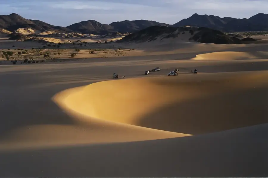
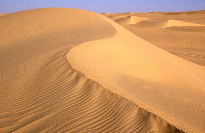
Watch as the setting sun paints the seas of sand surrounding the village in deep reds.
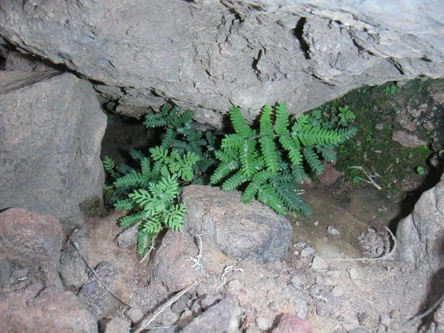
Find peace under the palm trees within the old mud walls of the settlement.
Water temperature…
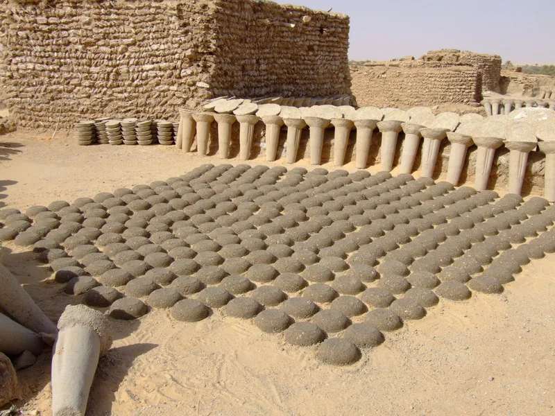
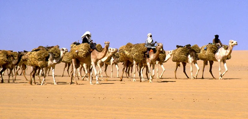
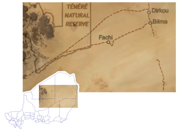
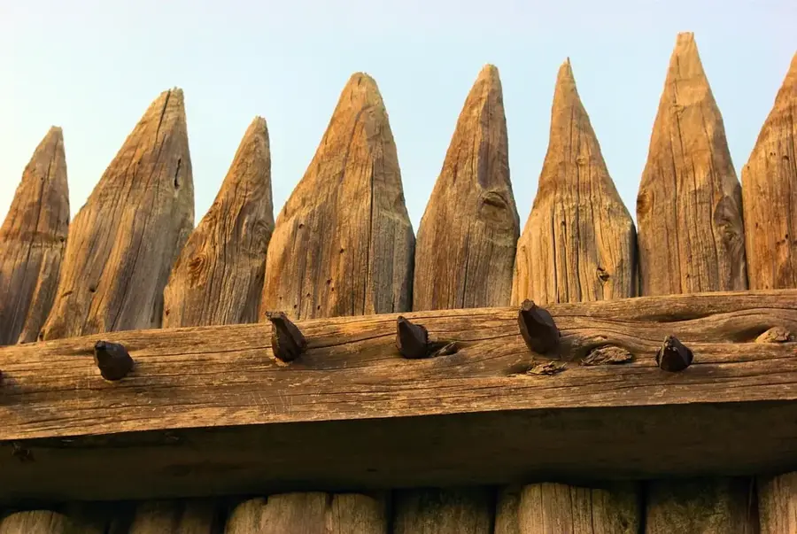
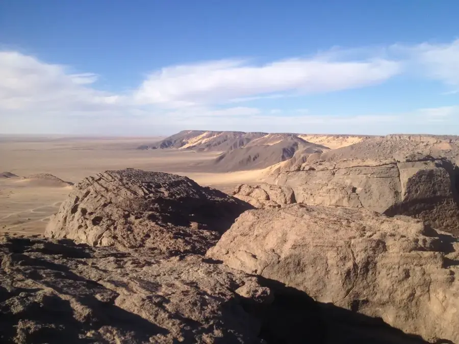
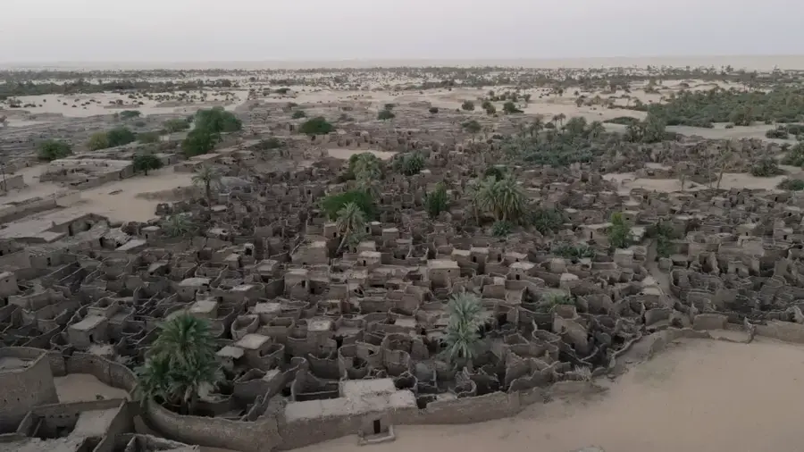
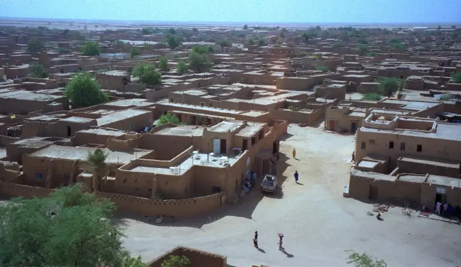
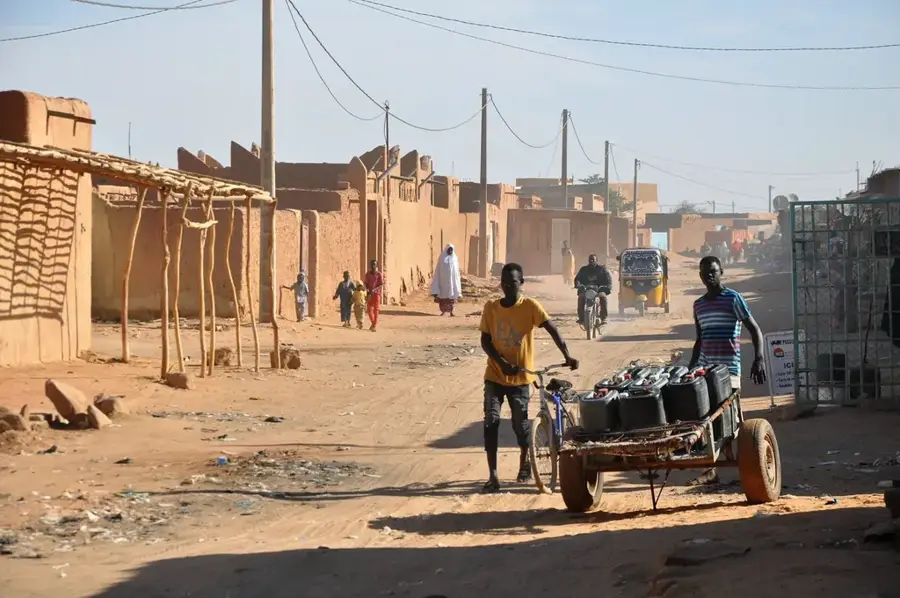
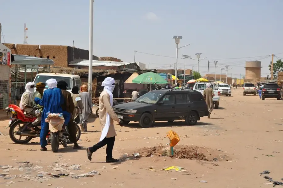
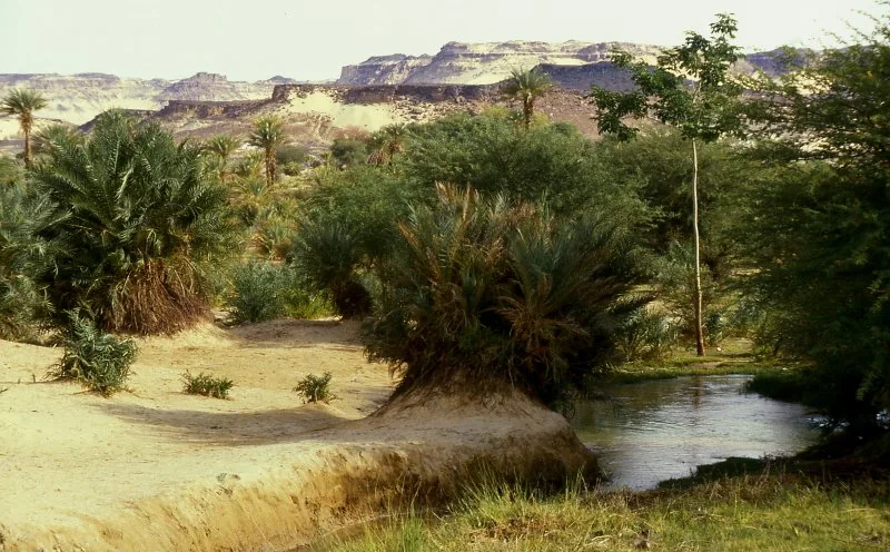
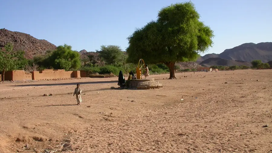
Fachi is an isolated oasis town in eastern Niger, located in the heart of the Ténéré Desert between the Aïr Mountains and the Kaouar Escarpment. The settlement is a fortified village, or ksar, historically designed to protect inhabitants from desert raids. Geographically, Fachi is positioned midway along the famous Azalaï caravan route, which transports salt from Bilma to southern markets. Life in Fachi is sustained by groundwater that supports date palm groves and small-scale gardening. The town is notable for its traditional architecture using salt blocks and mud, a method perfectly adapted to the extreme desert environment. Historically, Fachi served as a vital exchange point for dates and salt between nomadic Tuareg and sedentary Kanuri peoples. Despite its profound isolation, the community maintains rich cultural traditions that are revitalized by the regular arrival of large camel caravans.
- Location: Niger
- Population: ~2.215 (2026)
Best time to visit & climate
The most pleasant time to visit is Feb, Mar, Nov.
| Jan | Feb | Mar | Apr | May | Jun | Jul | Aug | Sep | Oct | Nov | Dec | |
|---|---|---|---|---|---|---|---|---|---|---|---|---|
| Avg °C | 16 | 19 | 24 | 29 | 33 | 34 | 34 | 33 | 32 | 28 | 22 | 17 |
| Rain mm | 0 | 0 | 0 | 0 | 36 | 1 | 3 | 11 | 2 | 0 | 0 | 0 |
Geography
Facts
- Fachi is located approximately 400 kilometers east of Agadez, surrounded by sand dunes.
- The town is also known as 'Agram', which means 'oasis' in the local Kanuri language.
- Fachi's fortification walls were originally built to defend against Tuareg raids.
- The town possesses its own salt mines, though they are smaller than those in Bilma.
- The autumn date harvest is the most significant economic event for the community.
- Fachi has no paved roads; it is accessible only by desert tracks or camel caravans.
Explore nearby
Notable places around
Route planner — Car & Motorhome
Where do you start? We build the route here, with stops and country notes along the way.
© OpenStreetMap contributors · OpenRouteService
Frequently asked questions
How to reach Fachi?
What is the peculiarity of Fachi?
Is Fachi safe for tourists?
Is a permit required?
When is the weather best?
Fachi: where is it located?
Fachi: when is the best time to visit?
Fachi: why is it worth visiting?

Nearby cities
History & landmarks
More places