Plizio Visual Lab
Erg Ténéré
Weather…
Water temperature…
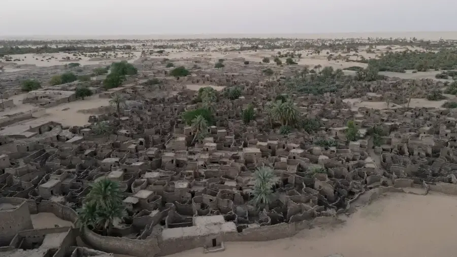
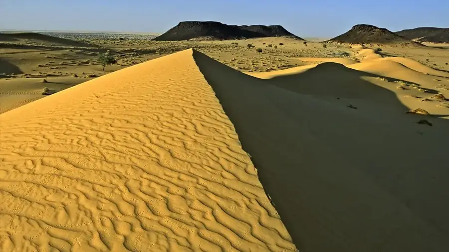
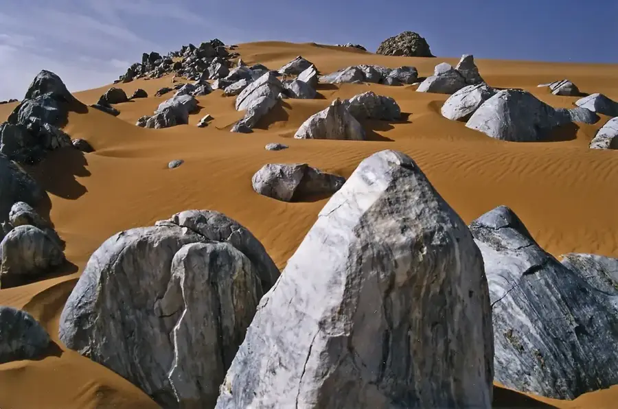
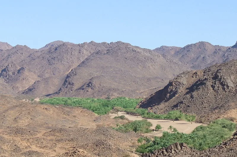
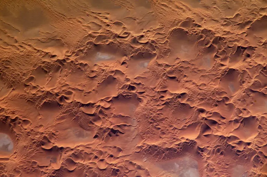
The Erg Ténéré is a massive sand sea located in northwestern Niger, forming one of the most iconic landscapes of the central Sahara. Stretching between the Aïr Mountains to the west and the Kaouar cliffs to the east, it is characterized by vast systems of longitudinal and crescent-shaped dunes (barchans). These golden sand structures can reach staggering heights of over 200 meters, constantly shifting under the influence of the prevailing Harmattan winds. The Ténéré is often described as a 'desert within a desert' due to its extreme aridity and the total absence of vegetation in its core. The aesthetic appeal of the erg is unmatched, with sand colors shifting from pale cream to deep ochre at sunset. Despite its current barren state, the area was a lush savanna thousands of years ago, as evidenced by the discovery of ancient pottery, arrowheads, and even hippopotamus bones beneath the dunes. Today, it remains one of the most isolated places on Earth, primarily crossed by Tuareg salt caravans.
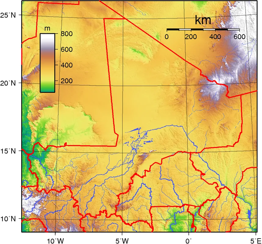
- Location: Niger
- Nearby: Fachi (67 km)
Best time to visit & climate
The most pleasant time to visit is Feb, Mar, Nov.
| Jan | Feb | Mar | Apr | May | Jun | Jul | Aug | Sep | Oct | Nov | Dec | |
|---|---|---|---|---|---|---|---|---|---|---|---|---|
| Avg °C | 16 | 19 | 24 | 29 | 33 | 34 | 33 | 33 | 32 | 28 | 22 | 17 |
| Rain mm | 0 | 0 | 0 | 0 | 29 | 1 | 8 | 21 | 3 | 1 | 0 | 0 |
📋 Practical info
Geography
Facts
- The highest dunes in the Erg Ténéré exceed 240 meters in altitude.
- The erg is a major part of the Aïr and Ténéré Natural Reserves UNESCO site.
- Sand in the Ténéré is exceptionally fine, often referred to as 'sugar sand'.
- Archaeologists have found evidence of 'Green Sahara' civilizations here from 8,000 years ago.
- The temperature difference between day and night can exceed 30 degrees Celsius.
- Most of the erg is situated at an elevation of about 400 to 500 meters.
Explore nearby
Notable places around
Route planner — Car & Motorhome
Where do you start? We build the route here, with stops and country notes along the way.
© OpenStreetMap contributors · OpenRouteService
Sights nearby
Frequently asked questions
What is an Erg?
Is hiking through the Erg safe?
Best season for Erg Ténéré?
Do I need special vehicles?
How is the water supply?
Erg Ténéré: where is it located?
Erg Ténéré: when is the best time to visit?
Erg Ténéré: why is it worth visiting?

Nature
More places