Plizio Visual Lab
Thaba-Tseka

ℹ️Practical info — Thaba-Tseka
▾
🌤 Weather — 5 days
📍 Nearby
Sights nearby
💡 Tips
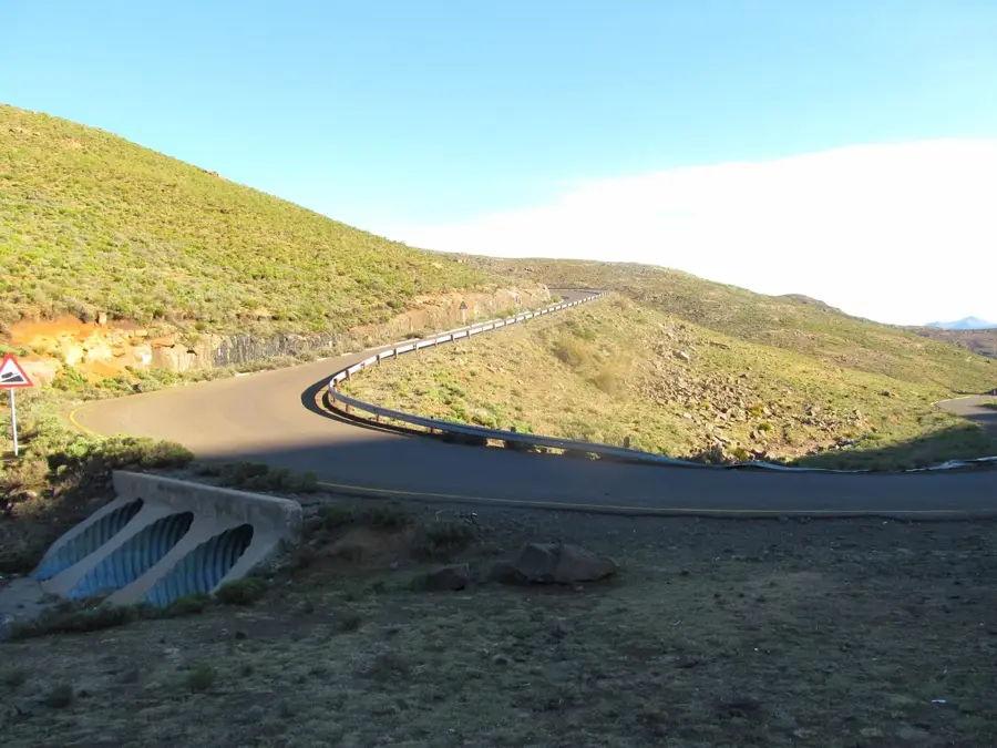
- Allow plenty of time for the winding dirt and gravel roads from Maseru; the drive takes much longer than the distance suggests.
- Fuel up your vehicle here, as petrol stations are incredibly rare in the surrounding mountain villages.
- Pack warm clothing in layers; the weather on the central plateau can change dramatically within hours.
- Use the town as a good starting point for multi-day Basotho pony treks deep into the highlands.
🍽 Food
A spicy vegetable relish served with barbecued meat, widely available at local taverns.
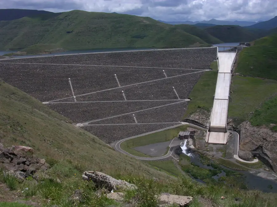
When available, try fresh trout sourced from the nearby Katse Dam at local guesthouses.
The hearty standard fare that will warm you up at the simple diners in the town center.
🛍 Shopping · 🧘 Quiet spots
Discover local leatherwork designed for horse riding at the small artisan stalls.
Buy handmade baskets and traditional Mokorotlo hats at the town market.
Walk just outside the town limits for expansive, undisturbed views over the Maluti mountain range.
Follow the small herder paths leading out of the settlement for a moment of absolute silence.
Water temperature…
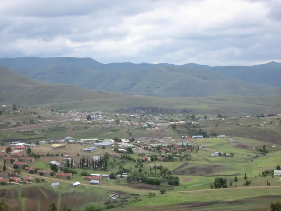
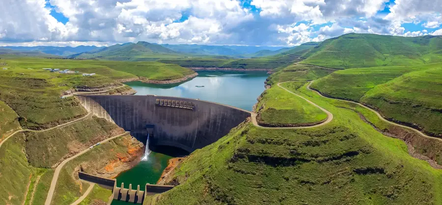
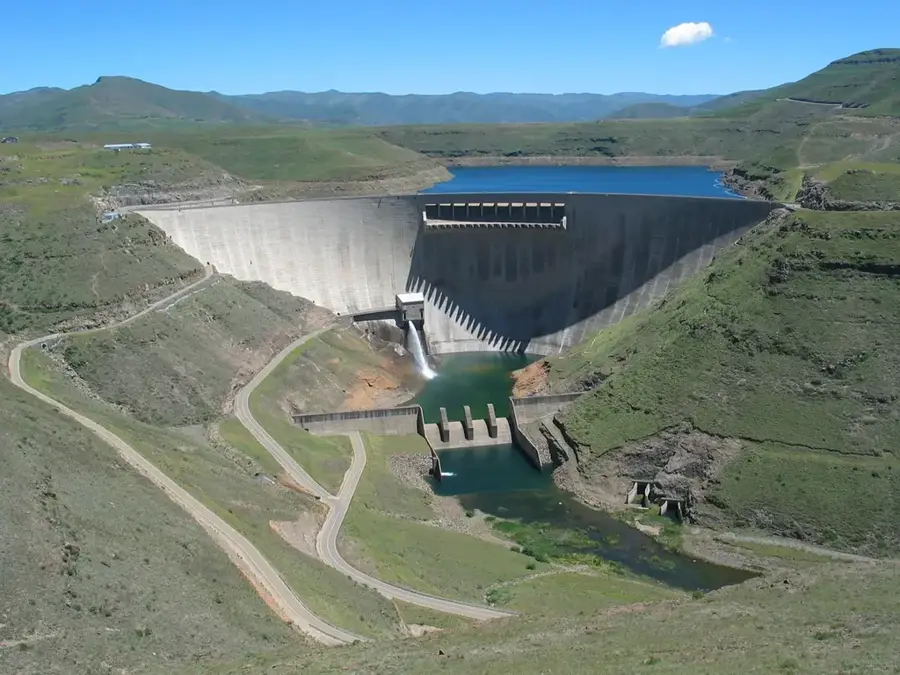
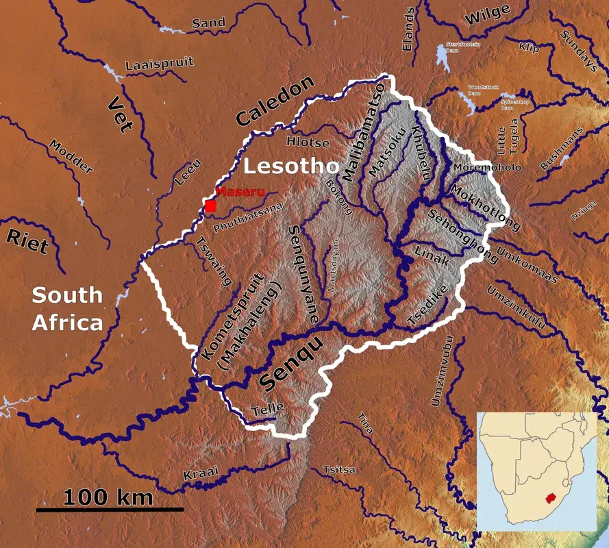
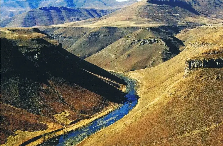
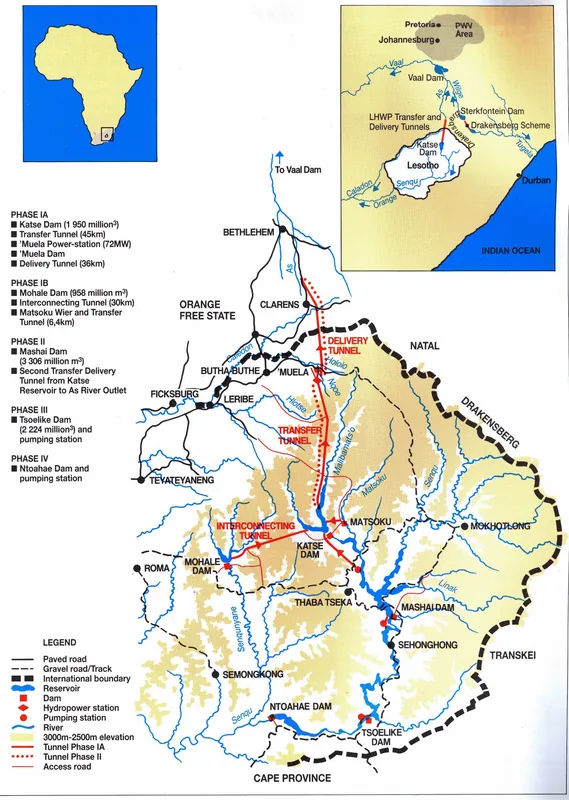
Thaba-Tseka is the capital of the Thaba-Tseka District in the central highlands of Lesotho, perched at a significant elevation of approximately 2200 meters. Established relatively recently in 1980 as an administrative center, the town was created to facilitate the development of remote mountain regions and decentralize government services. Geographically positioned in the heart of the Maloti Mountains, it serves as a critical junction for the Lesotho Highlands Water Project, particularly due to its proximity to the Katse Dam. The town's architecture is largely modern and functional, featuring government offices and trading centers that cater to a growing urban population. Economically, Thaba-Tseka is heavily reliant on pastoralism, with wool and mohair production providing the primary livelihood for surrounding rural communities. Its central location makes it a vital logistics hub for the movement of goods and services between the western lowlands and the eastern mountain interior.
- Location: Lesotho
- Nearby: Ha Rafanyane (17 km)
- Population: ~16.765 (2026)
Best time to visit & climate
The most pleasant time to visit is Sep–Nov.
| Jan | Feb | Mar | Apr | May | Jun | Jul | Aug | Sep | Oct | Nov | Dec | |
|---|---|---|---|---|---|---|---|---|---|---|---|---|
| Avg °C | 15 | 15 | 13 | 9 | 6 | 3 | 3 | 5 | 9 | 12 | 14 | 15 |
| Rain mm | 216 | 182 | 119 | 67 | 17 | 12 | 12 | 22 | 30 | 81 | 115 | 176 |
Geography
Facts
- Founded in 1980
- Elevation of 2200 meters
- Major livestock hub
- Near the Katse Dam
- Youngest district capital
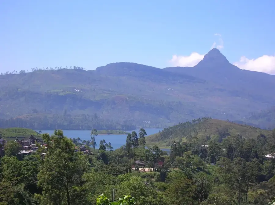
- Located in the Maloti Mountains
Explore nearby
Notable places around
Route planner — Car & Motorhome
Where do you start? We build the route here, with stops and country notes along the way.
© OpenStreetMap contributors · OpenRouteService
Frequently asked questions
Why travel to Thaba-Tseka?
How is the road connection from Maseru?
What can you do at Katse Dam?
Is Thaba-Tseka accessible in winter?
Is there medical care available?
Thaba-Tseka: where is it located?
Thaba-Tseka: when is the best time to visit?
Thaba-Tseka: why is it worth visiting?

Nearby cities
History & landmarks
Nature

More places