Plizio Visual Lab
Terskey Ala-Too
Weather…
Water temperature…
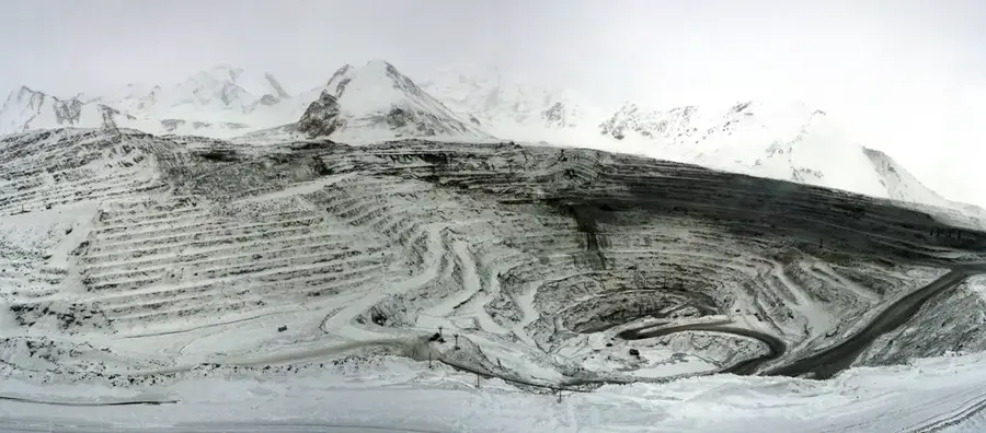
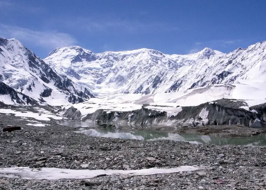
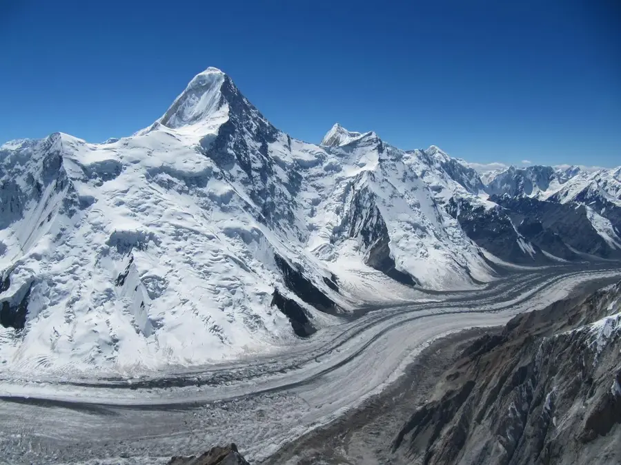
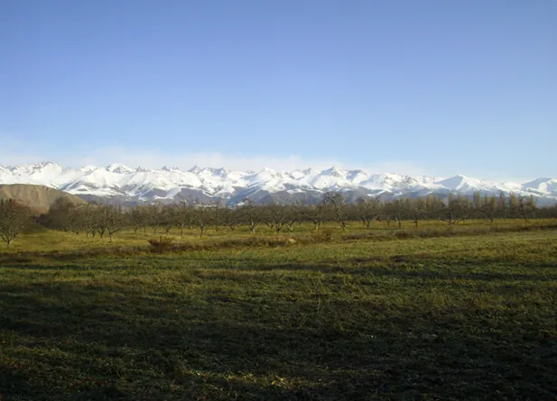
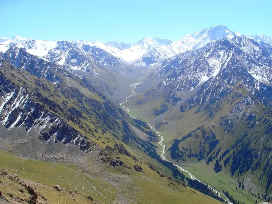
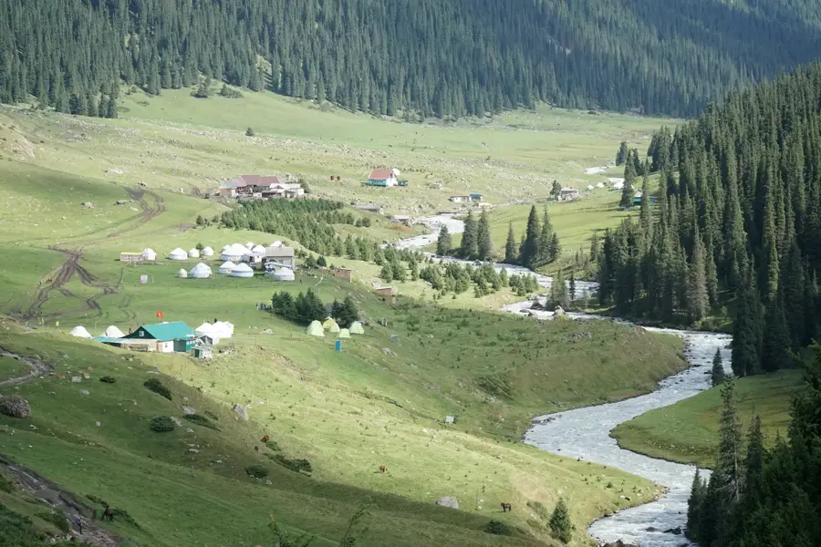
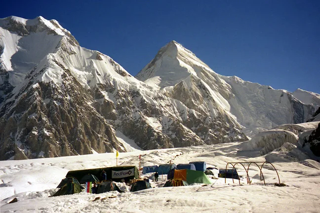
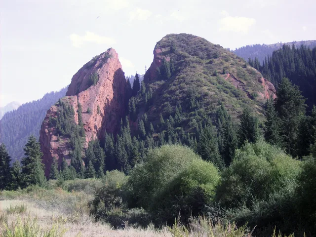
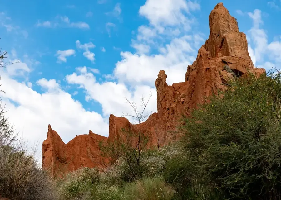
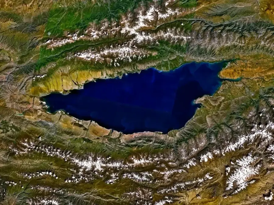
The Terskey Ala-Too is a spectacular and massive mountain range within the Tian Shan system, serving as a dramatic natural fortress wall along the entire southern shore of Lake Issyk-Kul. The name "Terskey" literally translates to "shady side" in Kyrgyz, highlighting the fact that its steep northern slopes face away from the direct sun. The mountain chain spans approximately 354 kilometers in length and reaches its maximum elevation at the majestic Karakol Peak, which soars to 5,216 meters. The range is globally renowned for its deeply cut, densely forested gorges that plunge dramatically toward the lake basin, most notably the iconic Jeti-Ögüz (Seven Bulls) gorge, the Karakol Valley, and the natural hot springs of Altyn-Arashan. The extensive glaciers of the Terskey Ala-Too act as the primary freshwater source for Issyk-Kul and significantly influence the basin's microclimate. Covered in thick spruce forests, pristine alpine pastures, and rushing mountain rivers, the Terskey Ala-Too is widely considered one of Central Asia's premier destinations for multi-day trekking and horseback riding adventures.
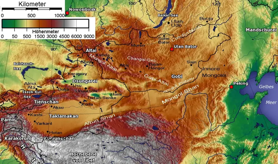
- Location: Kyrgyzstan
- Nearby: Altyn-Arashan (13 km)
Best time to visit & climate
The most pleasant time to visit is Jun–Aug.
| Jan | Feb | Mar | Apr | May | Jun | Jul | Aug | Sep | Oct | Nov | Dec | |
|---|---|---|---|---|---|---|---|---|---|---|---|---|
| Avg °C | -18 | -16 | -10 | -3 | 1 | 4 | 7 | 6 | 2 | -4 | -11 | -16 |
| Rain mm | 7 | 11 | 15 | 29 | 43 | 50 | 45 | 50 | 34 | 18 | 14 | 9 |
📋 Practical info
Geography
Facts
- Forms the majestic, towering southern backdrop to the massive Lake Issyk-Kul.
- "Terskey" literally means "shadowy side" due to its north-facing slopes.
- Karakol Peak marks the absolute highest point in the range at 5,216 meters.
- The entire mountain chain extends for approximately 354 kilometers.
- Features highly famous valleys like Jeti-Ögüz and Altyn-Arashan.
- Glaciers in the range act as the primary freshwater source for Issyk-Kul.
Explore nearby
Notable places around
Route planner — Car & Motorhome
Where do you start? We build the route here, with stops and country notes along the way.
© OpenStreetMap contributors · OpenRouteService
Sights in the town Terskey Ala-Too (1)
Sights nearby
Frequently asked questions
What are the most famous sights in Terskey Ala-Too?
Which city serves as the best starting point?
How difficult is the trekking to Ala-Kul Lake?
Are there wild animals there?
When does the snow melt on the passes?
Terskey Ala-Too: where is it located?
Terskey Ala-Too: when is the best time to visit?
Terskey Ala-Too: why is it worth visiting?

Nearby cities
History & landmarks
Nature

More places