Plizio Visual Lab
Mýrdalsjökull
Weather…
Water temperature…
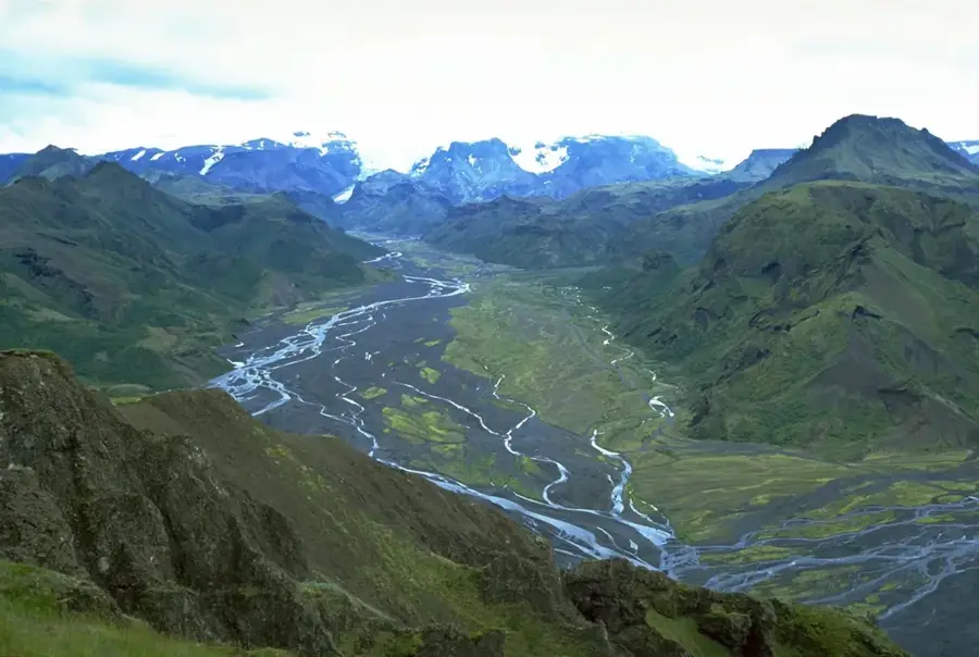
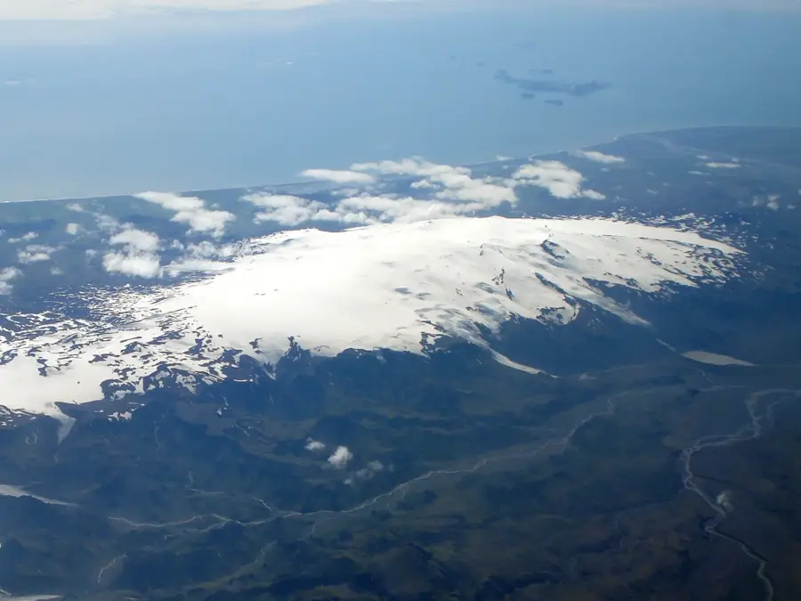
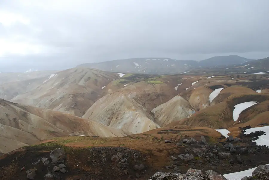
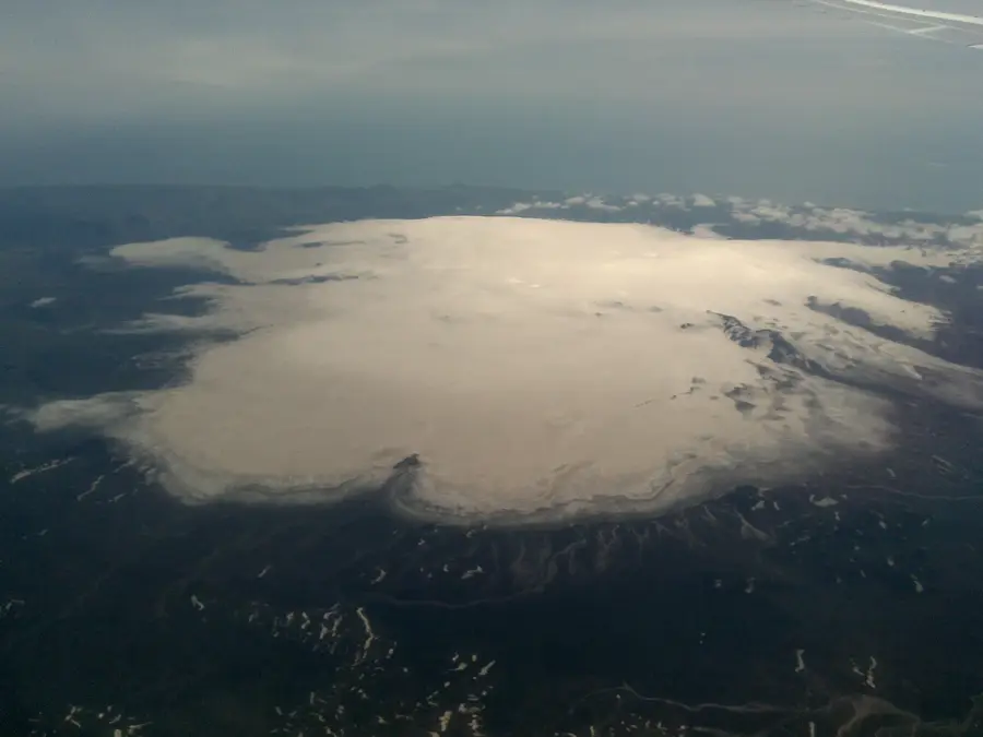
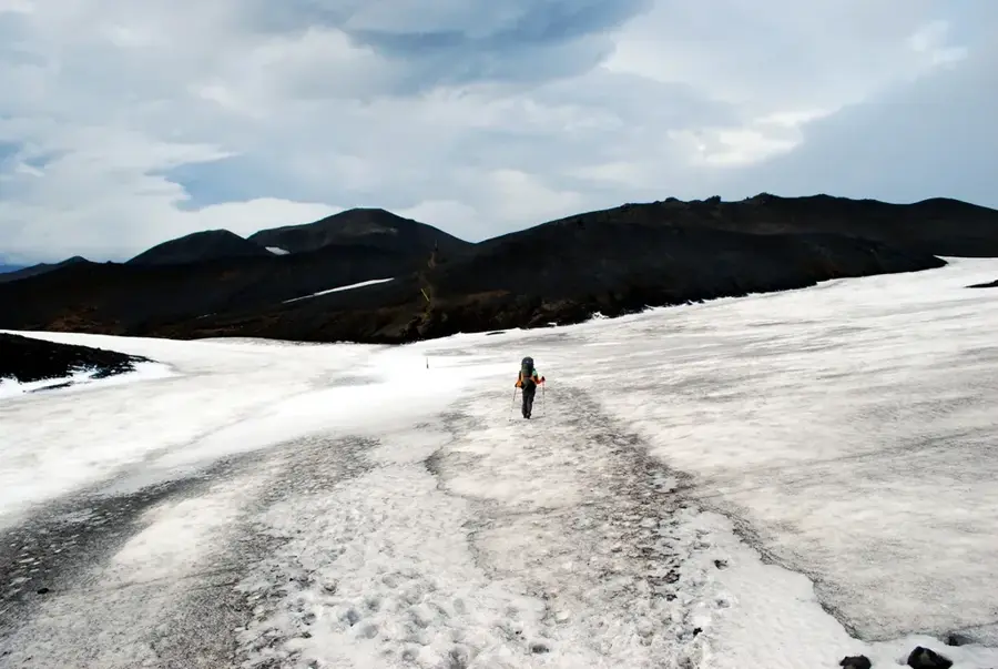
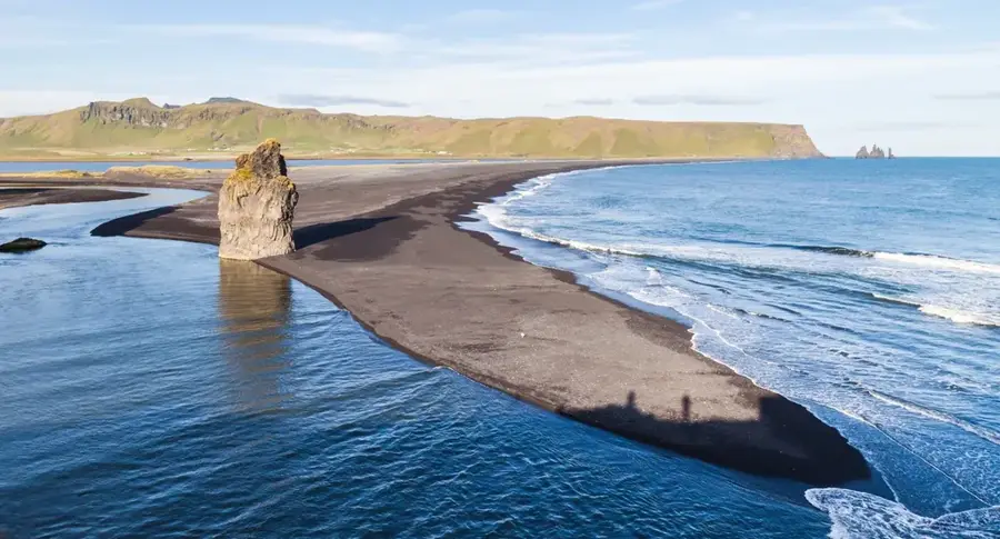
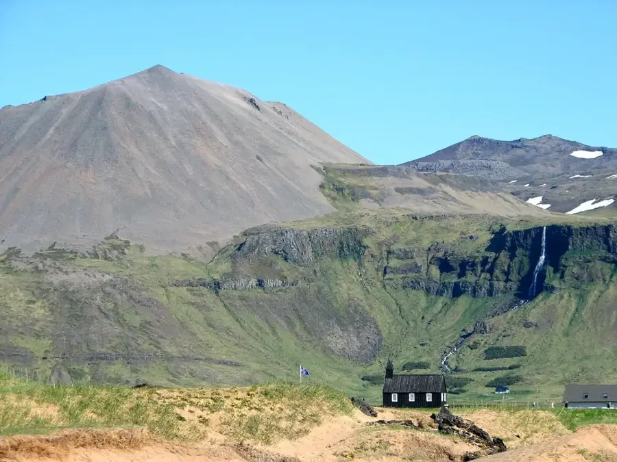
Mýrdalsjökull is the fourth largest glacier in Iceland, covering an area of approximately 595 square kilometers in the southernmost part of the island. It is primarily renowned for concealing one of the country's most dangerous and active volcanoes, Katla, beneath its ice cap. Since Katla erupts on average every 40 to 80 years, and its last major eruption occurred in 1918, the area is under constant scientific monitoring. An eruption would trigger massive glacial outburst floods (jökulhlaups) that could inundate the coastal plains. The glacier's peak reaches an elevation of about 1,493 meters above sea level. This region receives some of the highest precipitation levels in Iceland, which aids the continuous replenishment of the ice mass, even as the peripheral glacier tongues are retreating. The surrounding landscape is characterized by deep black volcanic sands and contrasting lush green mountains. Mýrdalsjökull is a crucial research site for predicting volcanic activity and its impact on the vital Ring Road infrastructure.
- Location: Iceland
- Nearby: Þórsmörk (19 km)
Best time to visit & climate
The most pleasant time to visit is Jun–Aug.
| Jan | Feb | Mar | Apr | May | Jun | Jul | Aug | Sep | Oct | Nov | Dec | |
|---|---|---|---|---|---|---|---|---|---|---|---|---|
| Avg °C | 1 | 1 | 1 | 3 | 5 | 8 | 10 | 10 | 8 | 4 | 2 | 1 |
| Rain mm | 250 | 232 | 222 | 174 | 124 | 120 | 144 | 166 | 229 | 235 | 221 | 251 |
📋 Practical info
Geography
Facts
- Covers 595 km², making it the fourth largest glacier in Iceland.
- Sits directly atop the highly active Katla volcano.
- The last major eruption of Katla was recorded in 1918.
- Reaches a maximum peak height of 1,493 meters.
- One of the wettest locations in Iceland due to orographic lift.
- Poses a high risk of jökulhlaups during volcanic unrest.
Explore nearby
Notable places around
Route planner — Car & Motorhome
Where do you start? We build the route here, with stops and country notes along the way.
© OpenStreetMap contributors · OpenRouteService
Sights nearby
Frequently asked questions
Where is Mýrdalsjökull located?
What volcano is hidden beneath it?
Can you go glacier hiking there?
Why is the ice sometimes black?
How dangerous is Katla?
Mýrdalsjökull: where is it located?
Mýrdalsjökull: when is the best time to visit?
Mýrdalsjökull: why is it worth visiting?

Nearby cities


History & landmarks


Nature
More places