Plizio Visual Lab
Lakagígar
Weather…
Water temperature…
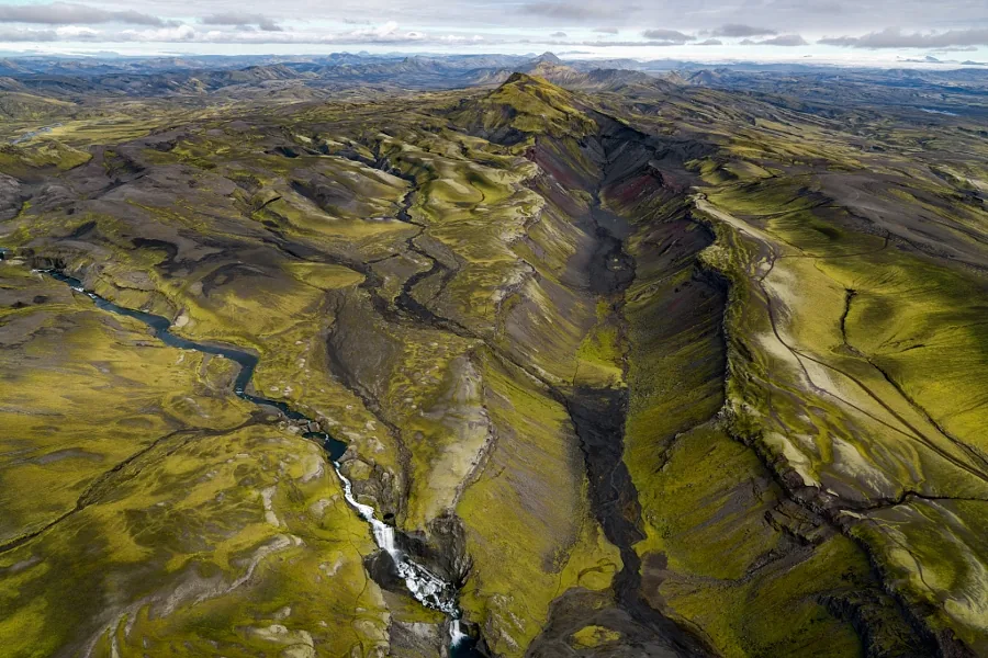
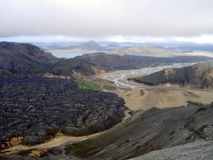
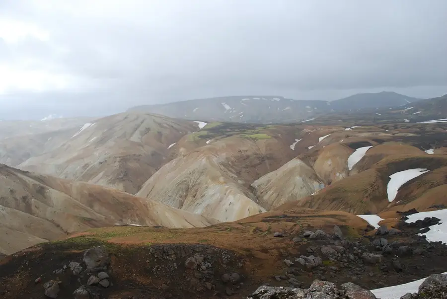
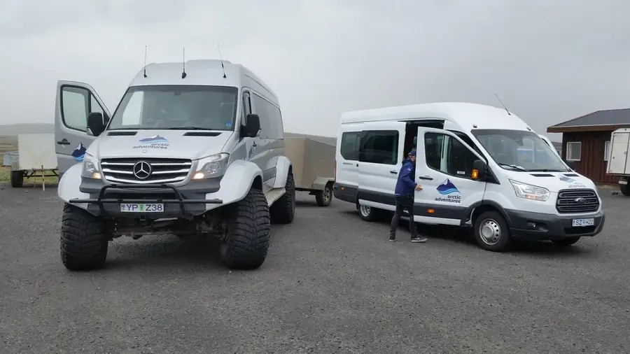
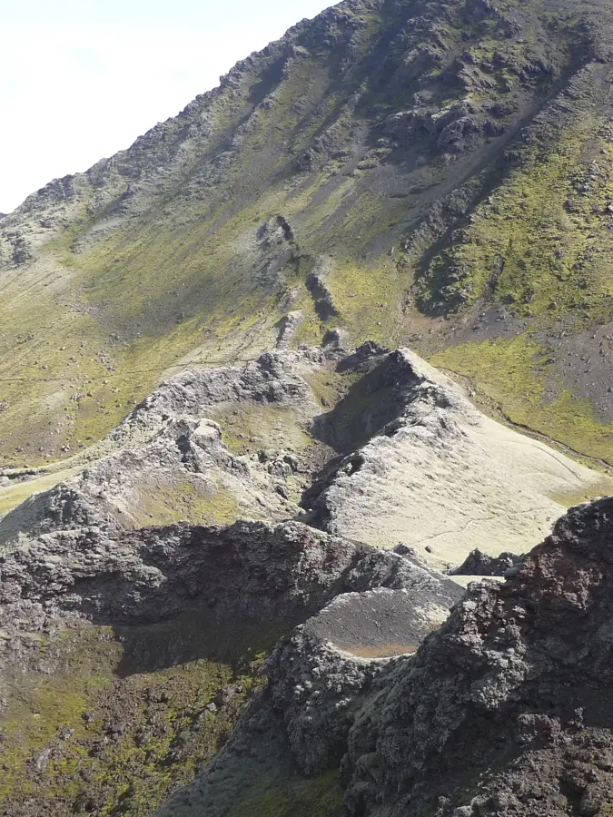
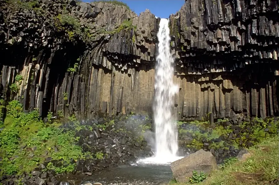
Lakagígar is an imposing chain of about 130 volcanic craters in southern Iceland, formed during one of the most devastating eruptions in recorded history. The Laki fissure eruption began on June 8, 1783, and lasted for eight months, ejecting an estimated 14 cubic kilometers of basalt lava. The massive release of sulfur dioxide created a toxic haze that spread across Europe, leading to significant cooling of the Northern Hemisphere's climate. In Iceland, the destruction of livestock led to the 'Haze Famine' (Móðuharðindin), which resulted in the death of approximately 25% of the population. Today, the area is part of Vatnajökull National Park and has a surreal landscape of moss-covered craters and vast lava fields. Accessing the site requires a 4x4 vehicle, as the route involves navigating rugged terrain and crossing several deep rivers.
- Location: Iceland
- Top sights: Varmárfell · Blængur
- Nearby: Landmannalaugar (42 km)
Best time to visit & climate
The most pleasant time to visit is Jun–Aug.
| Jan | Feb | Mar | Apr | May | Jun | Jul | Aug | Sep | Oct | Nov | Dec | |
|---|---|---|---|---|---|---|---|---|---|---|---|---|
| Avg °C | -4 | -3 | -3 | -1 | 2 | 6 | 7 | 7 | 4 | 1 | -2 | -4 |
| Rain mm | 263 | 244 | 225 | 185 | 127 | 120 | 146 | 166 | 241 | 242 | 227 | 260 |
📋 Practical info
Geography
Facts
- Consists of approximately 130 craters along a 25 km fissure
- The 1783 eruption lasted for 8 months
- Ejected 14 cubic kilometers of lava and toxic gases
- Led to the death of 25% of Iceland's population
- Part of Vatnajökull National Park and UNESCO World Heritage
- Accessible only via rugged highland F-roads
Explore nearby
Notable places around
Route planner — Car & Motorhome
Where do you start? We build the route here, with stops and country notes along the way.
© OpenStreetMap contributors · OpenRouteService
Sights in the town Lakagígar (2)
Sights nearby
Frequently asked questions
How many craters are in this row?
Do I need a 4x4 for Lakagígar?
What happened during the 1783 eruption?
Are there toilets or water available?
How long does the trip from the Ring Road take?
Lakagígar: where is it located?
Lakagígar: what is there to see?
Lakagígar: when is the best time to visit?
Lakagígar: why is it worth visiting?

Nearby cities


History & landmarks


Nature
More places