Plizio Visual Lab
Vitorog
Weather…
Water temperature…
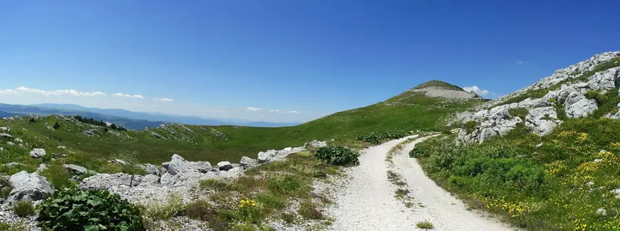
Vitorog is a massive mountain range in central-western Bosnia and Herzegovina, situated at the junction of the Šipovo, Kupres, and Glamoč municipalities. Its highest peak, Veliki Vitorog, rises to 1,906 meters. The mountain is renowned for its pristine wilderness and dense coniferous forests, which provide a sanctuary for rare wildlife such as capercaillies and brown bears. Geologically, Vitorog is a classic karst formation, featuring numerous caves and sinkholes, including the impressive Vaganska Cave, one of the deepest and longest in the region. During the Yugoslav era, a strategically important military communication center was located on the summit, the ruins of which remain a point of interest for hikers today. The climate is characterized by long, snowy winters and short, cool summers, making it a destination for experienced outdoorsmen. Historically, the Vitorog area has often served as a borderland between different cultural and administrative zones, influencing local traditions.
- Location: Bosnia and Herzegovina
- Nearby: Glamoč (17 km)
Best time to visit & climate
The most pleasant time to visit is Jun–Aug.
| Jan | Feb | Mar | Apr | May | Jun | Jul | Aug | Sep | Oct | Nov | Dec | |
|---|---|---|---|---|---|---|---|---|---|---|---|---|
| Avg °C | -2 | -1 | 2 | 7 | 11 | 15 | 18 | 19 | 13 | 9 | 4 | 0 |
| Rain mm | 94 | 89 | 78 | 75 | 72 | 64 | 38 | 54 | 92 | 94 | 128 | 115 |
📋 Practical info
Geography
Facts
- The highest peak, Veliki Vitorog, stands at 1,906 meters.
- Vaganska Cave is over 400 meters in length.
- The Janj River has its source within the mountain range.
- Remnants of a former military base are located on the summit.
- The mountain is a key habitat for the protected capercaillie.
- Snow cover can last for up to six months of the year.
Explore nearby
Notable places around
Route planner — Car & Motorhome
Where do you start? We build the route here, with stops and country notes along the way.
© OpenStreetMap contributors · OpenRouteService
Sights in the town Vitorog (1)
Sights nearby
Frequently asked questions
What is unique about the Vitorog peak?
Where is Mount Vitorog located?
How high is Vitorog?
How is the view from the summit?
Is the bunker accessible to tourists?
Vitorog: where is it located?
Vitorog: when is the best time to visit?
Vitorog: why is it worth visiting?
Nearby cities