Plizio Visual Lab
Veletovo Fortress

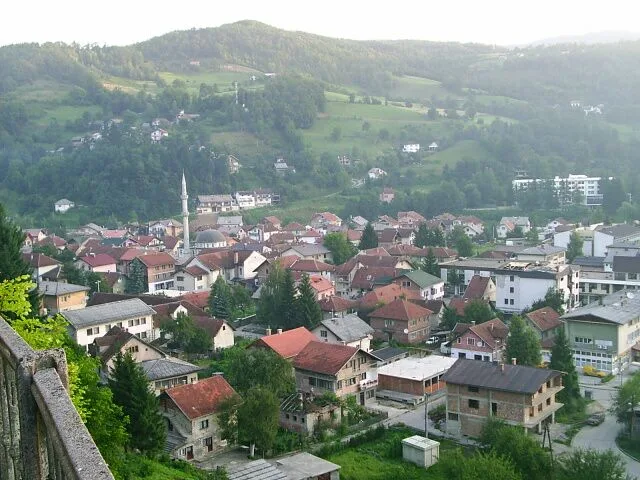
Veletovo Fortress is situated on a steep rocky ridge above the village of Veletovo near Višegrad. This medieval fortification primarily served to monitor the valley and the important trade routes connecting Central Bosnia with Serbia. The walls of the fortress follow the natural topography of the terrain, making it a formidable defensive position during the Middle Ages. Historical sources mention the fortress in the context of defense against Ottoman expansion in the 15th century. Following its eventual capture, the site gradually lost its military significance and fell into ruin over the centuries. Today, clear remnants of the defensive walls and towers are still visible, attracting archaeologists and hikers. The strategic location also gives a commanding view over the surrounding mountain landscape and the Drina River gorges.
- Location: Bosnia and Herzegovina
- Nearby: Foča-Ustikolina (10 km)
Best time to visit & climate
The most pleasant time to visit is Jun–Aug.
| Jan | Feb | Mar | Apr | May | Jun | Jul | Aug | Sep | Oct | Nov | Dec | |
|---|---|---|---|---|---|---|---|---|---|---|---|---|
| Avg °C | -2 | -1 | 3 | 7 | 12 | 16 | 18 | 18 | 13 | 9 | 4 | -1 |
| Rain mm | 89 | 87 | 86 | 74 | 86 | 101 | 65 | 55 | 84 | 92 | 108 | 100 |
📋 Practical info
Geography
Facts
- Monitored the trade route between Bosnia and Serbia.
- Built on a steep rocky ridge for maximum defense.
- Mentioned in documents regarding the 15th-century Ottoman conquest.
- Located in the vicinity of the modern town of Višegrad.
- The walls are integrated into the natural rock formations.
- Served as a refuge for the local population during attacks.
Explore nearby
Notable places around
Route planner — Car & Motorhome
Where do you start? We build the route here, with stops and country notes along the way.
© OpenStreetMap contributors · OpenRouteService
Sights in the town Veletovo Fortress (1)
Sights nearby
Frequently asked questions
Where exactly is Veletovo located?
What is left of the fortress today?
Is the climb dangerous?
Is there drinking water available?
Why was the fortress built there?
Veletovo Fortress: where is it located?
Veletovo Fortress: when is the best time to visit?
Veletovo Fortress: why is it worth visiting?
Nearby cities