Plizio Visual Lab
Trebević Protected Landscape
Weather…
Water temperature…
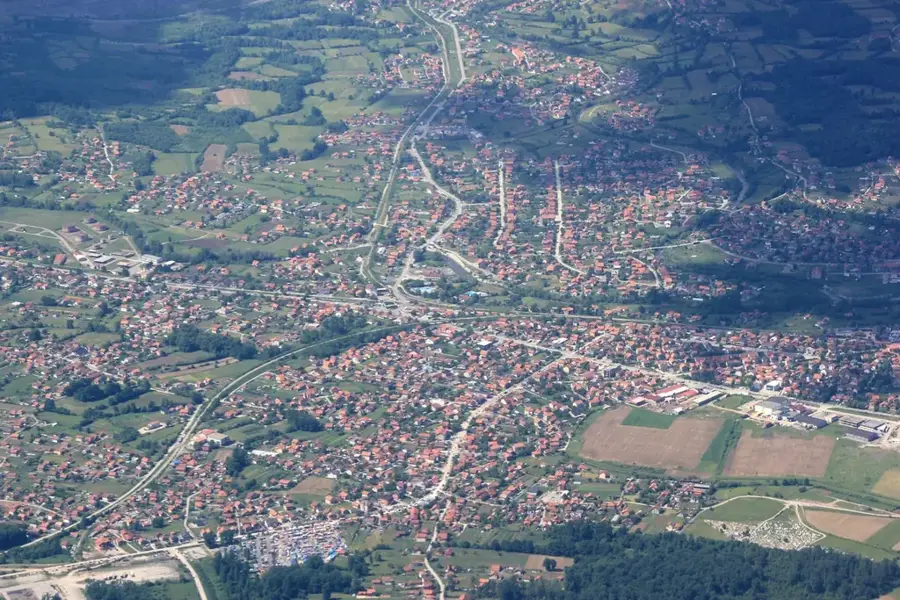
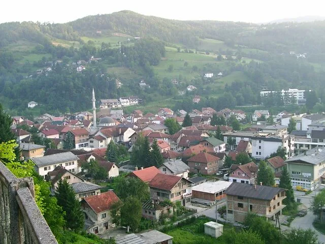
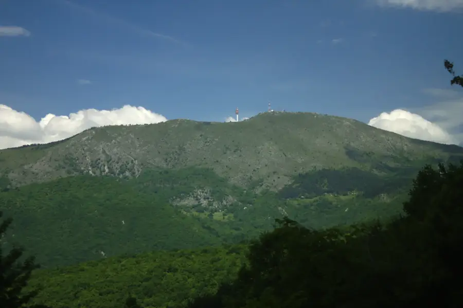
Mount Trebević is one of the most iconic symbols of Sarajevo and a protected landscape rising to an altitude of 1,627 meters. Geographically situated to the southeast of the city, the mountain is divided between the Federation and the Republika Srpska. It gained international fame during the 1984 Winter Olympics, as it hosted the bobsleigh and luge competitions. The ruins of the Olympic track remain a popular destination for hikers and street artists today. In 2018, the reconstructed Sarajevo cable car resumed operation, connecting the Bistrik neighborhood directly to the mountain plateau and significantly boosting tourism. The mountain's flora is remarkably diverse, featuring hundreds of species, including the endemic Trebević bellflower. Despite suffering heavy damage as a front line during the 1990s war, the area has recovered and once again serves as the 'lungs of the city'. Numerous viewpoints along its ridges offer wide-open panoramic vistas of the entire Sarajevo valley.
- Location: Bosnia and Herzegovina
- Top sights: Austro-ugarski artiljerijski položaji iz I. svj. rata · Eksponat bob staze · Vidikovac
- Nearby: East Sarajevo (5 km)
Best time to visit & climate
The most pleasant time to visit is Jun–Aug.
| Jan | Feb | Mar | Apr | May | Jun | Jul | Aug | Sep | Oct | Nov | Dec | |
|---|---|---|---|---|---|---|---|---|---|---|---|---|
| Avg °C | -2 | -1 | 2 | 7 | 12 | 16 | 18 | 18 | 13 | 9 | 4 | -1 |
| Rain mm | 63 | 64 | 69 | 69 | 99 | 103 | 75 | 61 | 77 | 71 | 74 | 73 |
📋 Practical info
Geography
Facts
- Highest peak: 1,627 m
- Olympic year: 1984
- Cable car reopened: 2018
- Protected area: Approx. 400 ha
- Feature: Olympic bobsleigh track
- Location: Southeast of Sarajevo
Explore nearby
Notable places around
Route planner — Car & Motorhome
Where do you start? We build the route here, with stops and country notes along the way.
© OpenStreetMap contributors · OpenRouteService
Sights in the town Trebević Protected Landscape (10)
Vidikovac
Viewpoint on Trebević, provides panoramic views of Sarajevo and surroundings.
Trebević Protected Landscape
Protected landscape on Trebević, areas of natural and cultural value.
Bistrik Kula🏰 castle
Former observatory in Bosnia and Herzegovina, now a ruin on Trebević.
Majdan kamena
Archaeological site, former stone quarry on Trebević.
Palež kula
Fortification on Trebević, ruins of a historic fortress.
Utvrda Draguljac
Archaeological site, remains of a fortification called Draguljac on Trebević.
Spomen obilježje Kazani
Monument on Trebević, commemorates the victims of Kazani during the Bosnian War.
Trebević-Sofe
Peak of Trebević, the highest point of the mountain with a view.
Sights nearby
Frequently asked questions
What is the fastest way to get from Sarajevo to Trebević?
Are there remains of the Olympic Games there?
Can you see the whole city from Trebević?
Are there hiking trails there?
Are there hotels on the mountain?
Trebević Protected Landscape: where is it located?
Trebević Protected Landscape: what is there to see?
Trebević Protected Landscape: when is the best time to visit?
Trebević Protected Landscape: why is it worth visiting?
Nearby cities