Plizio Visual Lab
Parima-Tapirapecó National Park
Weather…
Water temperature…
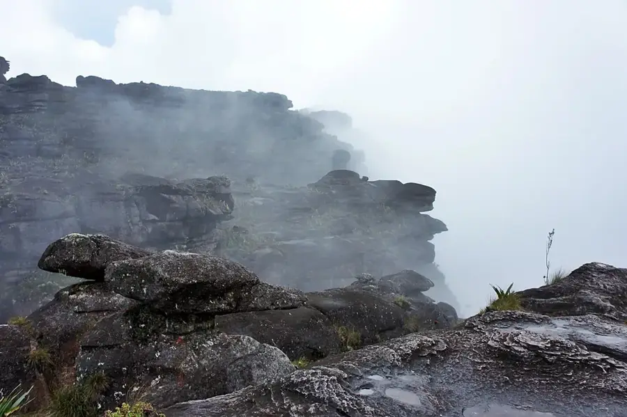
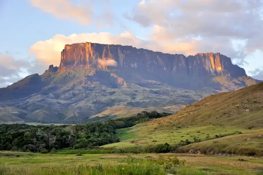
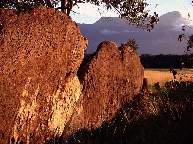
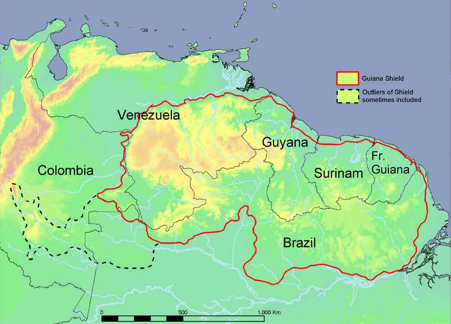
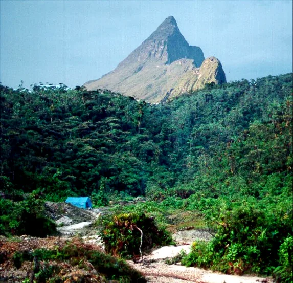
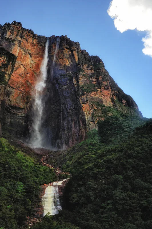
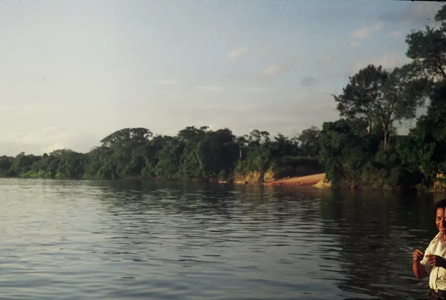
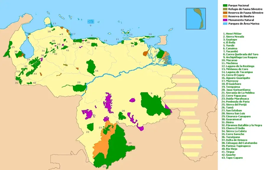
Parima-Tapirapecó National Park is Venezuela's largest national park and one of the largest in the world, spanning approximately 3.8 million hectares. Established in 1991, it is located in the Amazonas State along the border with Brazil. The park protects the headwaters of the Orinoco River and encompasses much of the Sierra Parima range and parts of the Guiana Shield. This remote region is almost entirely covered by pristine tropical rainforest and tepuis, hosting extraordinary biodiversity. Culturally, the park is of immense significance as it is home to the Yanomami people, whose traditional way of life and territory are meant to be preserved by the national park status. Due to its extreme remoteness and the absence of roads, the park remains largely unexplored and is accessible only by air or river. Its geological formations are among the oldest on Earth, creating a unique landscape of mountains, plateaus, and dense jungle that is vital for global climate regulation.
Best time to visit & climate
The most pleasant time to visit is Feb, Sep, Oct.
| Jan | Feb | Mar | Apr | May | Jun | Jul | Aug | Sep | Oct | Nov | Dec | |
|---|---|---|---|---|---|---|---|---|---|---|---|---|
| Avg °C | 25 | 25 | 25 | 24 | 23 | 23 | 23 | 23 | 24 | 24 | 24 | 24 |
| Rain mm | 111 | 101 | 143 | 241 | 315 | 266 | 209 | 170 | 122 | 115 | 121 | 126 |
📋 Practical info
Geography
Facts
- Spanning 38,290 km², it is the fifth-largest national park in the world by area.
- The park was officially established on August 1, 1991, under Decree No. 1,636.
- It houses the headwaters of the Orinoco River, discovered in 1951 by a Franco-Venezuelan expedition.
- The region is home to approximately 15,000 Yanomami indigenous people living in traditional communities.
- Elevations within the park range from 150 to 2,100 meters above sea level.
- Significant tributaries such as the Ocamo, Mavaca, and Siapa rivers originate within the park.
Explore nearby
Notable places around
Route planner — Car & Motorhome
Where do you start? We build the route here, with stops and country notes along the way.
© OpenStreetMap contributors · OpenRouteService
Sights nearby
Frequently asked questions
What is special about this park?
Is this park developed for tourism?
What protection measures apply here?
Is there infrastructure there?
Why is this park so important?
Parima-Tapirapecó National Park: where is it located?
Parima-Tapirapecó National Park: when is the best time to visit?
Parima-Tapirapecó National Park: why is it worth visiting?

History & landmarks
Nature
More places