Plizio Visual Lab
Serranía de la Neblina National Park

Weather…
Water temperature…
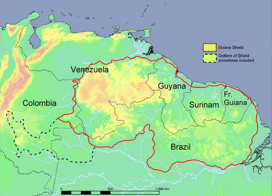
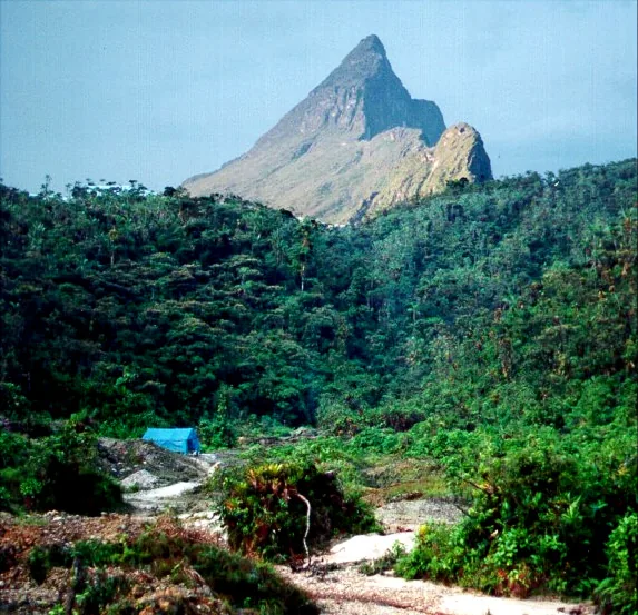
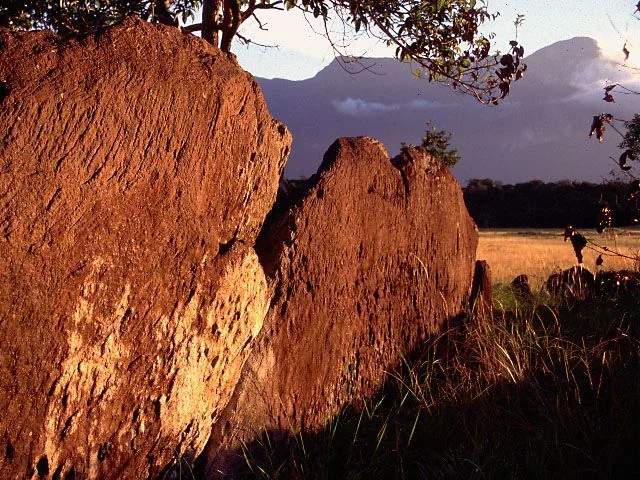
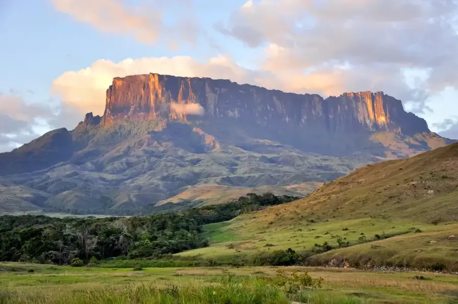
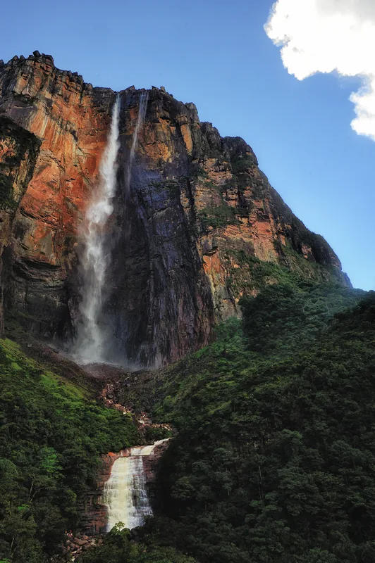
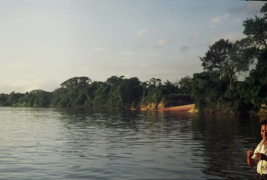
Serranía de la Neblina National Park was established on December 12, 1978, and is located in the far south of Venezuela on the border with Brazil. Covering 1.36 million hectares, it protects the Neblina massif, which features the highest peak of the Guiana Shield and the highest point in South America outside the Andes: Pico da Neblina at 2,995 meters. The park is renowned for its extreme isolation and spectacular tepuis that rise from the dense Amazon rainforest. The flora and fauna are characterized by an extremely high level of endemism, with many species found only on the isolated summits of this massif. Geologically, these are ancient sandstone formations shaped by millions of years of erosion, featuring deep canyons like the Cañón Grande del Río Baría. Historically, the area was only scientifically explored starting in the mid-20th century. Due to its remoteness, the park is accessible almost exclusively by helicopter or weeks-long river expeditions, and it is regarded as one of the last great untouched wilderness areas on Earth.
Best time to visit & climate
The most pleasant time to visit is Jul–Sep.
| Jan | Feb | Mar | Apr | May | Jun | Jul | Aug | Sep | Oct | Nov | Dec | |
|---|---|---|---|---|---|---|---|---|---|---|---|---|
| Avg °C | 26 | 26 | 26 | 25 | 25 | 25 | 25 | 25 | 26 | 26 | 26 | 26 |
| Rain mm | 231 | 204 | 263 | 260 | 297 | 239 | 180 | 172 | 148 | 170 | 181 | 215 |
📋 Practical info
Geography
Facts
- The official establishment was on December 12, 1978, under Decree No. 2,978.
- The park covers a massive area of 1,360,000 hectares in Amazonas State.
- Pico da Neblina is the highest mountain in the Tepui region at 2,995 meters.
- The Cañón Grande del Río Baría is one of the deepest canyons on Earth.
- The region records annual rainfall exceeding 4,000 mm.
- The park is a key component of the Alto Orinoco-Casiquiare Biosphere Reserve.
Explore nearby
Notable places around
Route planner — Car & Motorhome
Where do you start? We build the route here, with stops and country notes along the way.
© OpenStreetMap contributors · OpenRouteService
Sights nearby
Frequently asked questions
What is this park?
Is it open for tourists?
Why is it protected?
Can you camp there?
What is the weather like?
Serranía de la Neblina National Park: where is it located?
Serranía de la Neblina National Park: when is the best time to visit?
Serranía de la Neblina National Park: why is it worth visiting?

History & landmarks
Nature
More places