Plizio Visual Lab
Rebra
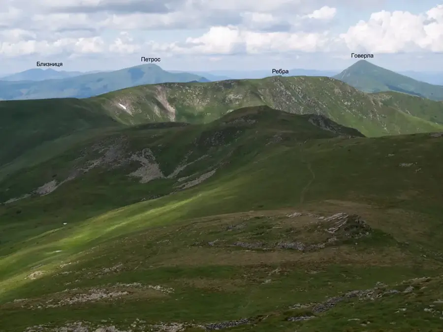
Mount Rebra is the lowest of the six Ukrainian peaks exceeding 2,000 meters, standing at an elevation of 2,001 meters in the Chornohora range. Its name, which translates to 'Ribs,' refers to the distinctive rocky outcrops and jagged ledges on its northern and eastern slopes that resemble a ribcage. These unique geological features were carved by ancient glaciers and subsequent frost shattering. The mountain sits on the administrative border between the Ivano-Frankivsk and Zakarpattia Oblasts. Rebra's slopes are covered with vast carpets of mountain pine and are home to diverse alpine flora, including the Carpathian bellflower. As a central point on the Chornohora ridge, it serves as a popular photography spot and a scenic resting area for high-altitude trekkers.
- Location: Ukraine
- Top sights: Rebra · Shpytsi
- Nearby: Verkhovyna (19 km)
Best time to visit & climate
The most pleasant time to visit is Jun–Aug.
| Jan | Feb | Mar | Apr | May | Jun | Jul | Aug | Sep | Oct | Nov | Dec | |
|---|---|---|---|---|---|---|---|---|---|---|---|---|
| Avg °C | -7 | -5 | -1 | 6 | 11 | 15 | 17 | 17 | 12 | 6 | 1 | -4 |
| Rain mm | 51 | 51 | 65 | 66 | 114 | 125 | 120 | 80 | 76 | 69 | 56 | 55 |
📋 Practical info
Geography
Facts
- Mount Rebra reaches an altitude of 2,001 meters.
- It is the shortest of the six peaks in Ukraine over 2,000m.
- The name 'Rebra' means 'Ribs' due to its jagged rock ridges.
- The mountain is composed of Paleogene sedimentary rocks.
- It lies on the border of Zakarpattia and Ivano-Frankivsk Oblasts.
- The northern slopes feature dramatic glacial hollows and debris flows.
Explore nearby
Notable places around
Route planner — Car & Motorhome
Where do you start? We build the route here, with stops and country notes along the way.
© OpenStreetMap contributors · OpenRouteService
Sights in the town Rebra (2)
Sights nearby
Frequently asked questions
How high is Mount Rebra?
Why is the mountain called 'Ribs'?
Where is this peak located?
Is it accessible for hikers?
What can you see from the peak?
Rebra: where is it located?
Rebra: what is there to see?
Rebra: when is the best time to visit?
Rebra: why is it worth visiting?

Nearby cities