Plizio Visual Lab
Hoverla
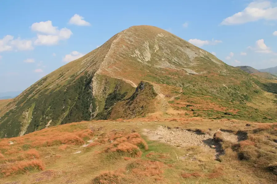
Hoverla is the highest mountain in Ukraine, standing at 2,061 meters above sea level, and serves as a central symbol of national pride. It is located in the Chornohora massif of the Carpathian Mountains, on the border between the Ivano-Frankivsk and Zakarpattia regions. Geologically, the mountain consists primarily of sandstone and features a distinct conical shape formed by ancient glacial activity. Vegetation is organized into altitudinal zones, transitioning from dense beech and spruce forests to subalpine meadows known as polonynas. The first documented ascent took place in 1780, and since then, the mountain has become the most popular destination for climbers in Ukraine. During winter, Hoverla poses a serious challenge due to avalanche risks and extreme weather conditions. The mountain is part of the Carpathian Biosphere Reserve, ensuring the protection of rare alpine flora and fauna. Every year, thousands of people climb the peak on Independence Day as a gesture of national unity.
- Location: Ukraine
- Top sights: Hoverla · Breskul · Pozhyzhevska
- Nearby: Dragobrat (15 km)
Best time to visit & climate
The most pleasant time to visit is Jun–Aug.
| Jan | Feb | Mar | Apr | May | Jun | Jul | Aug | Sep | Oct | Nov | Dec | |
|---|---|---|---|---|---|---|---|---|---|---|---|---|
| Avg °C | -7 | -5 | -1 | 6 | 11 | 15 | 17 | 17 | 12 | 6 | 1 | -4 |
| Rain mm | 51 | 51 | 65 | 66 | 114 | 125 | 120 | 80 | 76 | 69 | 56 | 55 |
📋 Practical info
Geography
Facts
- Highest point in Ukraine at exactly 2,061 meters.
- Located in the Chornohora massif of the Ukrainian Carpathians.
- First documented ascent occurred in the year 1780.
- The name likely originates from the Hungarian word 'Hóvár'.
- Home to rare alpine plants such as the edelweiss.
- Part of the Carpathian Biosphere Reserve since 1968.
Explore nearby
Notable places around
Route planner — Car & Motorhome
Where do you start? We build the route here, with stops and country notes along the way.
© OpenStreetMap contributors · OpenRouteService
Sights in the town Hoverla (4)
Sights nearby
Frequently asked questions
How high is Hoverla?
Is the climb difficult?
When is the best time for a climb?
Where does the most popular trail start?
What should you take to the summit?
Hoverla: where is it located?
Hoverla: what is there to see?
Hoverla: when is the best time to visit?
Hoverla: why is it worth visiting?

Nearby cities