Plizio Visual Lab
Tanambogo Island
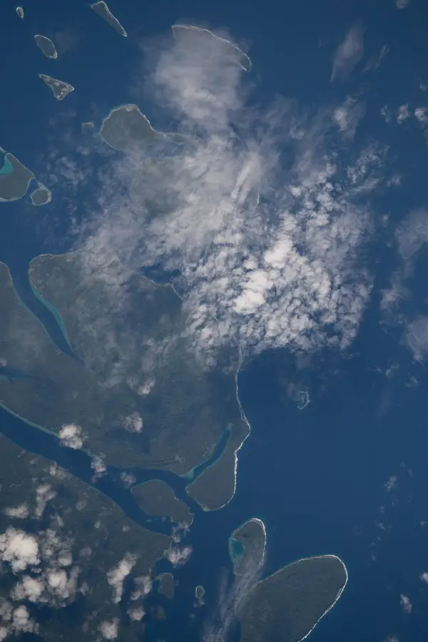
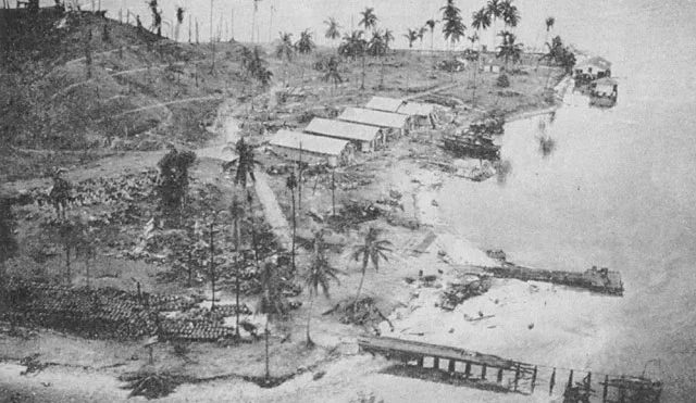
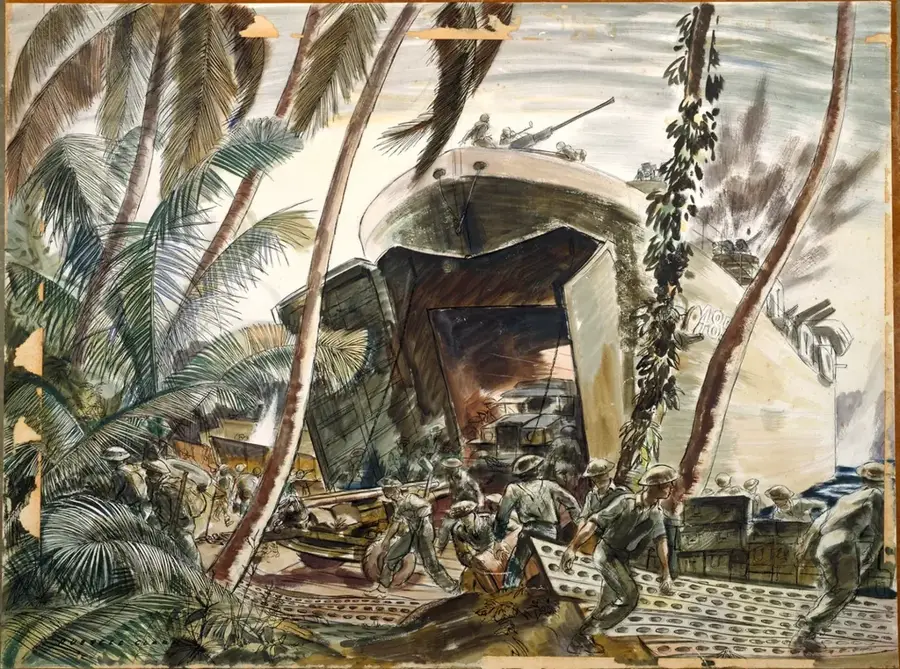
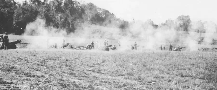
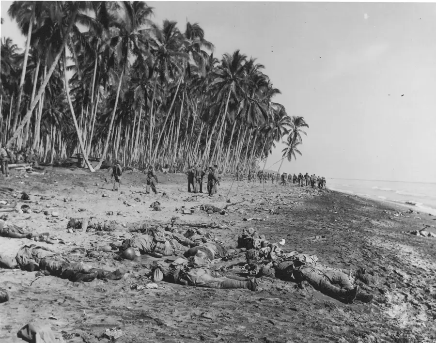
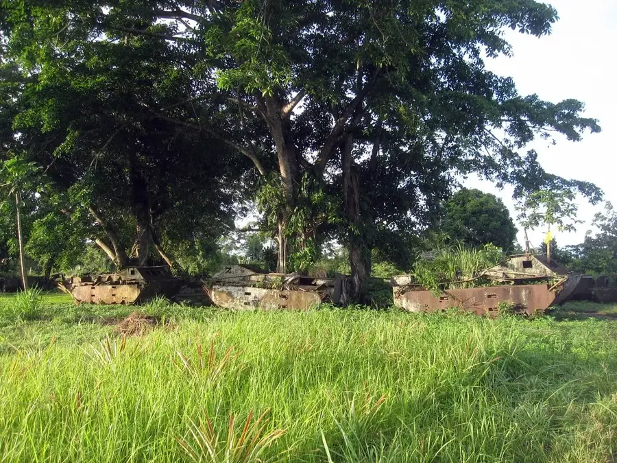
Tanambogo is a tiny island in the Tulagi vicinity, famously linked to its twin island Gavutu by a man-made stone causeway. During World War II, it was an integral part of the Japanese naval aviation infrastructure, serving as a vital seaplane base. The island is characterized by a steep central hill, which Japanese forces heavily fortified with tunnels and machine-gun nests during their 1942 occupation. The Allied assault in August 1942 met with such intense resistance that the initial landing attempt by US Marines was repulsed with significant casualties. Only after sustained naval bombardment by destroyers and the deployment of tanks across the causeway did the Americans secure the island. Currently, Tanambogo is uninhabited and covered in dense tropical growth, yet it remains a site of great interest for historians due to the well-preserved foundations of military structures and the visible effects of heavy artillery fire on its landscape.
- Location: Solomon Islands
- Top sights: Battle of Tulagi and Gavutu-Tanambogo · Japanese destroyer Kikuzuki (1926) · Halavo Seaplane Base
- Nearby: Tulagi (4 km)
Best time to visit & climate
The most pleasant time to visit is Jun, Aug, Sep.
| Jan | Feb | Mar | Apr | May | Jun | Jul | Aug | Sep | Oct | Nov | Dec | |
|---|---|---|---|---|---|---|---|---|---|---|---|---|
| Avg °C | 29 | 28 | 28 | 28 | 29 | 28 | 28 | 28 | 28 | 28 | 28 | 29 |
| Rain mm | 284 | 282 | 271 | 215 | 201 | 187 | 195 | 167 | 169 | 193 | 194 | 218 |
📋 Practical info
Geography
Facts
- The island was finally secured by US forces on August 8, 1942.
- Japanese snipers in the hill's caves presented a major threat to the invading Marines.
- The USS Buchanan destroyer provided direct fire support from very close range.
- The stone causeway connecting to Gavutu is roughly 150 meters in length.
- Before the war, Tanambogo housed senior staff for the regional copra industry.
- Visible shell craters from naval guns still pit the island's central hill.
Explore nearby
Notable places around
Route planner — Car & Motorhome
Where do you start? We build the route here, with stops and country notes along the way.
© OpenStreetMap contributors · OpenRouteService
Sights in the town Tanambogo Island (3)
Sights nearby
Frequently asked questions
Is Tanambogo known to tourists?
What makes the place special?
Are there shady spots for tourists?
Is the water suitable for swimming?
Should you take mosquito repellent?
Tanambogo Island: where is it located?
Tanambogo Island: what is there to see?
Tanambogo Island: when is the best time to visit?
Tanambogo Island: why is it worth visiting?

Nearby cities


History & landmarks

Nature
More places