Plizio Visual Lab
Northern Taebaek Mountains
Weather…
Water temperature…
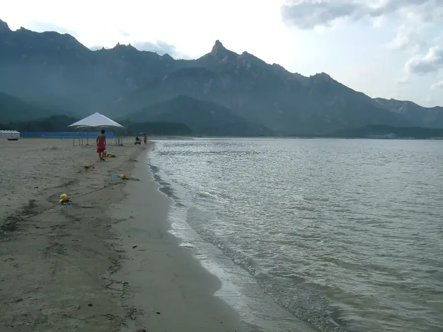
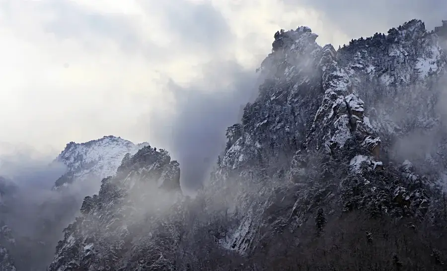
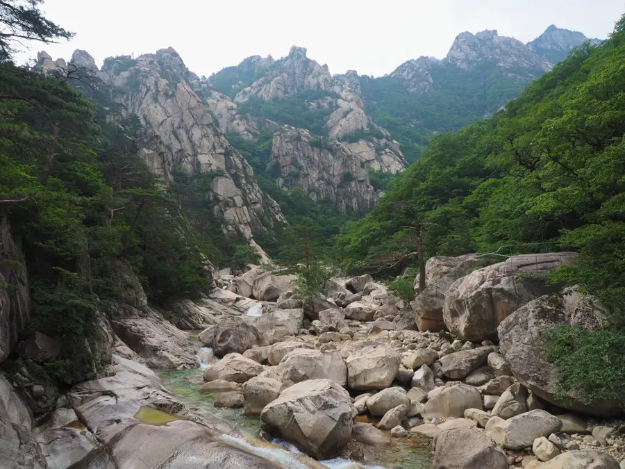
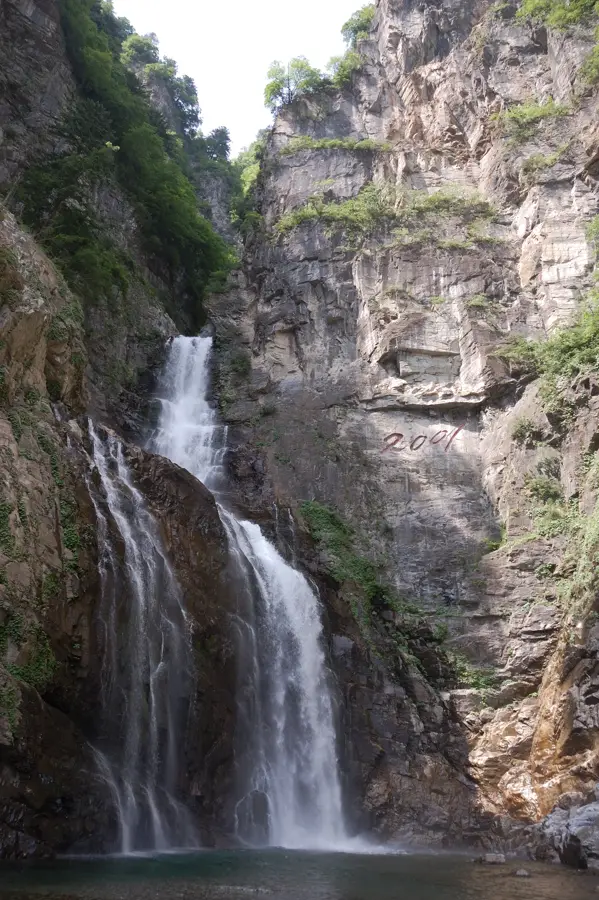
The Northern Taebaek Mountains form the backbone of the eastern Korean Peninsula, stretching through Kangwon and South Hamgyong Provinces. This mountain range is characterized by high, rugged peaks and an asymmetrical relief, where the eastern side drops steeply toward the East Sea of Korea (Sea of Japan), while the western side features gentler slopes. Geologically, the range consists of a mixture of Archean gneisses and Paleozoic sedimentary rocks, which were brought to their current position by later tectonic uplift processes. The Northern Taebaek Mountains serve as a significant watershed area, giving rise to many of Korea's major rivers. The region is home to extensive primary forests with high biodiversity, including rare orchid species and endangered mammals such as the musk deer. Historically, the mountains were a refuge for hermits and the site of numerous Buddhist monasteries embedded deep in inaccessible valleys. Today, the Northern Taebaek range is a crucial center for nature conservation and features diverse opportunities for scientific research into alpine ecology.
- Location: North Korea
- Top sights: Maeja Peak · Mount Chugyop
- Nearby: Mount Kumgang (16 km)
Best time to visit & climate
The most pleasant time to visit is May, Jun, Sep.
| Jan | Feb | Mar | Apr | May | Jun | Jul | Aug | Sep | Oct | Nov | Dec | |
|---|---|---|---|---|---|---|---|---|---|---|---|---|
| Avg °C | -7 | -4 | 1 | 7 | 14 | 19 | 22 | 22 | 17 | 11 | 3 | -5 |
| Rain mm | 24 | 33 | 37 | 69 | 79 | 96 | 324 | 259 | 150 | 74 | 65 | 28 |
📋 Practical info
Geography
Facts
- The range forms the most important watershed on the Korean Peninsula.
- The average elevation of the main chain is approximately 1,000 meters.
- Geologically, the mountains are over 2 billion years old (Precambrian).
- It is a key sanctuary for the endangered Siberian musk deer.
- The region receives high annual precipitation, reaching up to 1,500 mm.
- Many peaks are difficult to access due to their rugged and steep nature.
Explore nearby
Notable places around
Route planner — Car & Motorhome
Where do you start? We build the route here, with stops and country notes along the way.
© OpenStreetMap contributors · OpenRouteService
Sights in the town Northern Taebaek Mountains (2)
Sights nearby
Frequently asked questions
How high are the northern Taebaek Mountains?
Are there ski resorts?
Are the mountains suitable for hikers?
What flora can be found there?
When does the first snow fall?
Northern Taebaek Mountains: where is it located?
Northern Taebaek Mountains: what is there to see?
Northern Taebaek Mountains: when is the best time to visit?
Northern Taebaek Mountains: why is it worth visiting?

Nearby cities


Nature
More places