Plizio Visual Lab
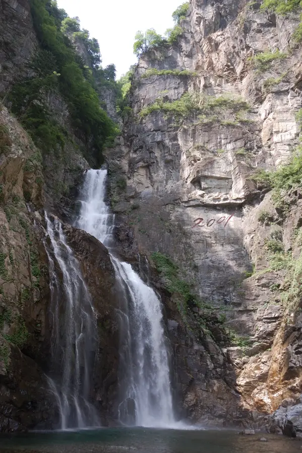
Ullim Falls
Weather…
Water temperature…
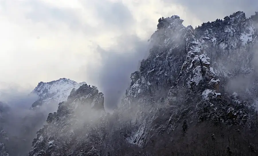
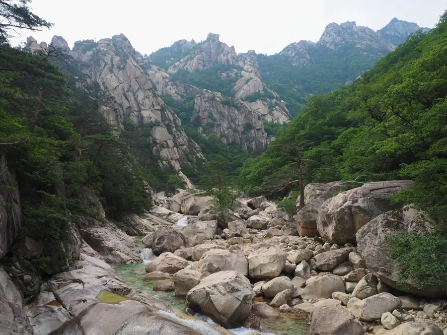
Ullim Falls is one of North Korea's most spectacular natural wonders, located in Chonnae County, Kangwon Province. It was only opened to the general public in late 1999 and 2001 after soldiers constructed an access road through the previously inaccessible terrain. The waterfall plunges from a height of approximately 75 meters over a sheer cliff face into a deep, crystalline pool below. The name 'Ullim' translates to 'Echo,' referring to the thunderous roar of the falling water that reverberates loudly throughout the narrow valley. The surrounding environment is characterized by dense mixed forests and unique rock formations typical of the Kumgang Mountain foothills. Geologically, the cliff consists of hard rock that has withstood erosion for millennia. The site has been carefully developed for visitors with bridges, observation decks, and pavilions designed to harmonize with the natural landscape. The falls are particularly impressive after heavy rainfall when the water volume increases dramatically and a fine mist fills the entire valley. Today, it stands as a prominent symbol of the pristine natural heritage of Kangwon Province.
- Location: North Korea
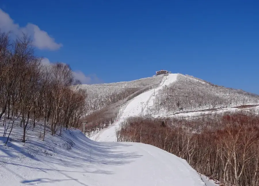
- Nearby: Masikryong Ski Resort (19 km)
Best time to visit & climate
The most pleasant time to visit is May, Jun, Sep.
| Jan | Feb | Mar | Apr | May | Jun | Jul | Aug | Sep | Oct | Nov | Dec | |
|---|---|---|---|---|---|---|---|---|---|---|---|---|
| Avg °C | -10 | -6 | 0 | 7 | 14 | 19 | 21 | 21 | 16 | 9 | 1 | -7 |
| Rain mm | 13 | 21 | 29 | 61 | 83 | 107 | 338 | 279 | 127 | 54 | 55 | 21 |
📋 Practical info
Geography
Facts
- The waterfall has a total drop height of about 75 meters.
- It is located in Chonnae County within Kangwon Province.
- The site was officially opened to the public in September 2001.
- The name 'Ullim' literally means echo in Korean.
- The water plunges into a natural pool that is 1.5 meters deep.
- It is frequently depicted in modern North Korean landscape art.
Explore nearby
Notable places around
Route planner — Car & Motorhome
Where do you start? We build the route here, with stops and country notes along the way.
© OpenStreetMap contributors · OpenRouteService
Sights in the town Ullim Falls (1)
Sights nearby
Frequently asked questions
Are the Ullim Falls easy to reach?
Why are they called 'Ullim'?
Is there an entrance fee?
Can you bathe under the waterfall?
When is the waterfall most impressive?
Ullim Falls: where is it located?
Ullim Falls: when is the best time to visit?
Ullim Falls: why is it worth visiting?

Nearby cities


Nature
More places