Plizio Visual Lab
Command Ridge Forest
Weather…
Water temperature…
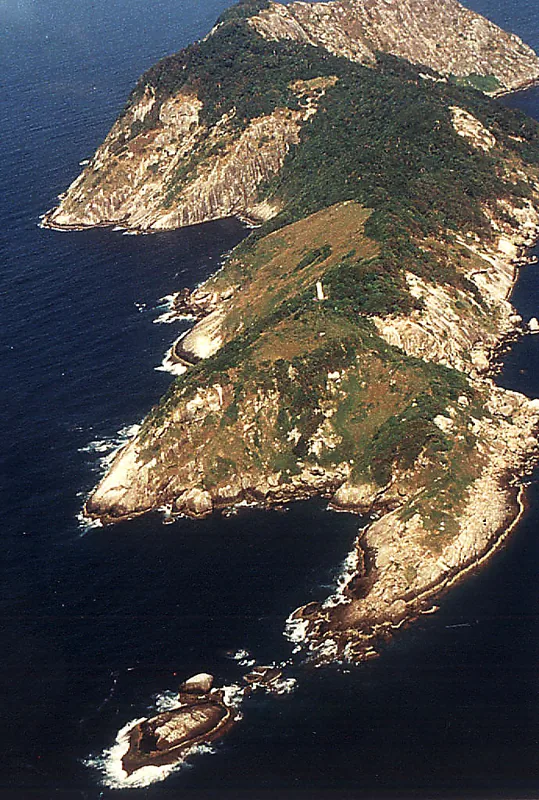
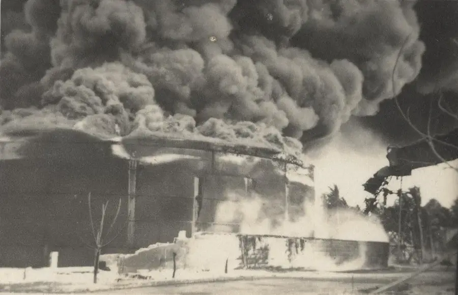
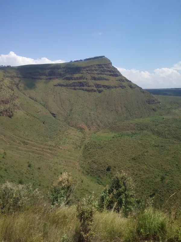
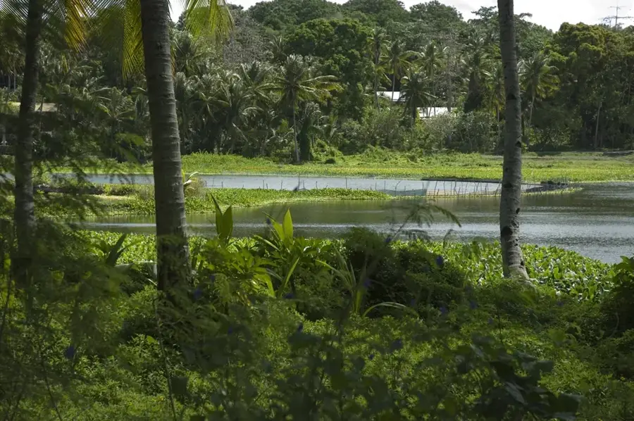
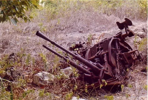
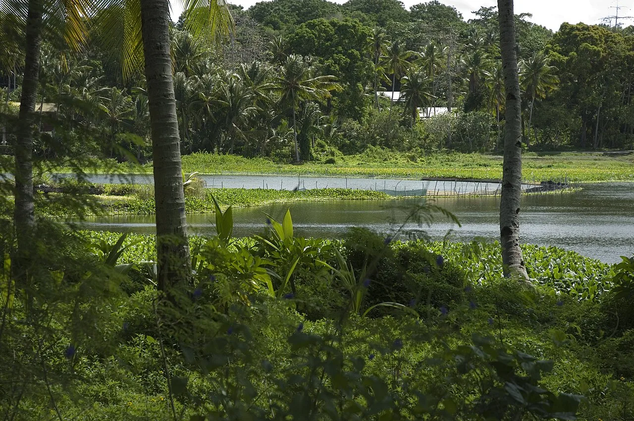
Command Ridge, standing at 65 meters as the highest point on Nauru, contains some of the island's most significant surviving forest cover. While much of the island's interior was stripped and transformed into a jagged, barren moonscape by decades of intensive phosphate mining, the slopes of Command Ridge retain remnants of the indigenous vegetation. The area is characterized by majestic Tamanu trees (Calophyllum inophyllum) and dense clusters of Pandanus, which provide a vital sanctuary for the island's birdlife. Most notably, it is a key habitat for the endemic Nauru reed warbler, the island's only unique songbird. Beyond its ecological importance, the ridge is a site of major historical significance; it served as a strategic lookout post for Japanese forces during World War II. Visitors can still find rusted anti-aircraft guns and reinforced bunkers located among the tropical flora. The forest features much-needed shade and panoramic views across the central plateau to the Pacific Ocean, making it a premier destination for history buffs.
- Location: Nauru
- Top sights: Command Ridge · Japanese WWII Gun · Monument to the Nauruans Exiled in WWII
- Nearby: Anibare (4 km)
Best time to visit & climate
The most pleasant time to visit is May, Jun, Sep.
| Jan | Feb | Mar | Apr | May | Jun | Jul | Aug | Sep | Oct | Nov | Dec | |
|---|---|---|---|---|---|---|---|---|---|---|---|---|
| Avg °C | 28 | 28 | 28 | 28 | 28 | 28 | 28 | 28 | 28 | 28 | 28 | 28 |
| Rain mm | 194 | 192 | 193 | 161 | 116 | 107 | 123 | 118 | 108 | 118 | 133 | 202 |
📋 Practical info
Geography
Facts
- Nauru's highest point (71 m)
- Located in Aiwo District
- Home to native tree species
- Habitat for various seabirds
- Overgrows old military emplacements
- Crucial forest fragment on the island
Explore nearby
Notable places around
Route planner — Car & Motorhome
Where do you start? We build the route here, with stops and country notes along the way.
© OpenStreetMap contributors · OpenRouteService
Sights in the town Command Ridge Forest (10)
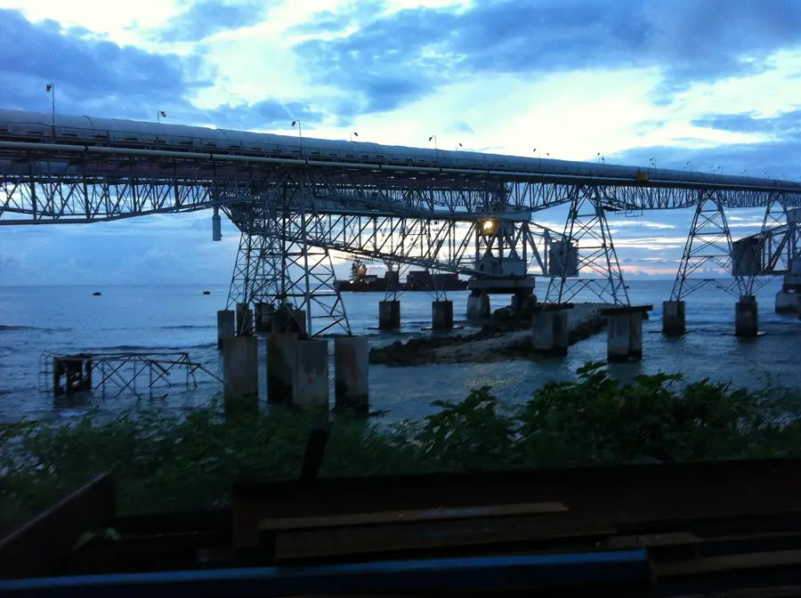
Cantilever Cranes
Two large cantilever cranes from the phosphate mining era, now disused.
Japanese WWII Prison
Ruins of a Japanese prison from World War II, built for holding prisoners of war.
Buada Chapel
Simple chapel by Buada Lagoon, used by the local community for worship and gatherings.
Orro Congregational Church
Protestant church in Orro, meeting place for the Congregationalist community.
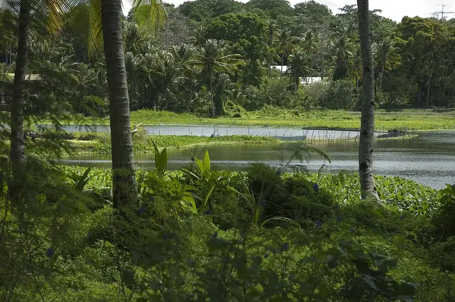
Lagoon viewpoint
Lookout point over Buada Lagoon, surrounded by palm trees and tropical vegetation.
Naoero Museum🏛 museum
National museum of Nauru, featuring exhibits on the island's history, culture, and nature.
Sights nearby
Frequently asked questions
How is the forest at Command Ridge?
Is it very hot there?
Are there many mosquitoes?
Can you get lost?
What shoes?
Command Ridge Forest: where is it located?
Command Ridge Forest: what is there to see?
Command Ridge Forest: when is the best time to visit?
Command Ridge Forest: why is it worth visiting?

Nearby cities


History & landmarks


Nature
More places