Plizio Visual Lab
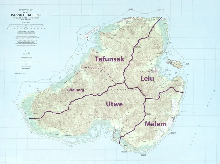
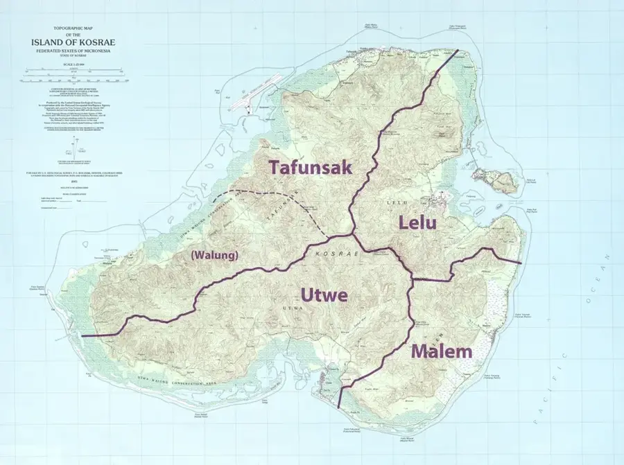
Tafunsak

ℹ️Practical info — Tafunsak
▾
🌤 Weather — 5 days
📍 Nearby
Sights nearby
💡 Tips
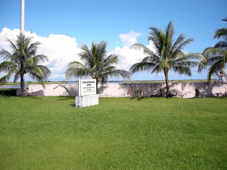
- The international airport is located here; flight arrival times are the busiest moments in the municipality.
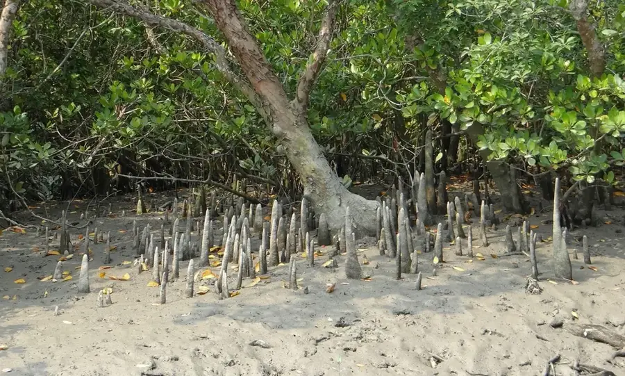
- Arrange a local boat guide to visit the pristine Yela Ka Forest, a unique conservation area.
- Rent a car to get around, as organized public transport is not available.
- Always carry cash (US Dollars) as card machines are rare.
- Sundays are strictly observed as a day of rest; most businesses will be closed.
🍽 Food
Best enjoyed grilled or as sashimi at local eateries along the main road.
A local staple dish available at small family-run diners.
Look for the famous sweet local tangerines when in season.
🛍 Shopping · 🧘 Quiet spots
Intricately woven mats and baskets sold by local women.
Great for buying fresh bananas, papayas, and drinking coconuts.
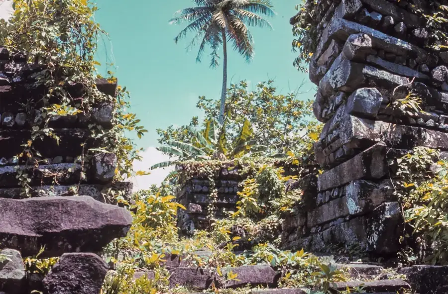
An ancient and serene forest of Ka trees, accessible mostly by boat.
Peaceful water views, especially during quiet afternoons.
Water temperature…
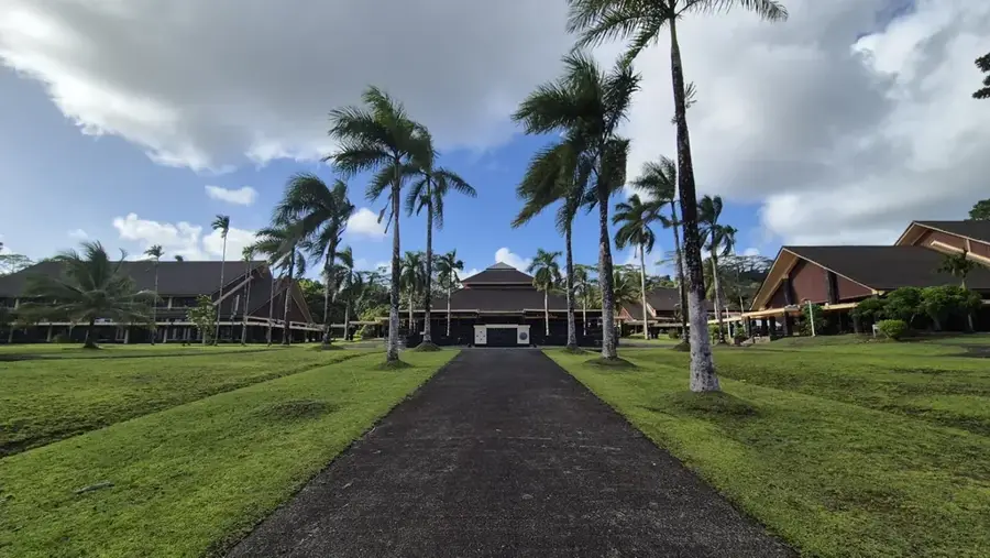
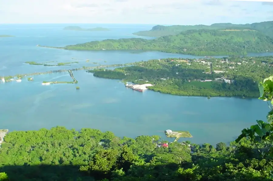
Tafunsak is the largest municipality on the island of Kosrae and serves as its primary gateway, housing the Kosrae International Airport. Located in the northernmost part of the island, it is a bustling community that manages to retain a peaceful, tropical charm. The town is famous for its extensive sandy beaches and the Blue Hole, a natural formation in the reef that is a favorite for snorkeling and swimming. The surrounding waters are part of a protected marine environment, boasting some of the healthiest coral systems in Micronesia, making Tafunsak a premier destination for underwater exploration. Inland, the municipality is characterized by dense mangrove forests and rugged, emerald-green peaks that provide a dramatic backdrop to the coastal settlements. Visitors can enjoy local hospitality at small guesthouses and explore the traditional customs that define Kosraean culture. With its combination of essential infrastructure and sweeping natural assets, Tafunsak is the first-rate starting point for any traveler looking to experience the unique blend of adventure and tranquility found on Kosrae.
- Location: Micronesia
- Nearby: Tofol (4 km)
Best time to visit & climate
The most pleasant time to visit is Feb, Aug, Sep.
| Jan | Feb | Mar | Apr | May | Jun | Jul | Aug | Sep | Oct | Nov | Dec | |
|---|---|---|---|---|---|---|---|---|---|---|---|---|
| Avg °C | 28 | 28 | 28 | 28 | 28 | 28 | 28 | 28 | 28 | 28 | 28 | 29 |
| Rain mm | 255 | 223 | 261 | 350 | 292 | 248 | 256 | 224 | 226 | 226 | 253 | 304 |
Geography
Facts
- Tafunsak covers nearly half of the land area of Kosrae state.
- Kosrae International Airport (KSA) was built on a reclaimed reef area.
- The municipality had a population of about 2,100 people in 2010.
- It includes the village of Walung, one of the most remote on the island.
- The name Tafunsak means half a forest in the local Kosraean language.
- The Yela Ka Forest, a protected biosphere reserve, is located within its borders.
Explore nearby
Notable places around
Route planner — Car & Motorhome
Where do you start? We build the route here, with stops and country notes along the way.
© OpenStreetMap contributors · OpenRouteService
Frequently asked questions
What is the main attraction in Tafunsak?
Is the Kosrae airport located in Tafunsak?
Are there good accommodation options?
Can you go hiking there?
What is the best time to visit?
Tafunsak: where is it located?
Tafunsak: when is the best time to visit?
Tafunsak: why is it worth visiting?

Nearby cities


History & landmarks


Nature


More places