Plizio Visual Lab
Uganda Escarpment
Weather…
Water temperature…
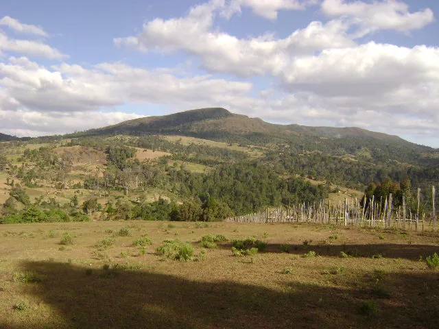
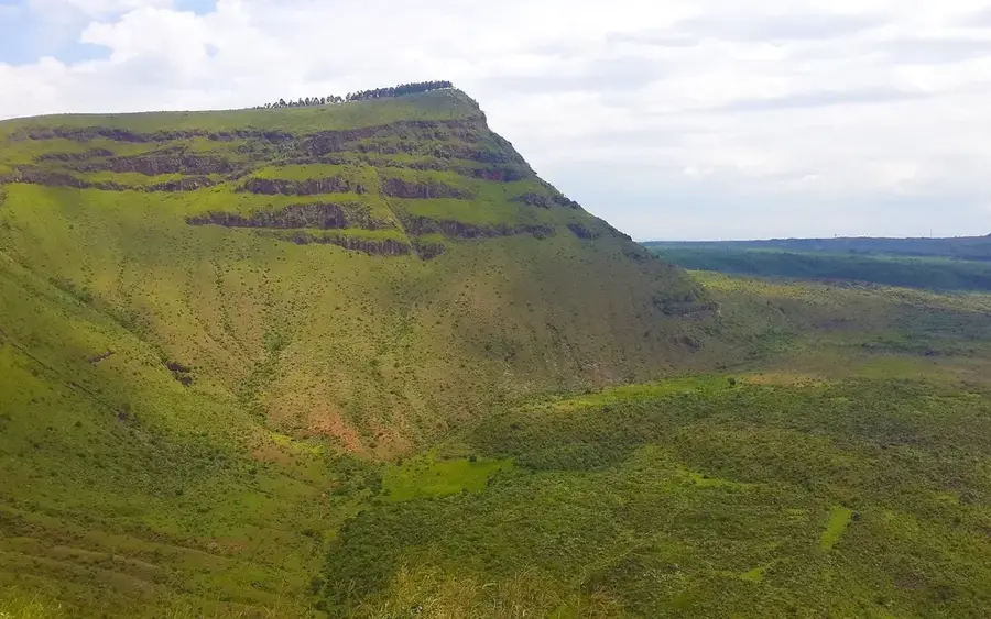
The Uganda Escarpment, often referred to in the context of the Elgeyo or Turkana Escarpments, marks the western edge of the Gregory Rift along the border between Kenya and Uganda. This massive geological fault represents a dramatic drop in elevation, where the terrain falls from fertile highlands above 2,500 meters to the drier valley floor at approximately 1,000 meters. Formed by the stretching of the African crust during the Tertiary and Quaternary periods, the escarpment provides spectacular views and significantly influences local climate and rainfall patterns. The slopes are frequently covered by dense montane forests, which serve as critical watersheds for rivers such as the Turkwel and the Suam. Historically, the region acted as a natural barrier to human migration and today provides a home for communities like the Pokot and Sebei. Geological activity remains evident here through occasional seismic shifts and the presence of nearby hot springs. The escarpment is also a major research site for understanding the evolution of the East African landscape.
- Location: Kenya
- Top sights: Kitum Cave · Mount Elgon National Park
- Nearby: Kimilili (20 km)
Best time to visit & climate
The most pleasant time to visit is Jan–Mar.
| Jan | Feb | Mar | Apr | May | Jun | Jul | Aug | Sep | Oct | Nov | Dec | |
|---|---|---|---|---|---|---|---|---|---|---|---|---|
| Avg °C | 18 | 19 | 20 | 19 | 18 | 17 | 17 | 17 | 18 | 18 | 18 | 18 |
| Rain mm | 45 | 55 | 114 | 212 | 224 | 120 | 118 | 167 | 184 | 195 | 152 | 82 |
📋 Practical info
Geography
Facts
- The escarpment extends for hundreds of kilometers along the East African Rift.
- The vertical drop can exceed 1,500 meters at its steepest points.
- The region is noted for its high rate of endemism among various plant species.
- The Suam River forms the natural boundary between Kenya and Uganda in this area.
- Rainfall on the windward side of the escarpment often exceeds 1,200 mm annually.
- Peregrine falcons utilize the steep cliffs as ideal nesting sites.
Explore nearby
Notable places around
Route planner — Car & Motorhome
Where do you start? We build the route here, with stops and country notes along the way.
© OpenStreetMap contributors · OpenRouteService
Sights in the town Uganda Escarpment (2)
Sights nearby
Frequently asked questions
What is the Uganda Escarpment?
Are there good viewpoints there?
What is the climate like there?
Is the road safe?
Can you hike there?
Uganda Escarpment: where is it located?
Uganda Escarpment: what is there to see?
Uganda Escarpment: when is the best time to visit?
Uganda Escarpment: why is it worth visiting?

Nearby cities

Nature

More places