Plizio Visual Lab
Menengai Crater
Weather…
Water temperature…
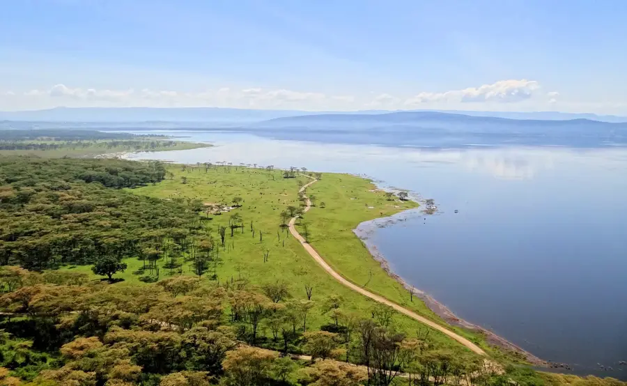
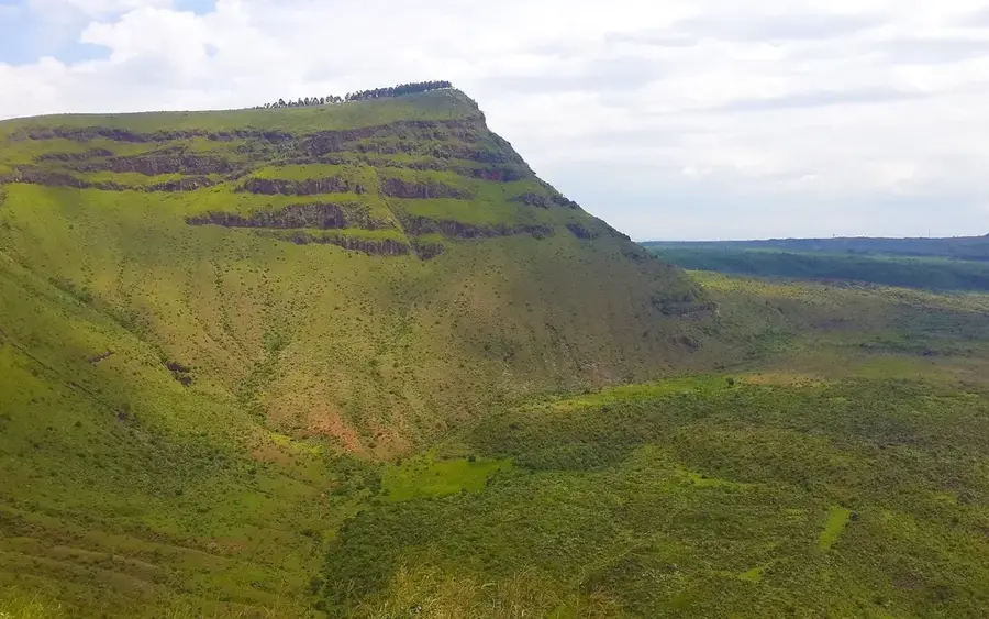
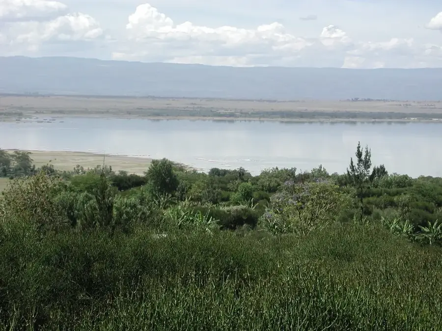
The Menengai Crater is one of the largest volcanic calderas in the world, situated on the northern outskirts of Nakuru in Kenya's Great Rift Valley. It is a massive shield volcano whose caldera covers an area of approximately 90 square kilometers and reaches a depth of up to 485 meters. Geologically, the current caldera was formed about 8,000 years ago through massive eruptions followed by the collapse of the volcanic summit. The name 'Menengai' is derived from the Maasai language, meaning 'place of spirits', reflecting historical battles between Maasai clans where many warriors were cast into the crater. The caldera floor is covered by rugged lava flows and scrubland, while the rim is increasingly used for geothermal drilling to generate renewable energy. Menengai Crater is a significant destination for hikers and tourists, offering vantage points with sweeping views of Lake Nakuru and the Rift Valley floor. Ongoing geothermal activity is evident through numerous fumaroles that vent hot steam from the earth's interior.
- Location: Kenya
- Top sights: Menengai II Geothermal Power Station · Menengai III Geothermal Power Station · Menengai I Geothermal Power Station
- Nearby: Nakuru (10 km)
Best time to visit & climate
The most pleasant time to visit is Jan–Mar.
| Jan | Feb | Mar | Apr | May | Jun | Jul | Aug | Sep | Oct | Nov | Dec | |
|---|---|---|---|---|---|---|---|---|---|---|---|---|
| Avg °C | 18 | 19 | 20 | 19 | 18 | 18 | 17 | 17 | 18 | 19 | 18 | 18 |
| Rain mm | 42 | 30 | 83 | 189 | 140 | 96 | 94 | 109 | 90 | 108 | 128 | 80 |
📋 Practical info
Geography
Facts
- The highest point on the rim of Menengai Crater is 2,278 meters above sea level.
- Menengai is considered the second-largest volcanic caldera in Africa.
- The crater's diameter is approximately 12 kilometers at its widest point.
- Geothermal projects within the crater aim to generate over 100 MW of electricity.
- The last significant volcanic activity is estimated to have occurred 1,400 years ago.
- A prominent 'View Point' on the rim provides a 360-degree panorama of Central Kenya.
Explore nearby
Notable places around
Route planner — Car & Motorhome
Where do you start? We build the route here, with stops and country notes along the way.
© OpenStreetMap contributors · OpenRouteService
Sights in the town Menengai Crater (3)
Sights nearby
Frequently asked questions
Is the Menengai Crater active?
How large is the crater?
Can you hike down to the crater floor?
Is there an entry fee?
Are there viewpoints there?
Menengai Crater: where is it located?
Menengai Crater: what is there to see?
Menengai Crater: when is the best time to visit?
Menengai Crater: why is it worth visiting?

Nearby cities
Nature
More places