Plizio Visual Lab
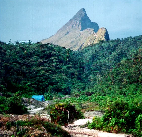
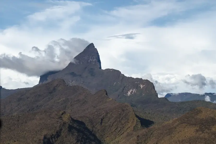
Pico da Neblina
Weather…
Water temperature…
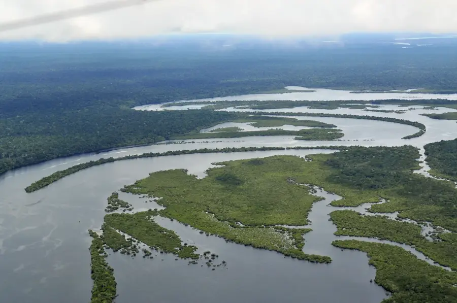
Pico da Neblina is the highest peak in Brazil, reaching an elevation of 2,995.30 meters. Located in the northern part of the country in Amazonas state, it sits right on the border with Venezuela within the Serra do Imeri range. Its name, which translates to 'Mist Peak,' refers to the fact that it is shrouded in dense clouds for most of the year. The mountain was discovered as late as 1953 and first climbed in 1965, as it is hidden deep within the inaccessible tropical rainforest. The area is part of the Pico da Neblina National Park and overlaps with the Yanomami indigenous territory. Due to extreme isolation and harsh climatic conditions, climbing the peak is a major logistical challenge requiring special permits and experienced guides. The flora on the mountain features many endemic species adapted to the high rainfall and cooler temperatures near the summit. Scientifically, the peak is significant for studying the evolution of isolated ecosystems on South American tepuis.
- Location: Brazil
- Top sights: Pico Phelps · Pico 31 de Março · Pico da Neblina
Best time to visit & climate
The most pleasant time to visit is Jul–Sep.
| Jan | Feb | Mar | Apr | May | Jun | Jul | Aug | Sep | Oct | Nov | Dec | |
|---|---|---|---|---|---|---|---|---|---|---|---|---|
| Avg °C | 26 | 26 | 26 | 25 | 25 | 25 | 25 | 25 | 26 | 26 | 26 | 26 |
| Rain mm | 231 | 204 | 263 | 260 | 297 | 239 | 180 | 172 | 148 | 170 | 181 | 215 |
📋 Practical info
Geography
Facts
- The official height is 2,995.30 meters above sea level.
- It is located in Brazil's largest national park (2.2 million hectares).
- The first recorded ascent took place on March 30, 1965.
- The summit is shrouded in clouds about 300 days a year.
- The climate is tropical highland with very high rainfall.
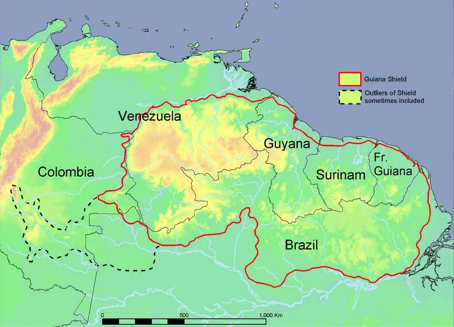
- Geologically, the mountain is part of the Guiana Shield.
Explore nearby
Notable places around
Route planner — Car & Motorhome
Where do you start? We build the route here, with stops and country notes along the way.
© OpenStreetMap contributors · OpenRouteService
Sights in the town Pico da Neblina (3)
Sights nearby
Frequently asked questions
What is Pico da Neblina?
Where is the mountain located?
Are you allowed to climb the mountain?
Why is it called 'Neblina'?
What is the climate like on the summit?
Pico da Neblina: where is it located?
Pico da Neblina: what is there to see?
Pico da Neblina: when is the best time to visit?
Pico da Neblina: why is it worth visiting?

Nearby cities
Nature

More places