Plizio Visual Lab

Mount Garet

Plizio editorial teamData Sources
Mountain
—°2
Mount Garet (Vanuatu)

Weather…

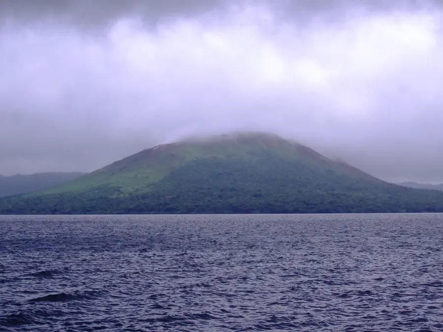
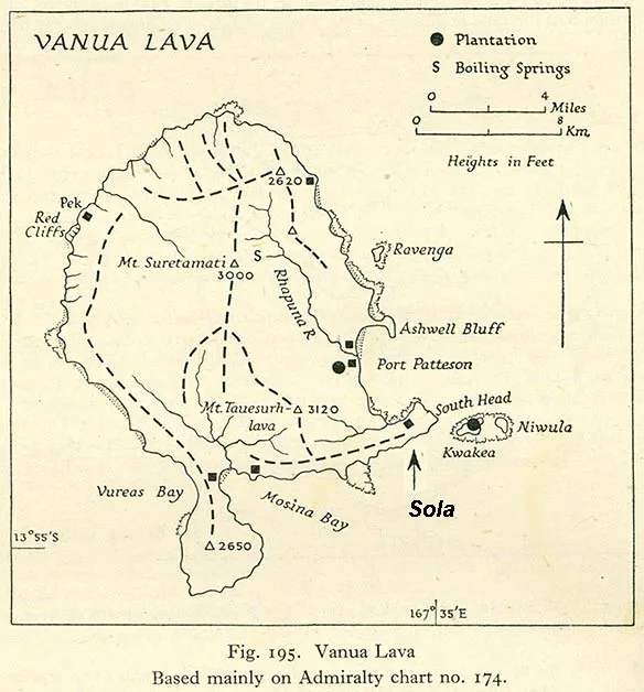
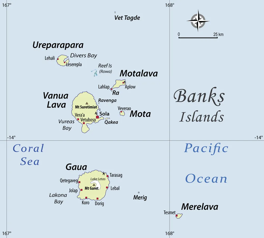
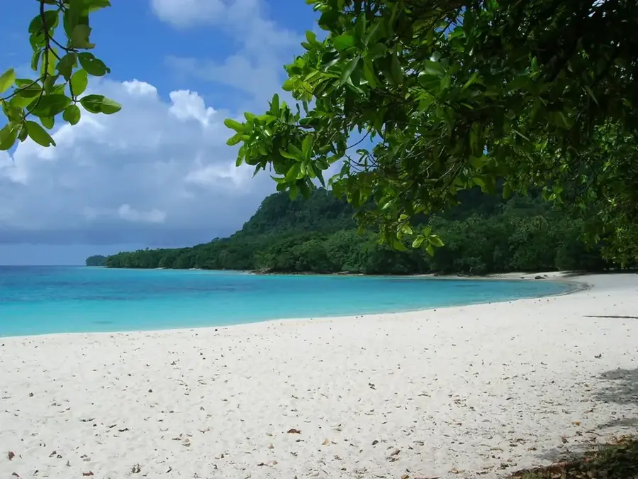
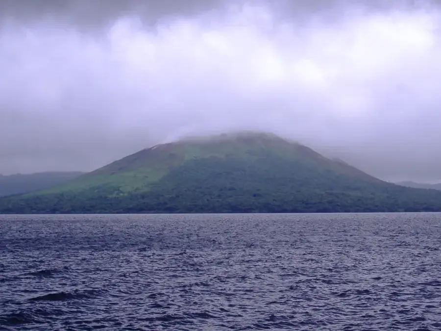
Mount Garet is an active stratovolcano located on Gaua Island in Torba Province. Rising to a height of 797 meters above sea level, it forms the volcanic centerpiece of the island and is encircled by the vast caldera of Lake Letas. The mountain's geological history is defined by phreatomagmatic eruptions, with the most recent significant period of activity recorded in 2011. The volcano's surroundings are ecologically vital, as Lake Letas is the largest freshwater lake in Vanuatu and provides a unique habitat for endemic species. For the local population, the mountain holds spiritual importance while simultaneously posing a persistent threat from ashfall and acid rain. Ascending the summit requires substantial effort due to the dense tropical vegetation and unstable volcanic terrain surrounding the crater.
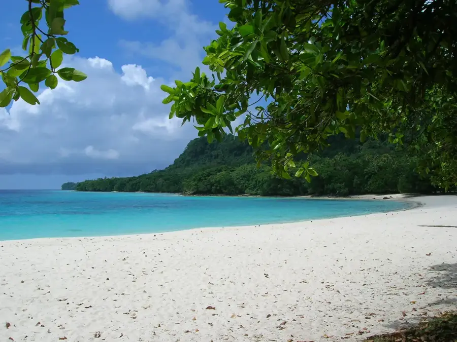
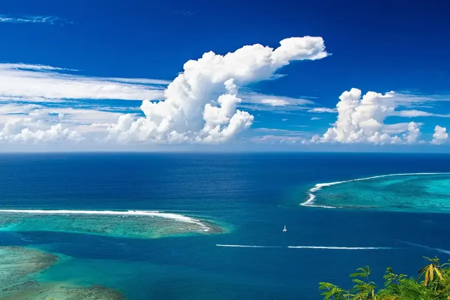
Best time to visit & climate

The most pleasant time to visit is Jul–Sep.

JanFebMarAprMayJunJulAugSepOctNovDec
Avg °C282828282727262626272728
Rain mm24924825426819115111399100178192214

📋 Practical info

🧭
Getting there
Mount Garet is located on the remote Gaua Island. Access requires a domestic flight to Gaua followed by a multi-hour trek from the coast to Lake Letas. To reach the volcanic cone situated within the lake, visitors typically cross the water in a traditional canoe before beginning the actual ascent up the slopes.
📅
Best season
The best time to visit is during the dry season (May to October), when rainforest trails are navigable and lake levels remain stable. During the rainy season, paths can become extremely muddy and the lake may be too rough for canoes in high winds. Clear days offer fantastic views of the surrounding lake and caldera.
⛰️
Terrain & paths
The terrain is varied and strenuous, ranging from dense, humid tropical forest to the open water of the lake and finally the steep, ash-covered slopes of the volcano. The climb up Mount Garet is sharp, and the ground can be unstable due to loose volcanic ash and rocks underfoot.
🎒
What to bring
Sturdy, waterproof hiking boots are essential for both the jungle paths and the volcanic terrain. Wear lightweight, quick-drying clothing and carry reliable rain gear. As expeditions often involve overnight stays, camping equipment and water purification methods (or sufficient supplies) are necessary.
🅿️
Parking
There are no parking facilities anywhere near Mount Garet. Access to the coastal starting point is usually by boat or on foot from the airstrip in Sola. Local transport options are limited and must be arranged in advance with villagers or tour operators on Gaua Island.
⚠️
Safety
Mount Garet is an active volcano; check current activity levels before attempting a visit. Sulfur fumes can be unpleasant or hazardous near the crater. Good physical condition is vital, as emergency rescue operations in this extremely remote region are very difficult and time-consuming.
⏱️
Time needed
An expedition to Mount Garet typically lasts 2 to 3 days. This includes the trek to the lake, the canoe crossing, the summit ascent, and the return journey. It is a profound wilderness experience that requires time to truly appreciate Gaua's unique geography and the beauty of Lake Letas.

Geography

Coordinates
-14.28890, 167.51670

Facts

  • Mount Garet reaches a maximum elevation of 797 meters.
  • The volcano sits within a caldera measuring 6 by 9 kilometers.
  • Lake Letas, surrounding the volcano, has a depth of up to 119 meters.
  • Between 2009 and 2010, hundreds of residents were evacuated due to ash.
  • The volcano is primarily composed of basaltic and andesitic rock.
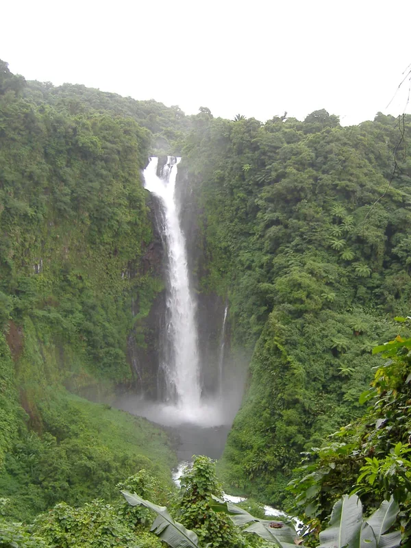
  • The Siri Waterfall drains the lake's water towards the sea.

Explore nearby

Notable places around

Route planner — Car & Motorhome

Where do you start? We build the route here, with stops and country notes along the way.

Vehicle
Only stops with (optional):

© OpenStreetMap contributors · OpenRouteService

Sights in the town Mount Garet (2)

Lake Letas📍 landmark

Lake Letas is a crater lake on Gaua Island, Vanuatu. Its water is turquoise, surrounded by steep slopes.

Mount Gharat📍 landmark

Mount Gharat is a volcano on Gaua, Vanuatu. The mountain rises above the rainforest and Lake Letas crater lake.

Sights nearby

Frequently asked questions

Is the mountain climbable?
Yes, but only with a guide as the terrain is unstable.
How active is this volcano?
It shows periodic volcanic activity.
Do I need special permits?
Yes, discuss this with your local tour guide.
Is the view worth it?
The view over the crater lake is panoramic.
What equipment is important?
Sturdy shoes and sufficient drinking water are essential.
Mount Garet: where is it located?
Mount Garet is located in Vanuatu.
Mount Garet: what is there to see?
Highlights include Lake Letas, Mount Gharat.
Mount Garet: when is the best time to visit?
The most pleasant time to visit is Jul, Sep.
Mount Garet: why is it worth visiting?
Mount Garet is an active stratovolcano located on Gaua Island in Torba Province.
View on map → The Top 50 Attractions → OpenStreetMap →
Oceania
Explore with Plizio Discover more places in Oceania
More places in Vanuatu →

Nearby cities

History & landmarks

Nature

More places