Plizio Visual Lab
Mount Tawenun

Weather…
Water temperature…
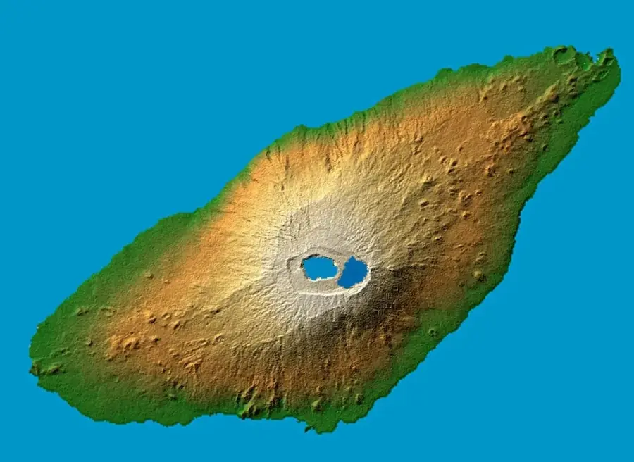
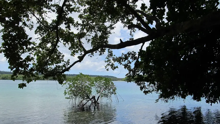
Mount Tawenun is the highest elevation on Pentecost island in Vanuatu, standing at 947 meters. It forms the backbone of the central highlands of this elongated island and is of critical importance to the local climate and agriculture. The slopes of Mount Tawenun are covered in dense, often cloud-shrouded rainforest, which plays a vital role in protecting soil stability. Pentecost is world-famous for the traditional 'Naghol' (land diving), and the valleys surrounding the mountain are home to communities that have practiced these customs for centuries. Geologically, the mountain is the result of tectonic uplift of the New Hebrides island arc and consists primarily of limestone and volcanic rock. Numerous rivers originate on its slopes, providing fresh water to coastal villages. The summit region is a biodiversity hotspot where rare ferns and orchids flourish, species not found in lower-lying areas.
Best time to visit & climate
The most pleasant time to visit is Jul–Sep.
| Jan | Feb | Mar | Apr | May | Jun | Jul | Aug | Sep | Oct | Nov | Dec | |
|---|---|---|---|---|---|---|---|---|---|---|---|---|
| Avg °C | 28 | 28 | 28 | 28 | 27 | 27 | 26 | 26 | 26 | 27 | 27 | 28 |
| Rain mm | 240 | 235 | 246 | 248 | 161 | 142 | 96 | 89 | 87 | 148 | 167 | 191 |
📋 Practical info
Geography
Facts
- Highest point of Pentecost at 947 meters
- Vital watershed for the entire island
- Geological mixture of limestone and basalt
- Center of traditional kastom villages
- Home to endemic orchid species
- Crucial for cloud-water harvesting by the forests
Explore nearby
Notable places around
Route planner — Car & Motorhome
Where do you start? We build the route here, with stops and country notes along the way.
© OpenStreetMap contributors · OpenRouteService
Sights nearby
Frequently asked questions
Are there hiking trails?
Is a guide needed?
How is the weather?
Is photography possible?
Is there infrastructure?
Mount Tawenun: where is it located?
Mount Tawenun: when is the best time to visit?
Mount Tawenun: why is it worth visiting?

Nearby cities


History & landmarks


Nature
More places