Plizio Visual Lab
Gaua Highlands

Weather…
Water temperature…
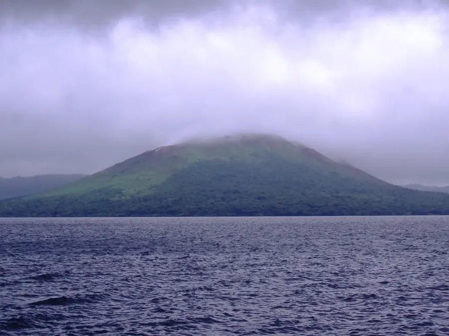
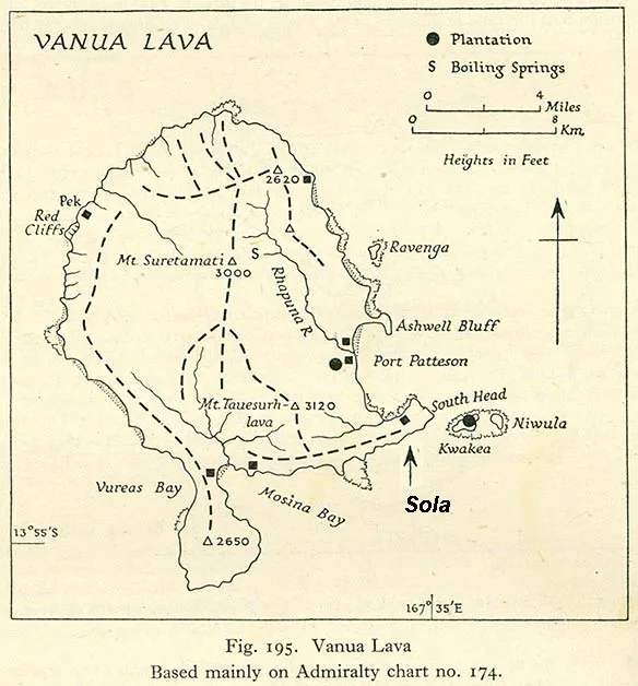
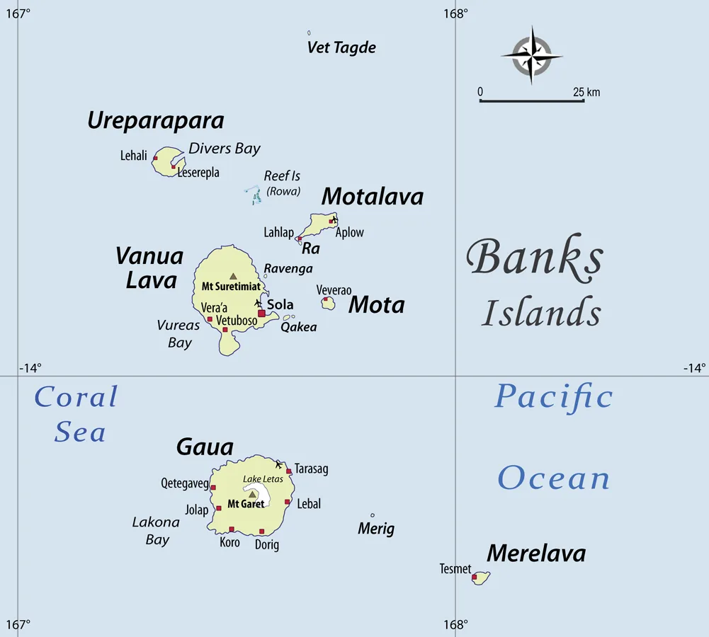
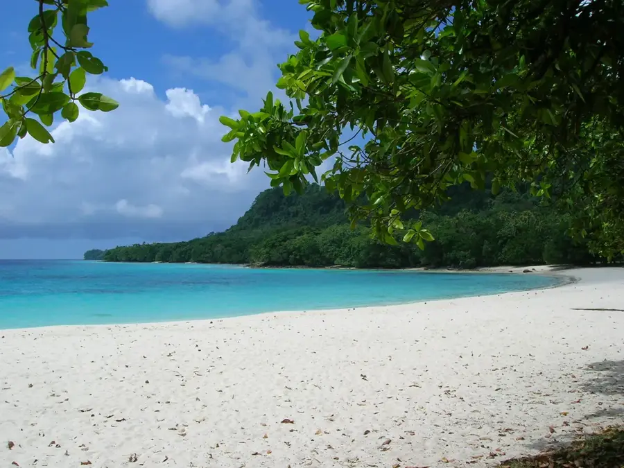
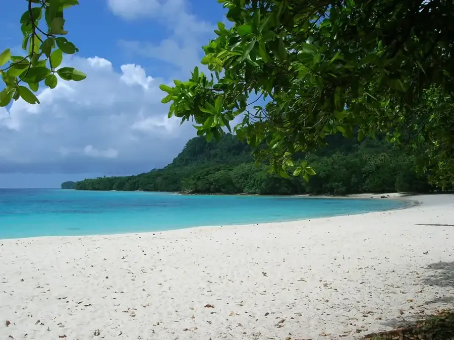
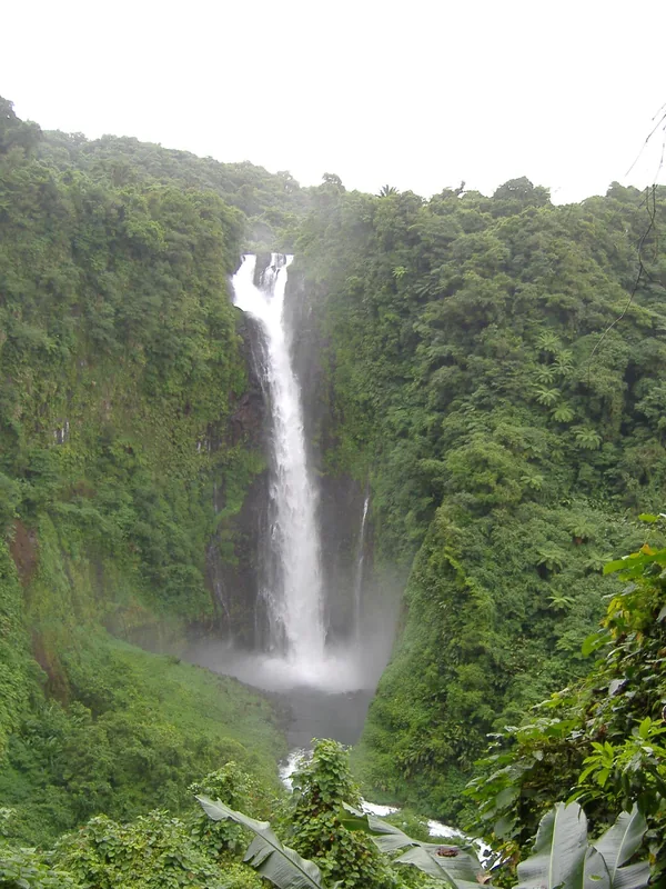
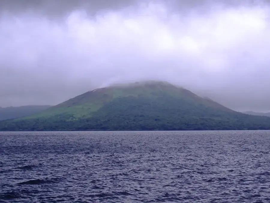
The Gaua Highlands form the central plateau of Gaua Island in the Banks Islands group, characterized by a dramatic and highly active volcanic landscape. At the center of this region lies Mount Gharat, a stratovolcano situated within a massive caldera that frequently emits ash and volcanic gases. Partially filling this caldera is Lake Letas, the largest freshwater lake in Vanuatu, covering an area of approximately 19 square kilometers in a distinct crescent shape. A highlight of the highlands is the Siri Waterfall, where the waters overflowing from Lake Letas plunge 120 meters (394 feet) over a massive cliff face. The fertile volcanic soil supports dense tropical forests that are home to various endemic species of birds and plants unique to the northern islands. Due to its ongoing geological activity, the highlands are subject to frequent monitoring, as eruptions can impact local agriculture and water supplies. Despite these risks, the area is of immense cultural and spiritual significance to the local population, who live in harmony with the volcano. The combination of its vast crater lake, towering waterfall, and active volcanic peak makes the Gaua Highlands one of the most remarkable geological sites in Oceania.
Best time to visit & climate
The most pleasant time to visit is Jul–Sep.
| Jan | Feb | Mar | Apr | May | Jun | Jul | Aug | Sep | Oct | Nov | Dec | |
|---|---|---|---|---|---|---|---|---|---|---|---|---|
| Avg °C | 28 | 28 | 28 | 28 | 27 | 27 | 26 | 26 | 26 | 27 | 27 | 28 |
| Rain mm | 249 | 248 | 254 | 268 | 191 | 151 | 113 | 99 | 100 | 178 | 192 | 214 |
📋 Practical info
Geography
Facts
- Lake Letas is the largest freshwater lake in Vanuatu, spanning 19 sq km.
- Mount Gharat is an active stratovolcano reaching a height of 797 meters.
- The Siri Waterfall features a 120-meter (394-foot) vertical drop.
- The central caldera of the highlands measures roughly 6 by 9 kilometers.
- The water in Lake Letas is slightly acidic due to nearby volcanic activity.
- A major eruption in 2009 led to the temporary evacuation of nearby villages.
Explore nearby
Notable places around
Route planner — Car & Motorhome
Where do you start? We build the route here, with stops and country notes along the way.
© OpenStreetMap contributors · OpenRouteService
Sights nearby
Frequently asked questions
What makes the Gaua Highlands so valuable?
How do you get there?
What are the accommodations like on-site?
Is the area safe?
What should one keep in mind during the hike?
Gaua Highlands: where is it located?
Gaua Highlands: when is the best time to visit?
Gaua Highlands: why is it worth visiting?

Nearby cities


History & landmarks

Nature

More places