Plizio Visual Lab
Mount Stih
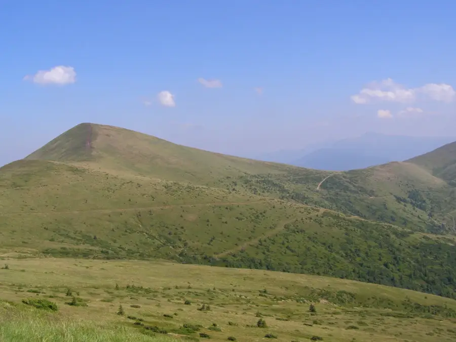
Mount Stih is a prominent peak within the Svydovets massif of the Ukrainian Carpathians, standing at an elevation of 1,704 meters. Located near the well-known Dragobrat ski resort, it serves as a major junction where several mountain ridges converge. The slopes of the mountain are characterized by vast alpine meadows, known locally as polonynas, which are used for grazing in the summer and host a rich variety of alpine flora. Geologically, Stih belongs to the flysch zone, a characteristic reflected in its sedimentary rock layers. Due to its strategic position, the summit features magnificent panoramic views of the surrounding valleys and neighboring Carpathian peaks. In winter, the mountain is a popular destination for freeride skiers and ski tourers, as it often maintains a reliable and deep snowpack. The climatic conditions are typical for high-altitude regions, with short summers and snowy, prolonged winters. Hiking trails from multiple directions lead to the summit, making it an accessible destination for outdoor enthusiasts throughout the year.
- Location: Ukraine
- Nearby: Dragobrat (8 km)
Best time to visit & climate
The most pleasant time to visit is Jun–Aug.
| Jan | Feb | Mar | Apr | May | Jun | Jul | Aug | Sep | Oct | Nov | Dec | |
|---|---|---|---|---|---|---|---|---|---|---|---|---|
| Avg °C | -6 | -5 | 0 | 6 | 12 | 15 | 18 | 18 | 13 | 7 | 2 | -4 |
| Rain mm | 56 | 54 | 65 | 61 | 111 | 117 | 113 | 77 | 77 | 70 | 59 | 58 |
📋 Practical info
Geography
Facts
- Stands at an elevation of 1,704 meters in Svydovets.
- Acts as a key junction for several mountain ridges.
- Positioned very close to the Dragobrat ski area.
- Known for its extensive alpine meadows (polonynas).
- Part of the Carpathian flysch geological zone.
- Popular spot for winter freeriding and ski touring.
Explore nearby
Notable places around
Route planner — Car & Motorhome
Where do you start? We build the route here, with stops and country notes along the way.
© OpenStreetMap contributors · OpenRouteService
Sights nearby
Frequently asked questions
In which mountain range is Stih located?
How high is the peak?
Can you ski there in winter?
How is the view from the summit?
Are there lakes there?
Mount Stih: where is it located?
Mount Stih: when is the best time to visit?
Mount Stih: why is it worth visiting?

Nearby cities