Plizio Visual Lab
Mount Elgon Caldera

Weather…
Water temperature…
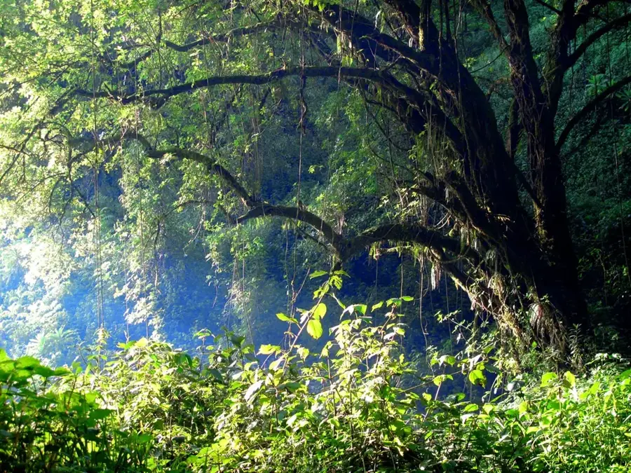
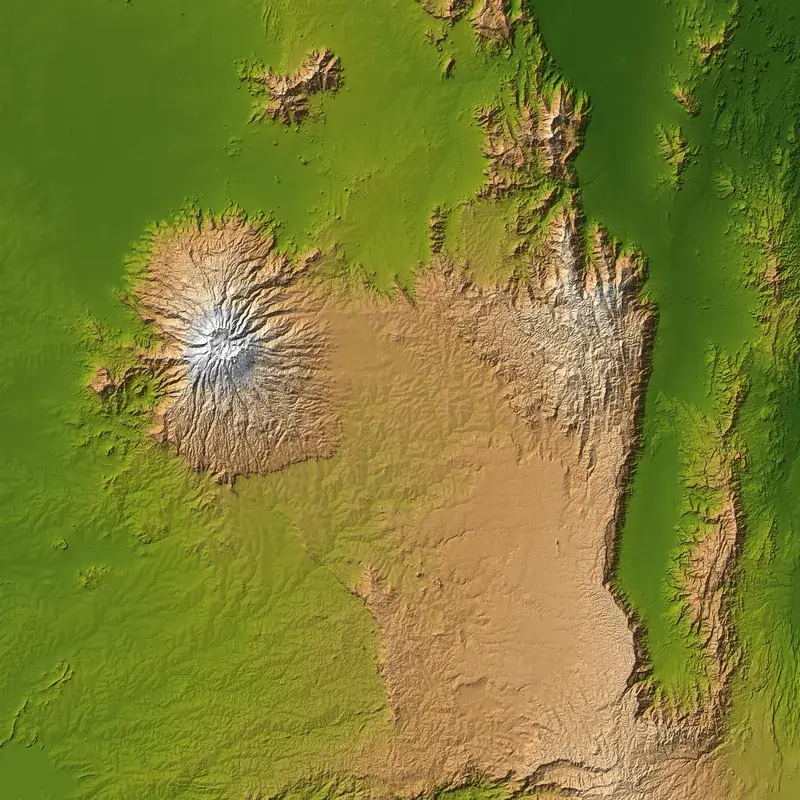
The Mount Elgon Caldera is one of the largest intact calderas in the world, forming the summit of Mount Elgon, a massive extinct shield volcano on the border of Uganda and Kenya. The caldera measures approximately 8 kilometers in diameter and covers an area of over 40 square kilometers. It was formed by the collapse of the volcano's peak after the magma chamber emptied in a massive eruption millions of years ago. Within the caldera are several peaks, including the highest point, Wagagai, at 4,321 meters on the Ugandan side. The caldera is a unique ecosystem, containing swamps, streams, and afro-alpine vegetation famous for its giant lobelias and groundsels. It acts as a huge water catchment, feeding numerous rivers and streams, including the Suam River, which flows to Lake Turkana, and the Nzoia and Lwakhakha rivers, which flow to Lake Victoria. The caldera and the entire mountain are protected by the Mount Elgon National Park, which straddles both countries. It is a popular destination for hikers, who can enjoy the relatively gentle slopes and the unique scenery. The caldera also supports diverse wildlife, including small antelope, monkeys, and rich birdlife.
- Location: Uganda
- Nearby: Sipi Falls (26 km)
Best time to visit & climate
The most pleasant time to visit is Jan–Mar.
| Jan | Feb | Mar | Apr | May | Jun | Jul | Aug | Sep | Oct | Nov | Dec | |
|---|---|---|---|---|---|---|---|---|---|---|---|---|
| Avg °C | 18 | 19 | 20 | 19 | 18 | 17 | 17 | 17 | 18 | 18 | 18 | 18 |
| Rain mm | 45 | 55 | 114 | 212 | 224 | 120 | 118 | 167 | 184 | 195 | 152 | 82 |
📋 Practical info
Geography
Facts
- The caldera has a diameter of approximately 8 km (5 miles).
- The highest peak within the caldera, Wagagai, is 4,321 meters (14,177 feet).
- Mount Elgon is estimated to have first been active around 24 million years ago.
- The caldera covers an area of over 40 square kilometers.
- It contains hot springs near the Suam River.
- The caldera is the result of the collapse of a volcano once taller than Kilimanjaro.
- The caldera contains the largest known cave visited by elephants, who mine it for salt.
Explore nearby
Notable places around
Route planner — Car & Motorhome
Where do you start? We build the route here, with stops and country notes along the way.
© OpenStreetMap contributors · OpenRouteService
Sights nearby
Frequently asked questions
How big is the Mount Elgon Caldera?
Can you hike there?
Is the park entrance fee expensive?
Are there dangerous animals there?
Do I need a guide for the caldera?
Mount Elgon Caldera: where is it located?
Mount Elgon Caldera: when is the best time to visit?
Mount Elgon Caldera: why is it worth visiting?

Nearby cities

History & landmarks


More places