Plizio Visual Lab
Bloody Ridge
Weather…
Water temperature…
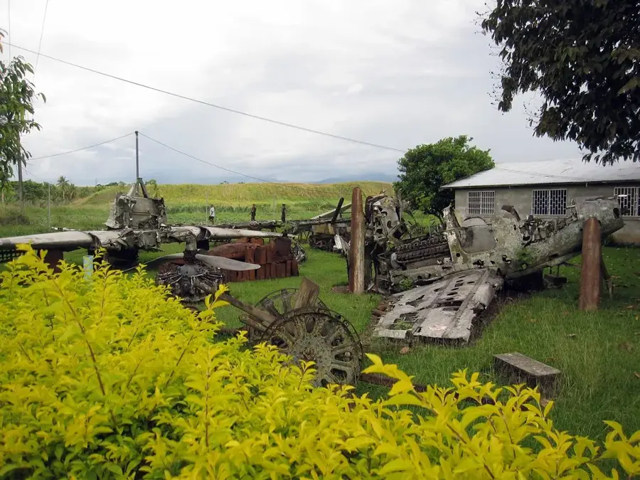
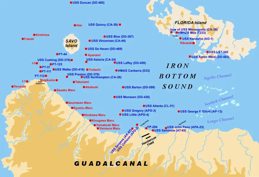
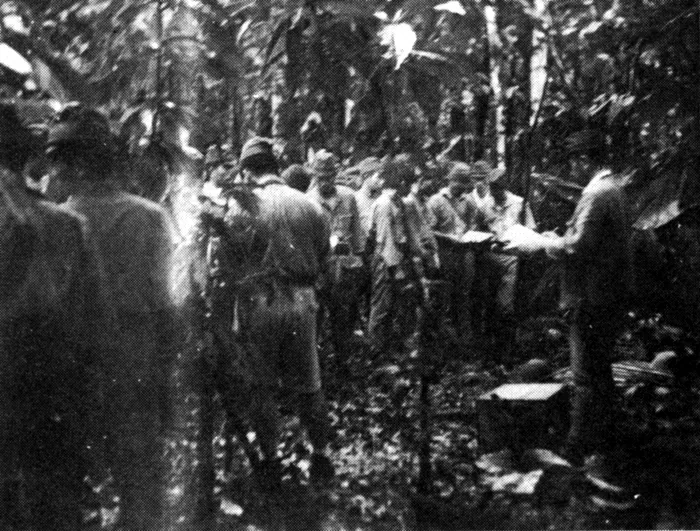
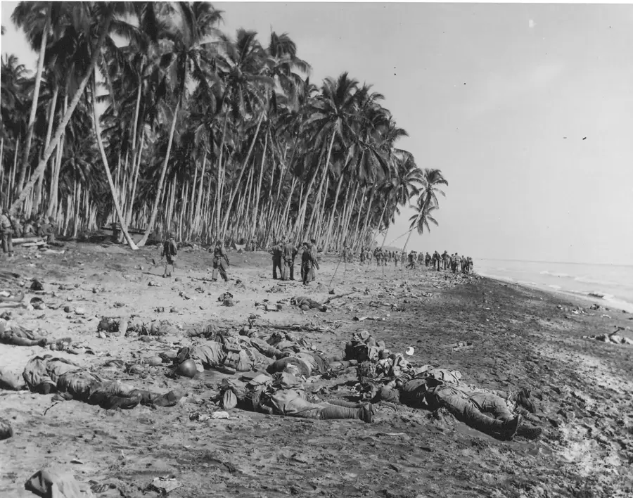
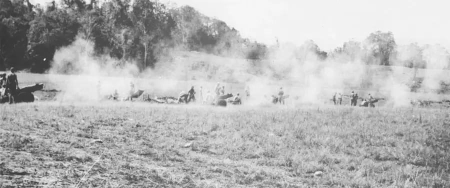
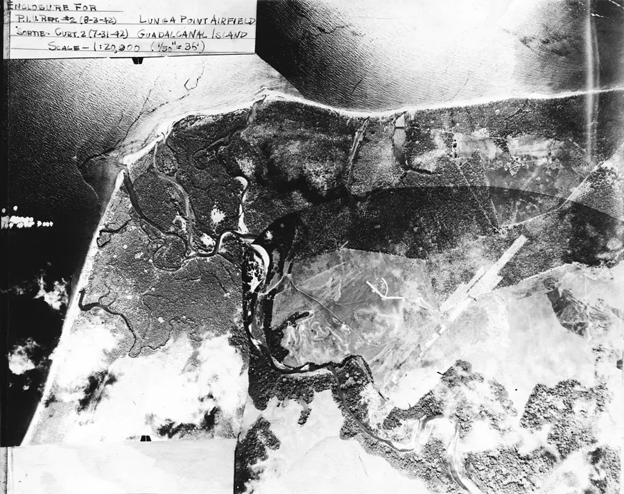
Bloody Ridge, formally known as Edson's Ridge, is a coral limestone ridge located about 1,000 yards south of Henderson Field. It became the site of one of the most critical defensive stands in the Pacific Theater during September 1942. Under the command of Lt. Col. Merritt 'Red Mike' Edson, roughly 800 Marines held the high ground against a determined assault by General Kiyotake Kawaguchi’s 3,500 Imperial Japanese troops. The victory prevented the Japanese from reaching the airfield, which would have likely ended the Allied presence on Guadalcanal. The fighting on the nights of September 12 and 13 was characterized by intense close-quarters combat and devastating artillery barrages. In 2017, the site was officially inaugurated as the Bloody Ridge National Peace Park, serving as a memorial to the thousands of lives lost and a symbol of the enduring peace in the Solomon Islands.
- Location: Solomon Islands
- Nearby: Tenaru (6 km)
Best time to visit & climate
The most pleasant time to visit is Jul–Sep.
| Jan | Feb | Mar | Apr | May | Jun | Jul | Aug | Sep | Oct | Nov | Dec | |
|---|---|---|---|---|---|---|---|---|---|---|---|---|
| Avg °C | 27 | 26 | 26 | 26 | 26 | 26 | 26 | 26 | 26 | 26 | 27 | 27 |
| Rain mm | 263 | 305 | 277 | 220 | 214 | 143 | 135 | 114 | 107 | 160 | 167 | 221 |
📋 Practical info
Geography
Facts
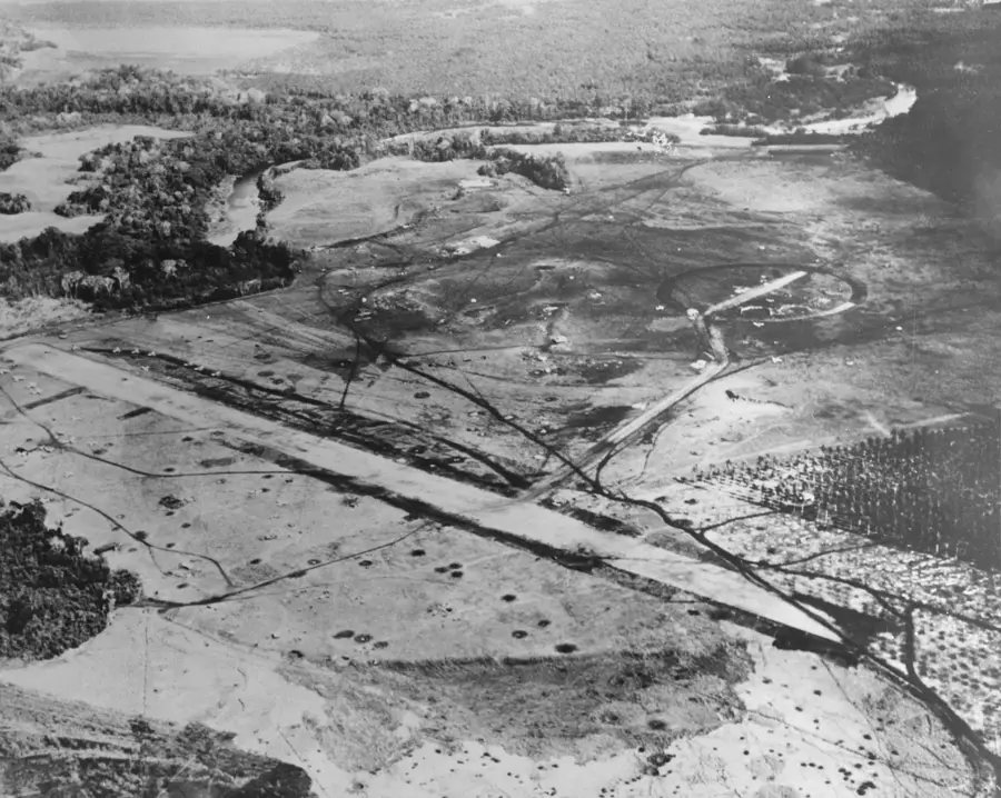
- Located 1,000 yards south of the Lunga River and Henderson Field.
- Colonel Merritt Edson was awarded the Medal of Honor for his leadership here.
- General Kawaguchi’s forces suffered nearly 50% casualties during the assault.
- The ridge provided a natural defensive position overlooking the airfield.
- The site was declared a National Peace Park on the 75th anniversary of the battle.
- Artifacts and foxholes are still visible to visitors along the hiking paths.
Explore nearby
Notable places around
Route planner — Car & Motorhome
Where do you start? We build the route here, with stops and country notes along the way.
© OpenStreetMap contributors · OpenRouteService
Sights in the town Bloody Ridge (1)
Sights nearby
Frequently asked questions
Why is the place called Bloody Ridge?
Is the site well signposted?
How difficult is the hike?
When is the best time of day to visit?
Is there an entry fee?
Bloody Ridge: where is it located?
Bloody Ridge: when is the best time to visit?
Bloody Ridge: why is it worth visiting?

Nearby cities


History & landmarks

Nature
More places