Plizio Visual Lab
Lungga Plain
Weather…
Water temperature…
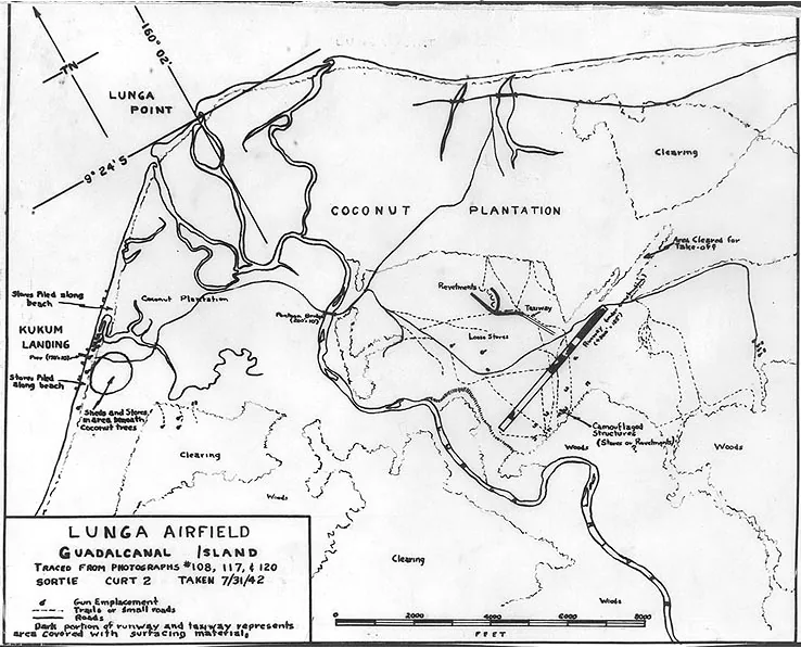
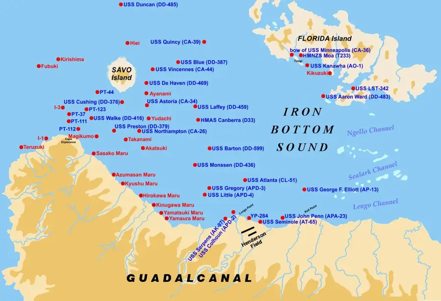
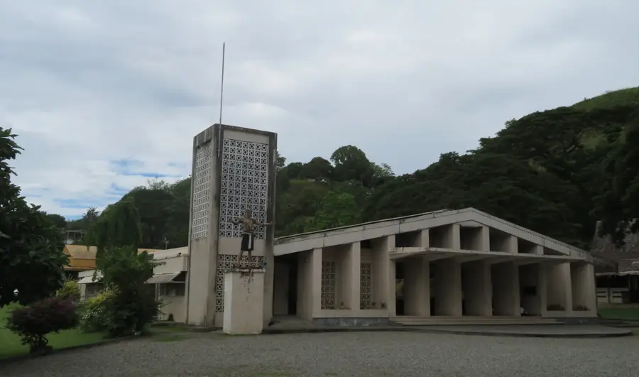
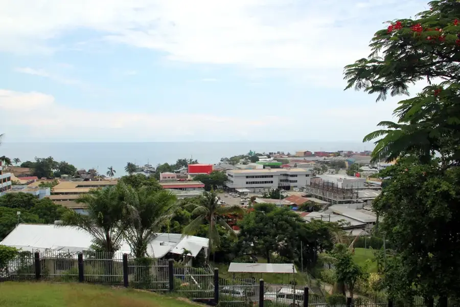
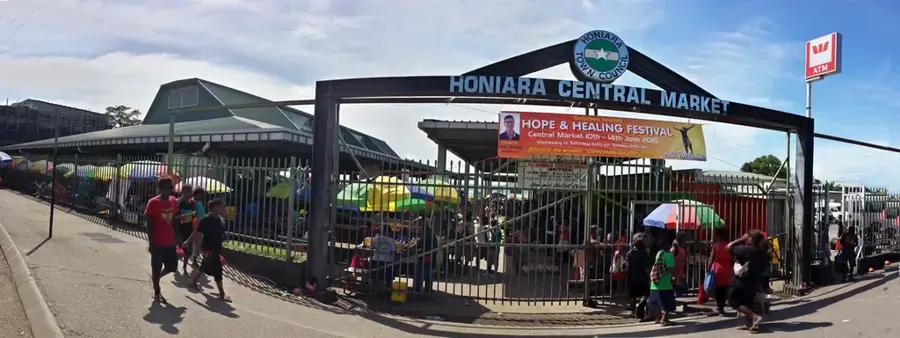
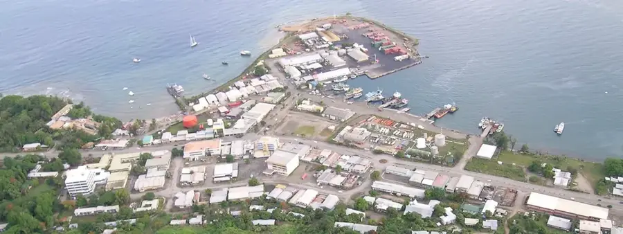
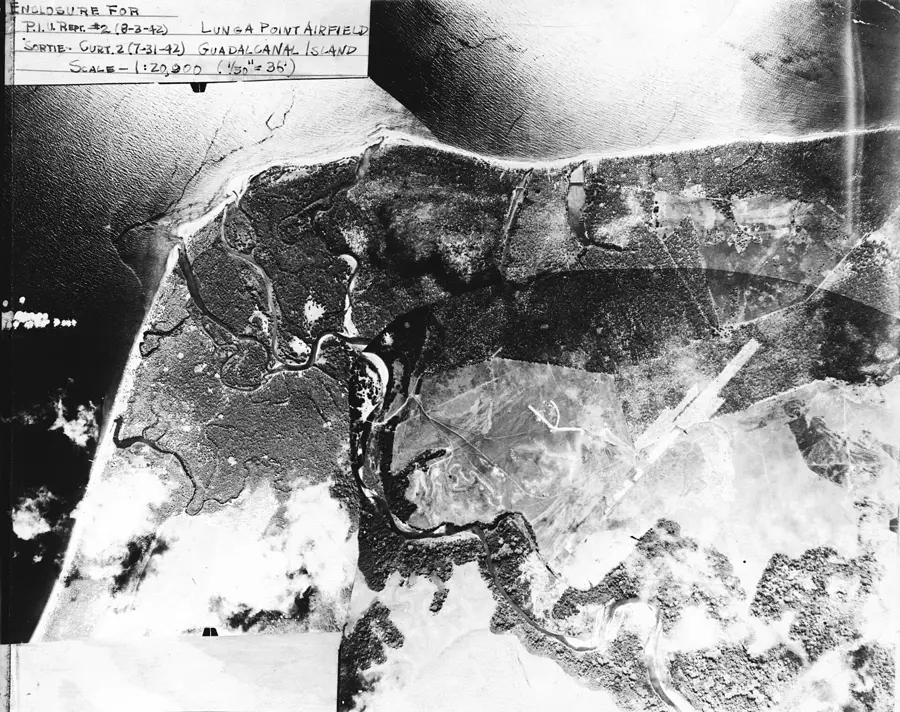
The Lungga Plain is a strategically vital coastal lowland situated on the northern shore of Guadalcanal Island in the Solomon Islands. Bordered to the west by the Lungga River, it was the site of some of the most intense fighting during the Pacific theater of World War II. The plain offered the only flat terrain on the otherwise mountainous island large enough for airfield construction, leading to the creation of what is now Honiara International Airport (formerly Henderson Field). Prior to the war, the area was primarily covered in coconut plantations used for copra production. Control over the Lungga Plain was the decisive factor in the months-long Battle of Guadalcanal in 1942. Today, the plain forms the economic heartland of the Solomon Islands, hosting the capital city, Honiara, along with major industrial zones and residential settlements.
- Location: Solomon Islands
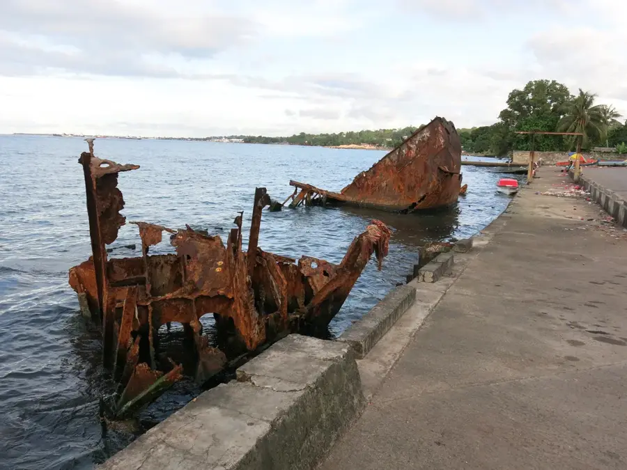
- Top sights: USS Serpens (AK-97) · USS Colhoun (DD-85)
- Nearby: Lungga (5 km)
Best time to visit & climate
The most pleasant time to visit is Jul–Sep.
| Jan | Feb | Mar | Apr | May | Jun | Jul | Aug | Sep | Oct | Nov | Dec | |
|---|---|---|---|---|---|---|---|---|---|---|---|---|
| Avg °C | 27 | 26 | 26 | 26 | 26 | 26 | 26 | 26 | 26 | 26 | 27 | 27 |
| Rain mm | 263 | 305 | 277 | 220 | 214 | 143 | 135 | 114 | 107 | 160 | 167 | 221 |
📋 Practical info
Geography
Facts
- The Lungga Plain covers an area of approximately 30 square kilometers on the north coast.
- The strategic Henderson Field airfield was completed here in August 1942.
- The Lungga River forms the western boundary of the plain and flows into Ironbottom Sound.
- Prior to 1942, the site was home to Lever's Pacific Plantations Ltd, a major copra enterprise.
- Honiara, the capital of the Solomon Islands, was built on this plain after World War II.
- The average elevation of the plain is less than 20 meters above sea level.
Explore nearby
Notable places around
Route planner — Car & Motorhome
Where do you start? We build the route here, with stops and country notes along the way.
© OpenStreetMap contributors · OpenRouteService
Sights in the town Lungga Plain (2)
Sights nearby
Frequently asked questions
How much time is needed to visit Lungga-Ebene?
Are there entry fees for the area?
Is photography allowed on site?
Is Lungga-Ebene accessible?
What is the best time of day to visit?
Lungga Plain: where is it located?
Lungga Plain: what is there to see?
Lungga Plain: when is the best time to visit?
Lungga Plain: why is it worth visiting?

Nearby cities


History & landmarks

Nature
More places