Plizio Visual Lab
Þórsmörk
ℹ️Practical info — Þórsmörk
▾
🌤 Weather — 5 days
📍 Nearby
Sights nearby
💡 Tips
- Do not attempt to drive a regular rental car here; the Krossá river crossing is deep and requires a specialized highland bus.
- The area is a hiker's paradise; consult wardens to choose trails matching your experience level.
- Cell phone reception is very spotty; make sure to download offline maps beforehand.
- The weather in this sheltered valley is often milder than on the coast, but still unpredictable.
- Pack a sturdy pair of hiking boots for the rugged and uneven terrain.
🍽 Food
Enjoy hearty meals like lamb or vegetarian options at the Húsadalur restaurant after a long hike.
Bring your own ingredients to cook at the well-equipped communal kitchen areas.
Pack Icelandic cheese and bread for a scenic lunch break on the trails.
🛍 Shopping · 🧘 Quiet spots
Limited essential supplies and trail snacks are available at the Volcano Huts reception.
Buy a unique Þórsmörk shirt at the main lodges to commemorate your highland trek.
A dramatic and peaceful canyon hike just outside the main valley.
A short but steep hike offering a serene 360-degree panorama of glaciers and valleys.
Wander through the sheltered, quiet woodland paths scattered around the valley.
Water temperature…
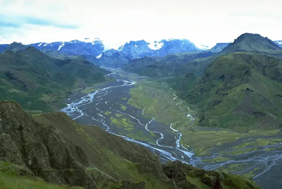
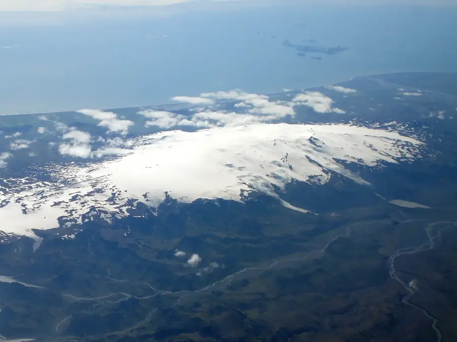
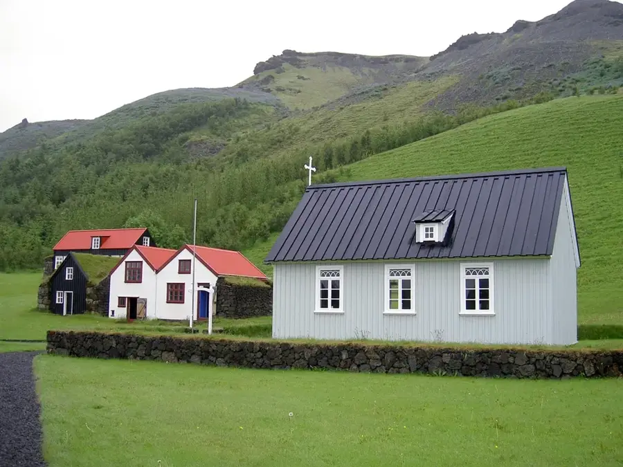
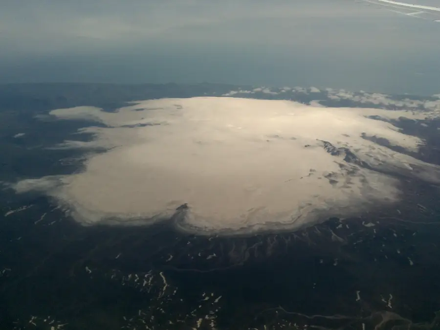
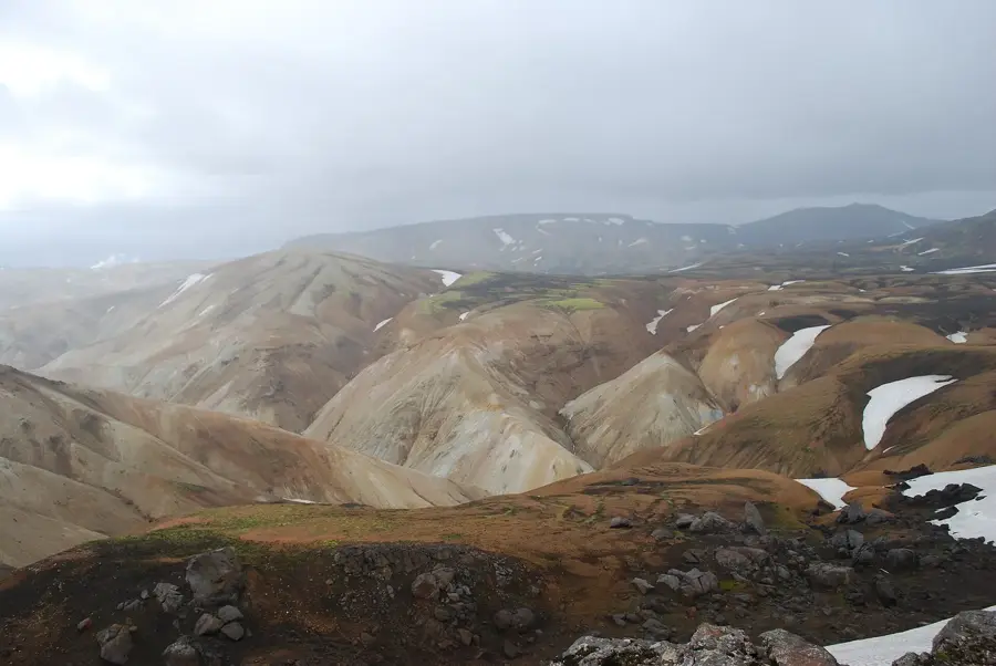
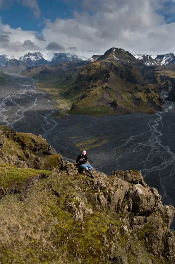
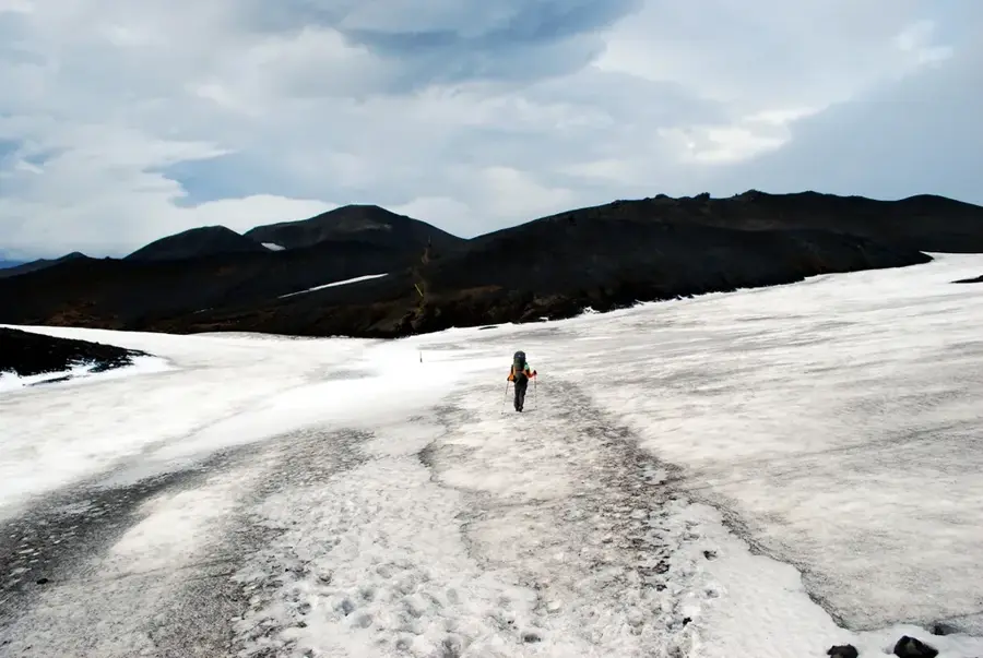
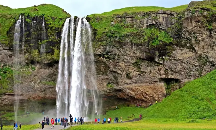
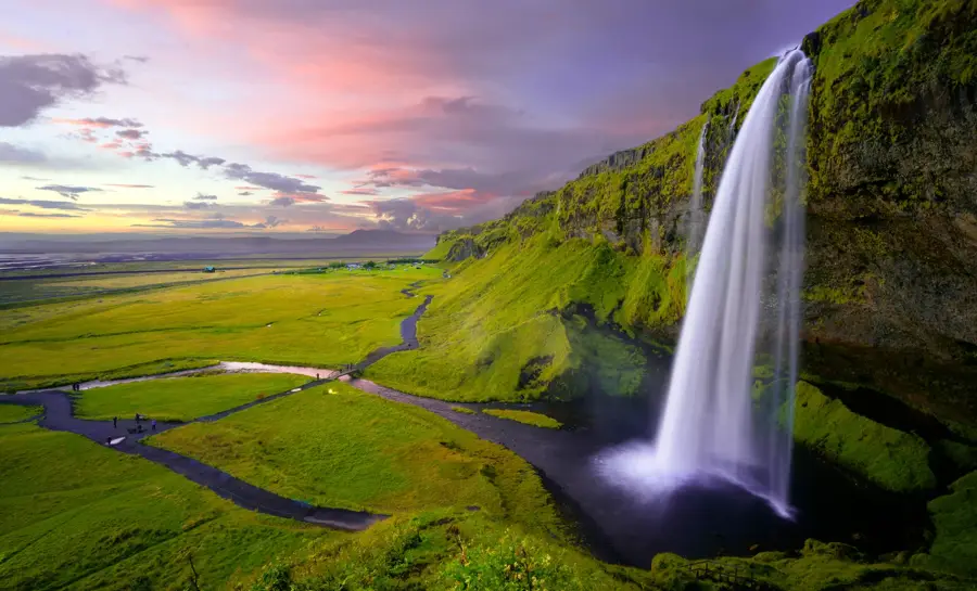
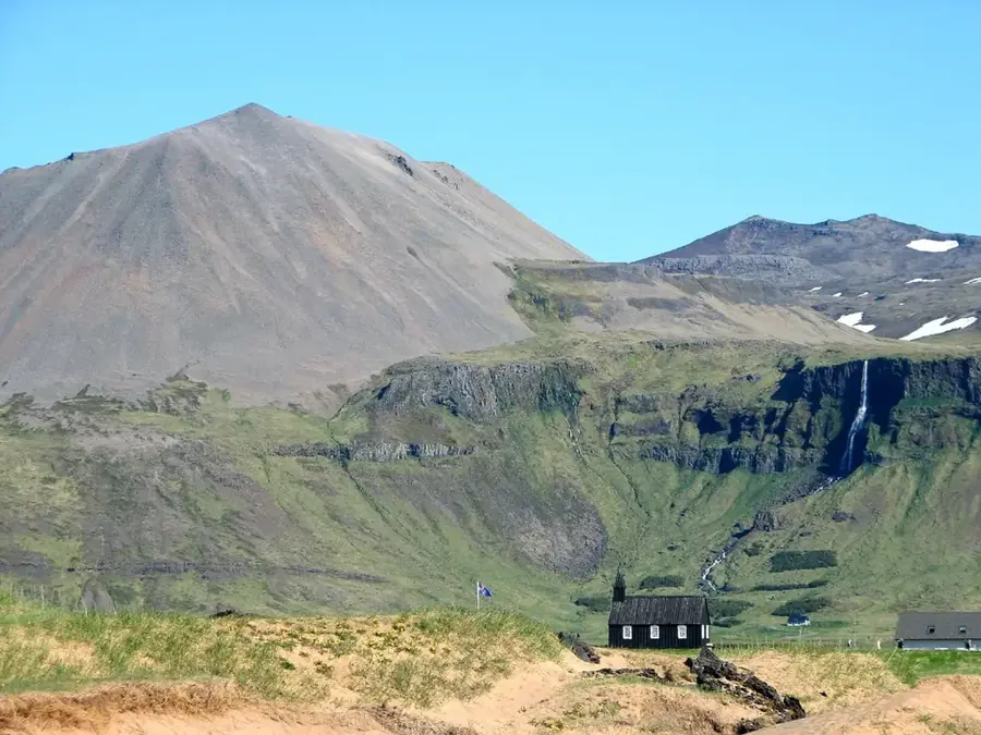
Þórsmörk, or "Thor's Forest," is a striking mountain ridge and valley in Southern Iceland. It is cradled between three glaciers: Eyjafjallajökull, Mýrdalsjökull, and Tindfjallajökull. This sheltered position creates a microclimate that is notably warmer and less windy than the surrounding coast, allowing for lush carpets of moss and thickets of birch trees, a rare sight in the often-barren Icelandic landscape. The valley is a premier hiking destination. One of the most popular trails leads to the top of Valahnúkur, offering a 360-degree panorama of the entire valley and the surrounding ice caps. Þórsmörk is also the southern terminus of the Laugavegur trail and a starting point for the Fimmvörðuháls hike over the volcanic pass. The terrain is defined by jagged ridges, deep canyons, and the temperamental Krossá river that snakes through the valley floor. Reaching Þórsmörk is an adventure in itself, as it requires fording multiple unbridged glacial rivers. Only high-clearance 4WD vehicles (Super Jeeps) or specialized highland buses should attempt the crossing of the Krossá. Accommodation is available in mountain huts and campsites. For those seeking true wilderness and dramatic landscapes, Þórsmörk is one of the most atmospheric places in Iceland.
- Location: Iceland
- Top sights: Útigönguhöfði · Hátindar · Valahnúkur
- Nearby: Vik (37 km)
Best time to visit & climate
The most pleasant time to visit is Jun–Aug.
| Jan | Feb | Mar | Apr | May | Jun | Jul | Aug | Sep | Oct | Nov | Dec | |
|---|---|---|---|---|---|---|---|---|---|---|---|---|
| Avg °C | 0 | 0 | 0 | 2 | 4 | 8 | 9 | 9 | 7 | 4 | 1 | 0 |
| Rain mm | 293 | 268 | 258 | 194 | 136 | 128 | 151 | 176 | 263 | 250 | 250 | 291 |
Geography
Facts
- Glacier valley
- Named after Thor
- Birch forests
- Major hiking hub
- Krossá River
- High-clearance 4WD only
- Eyjafjallajökull views
- Valahnúkur viewpoint
Explore nearby
Notable places around
Route planner — Car & Motorhome
Where do you start? We build the route here, with stops and country notes along the way.
© OpenStreetMap contributors · OpenRouteService
Sights in the town Þórsmörk (3)
Valahnúkur
Mountain in Iceland, a prominent peak in the Þórsmörk region.
Frequently asked questions
Why is it called Þórsmörk?
How do you cross the rivers to Þórsmörk?
Are there buses to Þórsmörk?
Can you camp there?
Which hike is the best?
Þórsmörk: where is it located?
Þórsmörk: what is there to see?
Þórsmörk: when is the best time to visit?
Þórsmörk: why is it worth visiting?

Nearby cities


History & landmarks


Nature
More places