Plizio Visual Lab
Potaro River
Weather…
Water temperature…
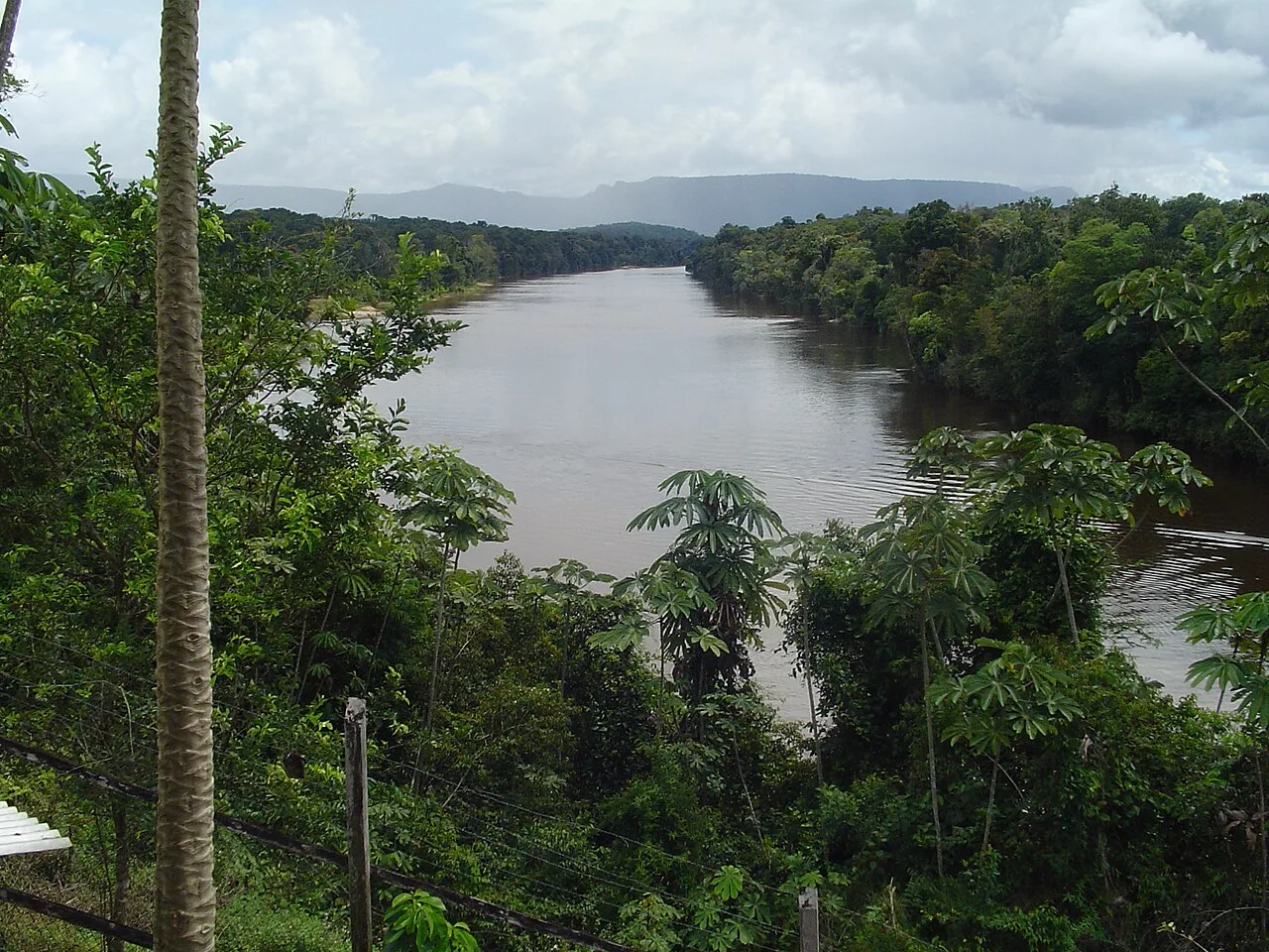
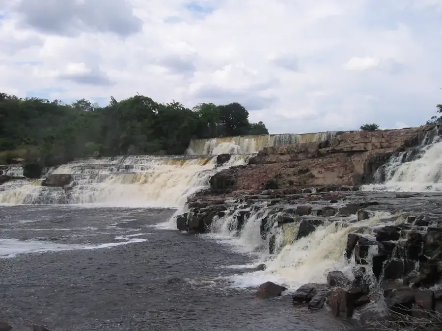
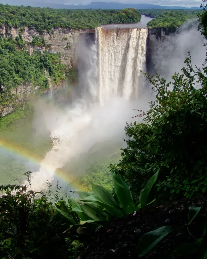
The Potaro River is world-renowned for feeding the magnificent Kaieteur Falls, one of the world's most powerful and highest single-drop waterfalls. Originating from Mount Ayanganna in the Pakaraima Mountains, the river flows for approximately 225 kilometers through some of the most pristine rainforest on the planet. Its journey eastward culminates in its junction with the Essequibo River, Guyana's largest waterway. The river was first officially mapped by geologist Charles Barrington Brown in 1870, whose arrival brought global attention to its natural wonders. Beyond the iconic falls, the Potaro basin is characterized by diverse ecosystems and significant mineral wealth, particularly gold and diamonds. This wealth has spurred a long-standing mining industry that coexists with conservation efforts within the Kaieteur National Park. The river is also culturally significant to the indigenous Patamona people, who have lived in its basin for generations. The Potaro remains a vital symbol of Guyana's raw natural beauty and a key focus for both hydroelectric potential and environmental preservation.
- Location: Guyana
- Nearby: Iwokrama Forest (60 km)
Best time to visit & climate
The most pleasant time to visit is Mar, Sep, Oct.
| Jan | Feb | Mar | Apr | May | Jun | Jul | Aug | Sep | Oct | Nov | Dec | |
|---|---|---|---|---|---|---|---|---|---|---|---|---|
| Avg °C | 26 | 26 | 27 | 27 | 26 | 25 | 25 | 26 | 27 | 27 | 27 | 26 |
| Rain mm | 149 | 108 | 92 | 139 | 284 | 265 | 251 | 178 | 84 | 81 | 117 | 179 |
📋 Practical info
Geography
Facts
- The Potaro River flows for a total of 225 kilometers.
- It is the source of Kaieteur Falls, which is about 741 feet high.
- The river originates from Mount Ayanganna, the second-highest peak in Guyana.
- It was named by the indigenous people, with meanings related to the local terrain.
- The river basin is a significant habitat for the Guianan Cock-of-the-rock bird.
- Potaro is one of the most important tributaries of the Essequibo River.
Explore nearby
Notable places around
Route planner — Car & Motorhome
Where do you start? We build the route here, with stops and country notes along the way.
© OpenStreetMap contributors · OpenRouteService
Sights nearby
Frequently asked questions
Is the Potaro River famous for waterfalls?
How do you reach the river and the falls?
Are there rare animals there?
Is bathing allowed in the Potaro River?
How is the climate on the Potaro?
Potaro River: where is it located?
Potaro River: when is the best time to visit?
Potaro River: why is it worth visiting?

Nearby cities
History & landmarks
Nature
More places