Plizio Visual Lab
Kaieteur Plateau

Weather…
Water temperature…
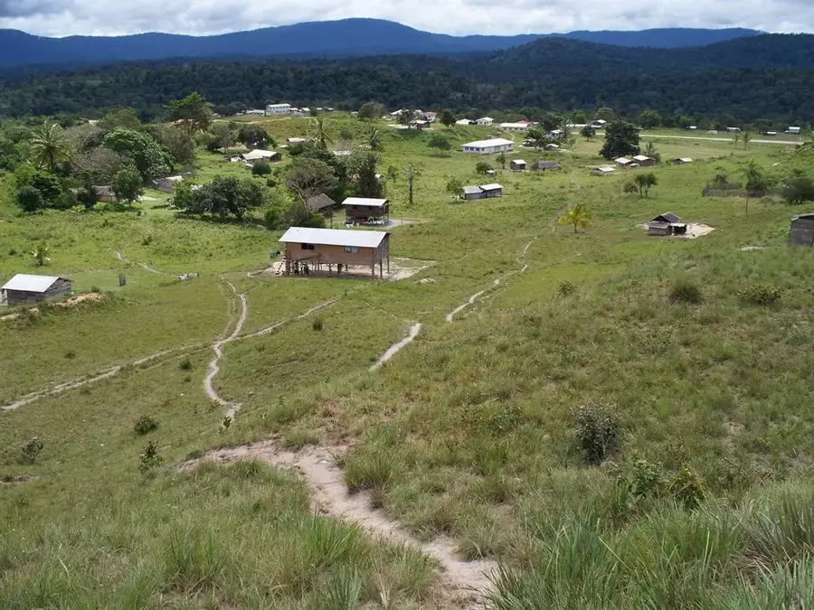
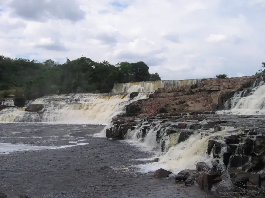
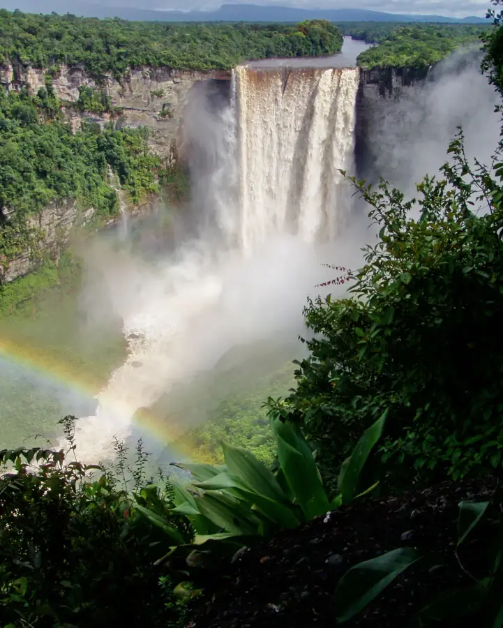
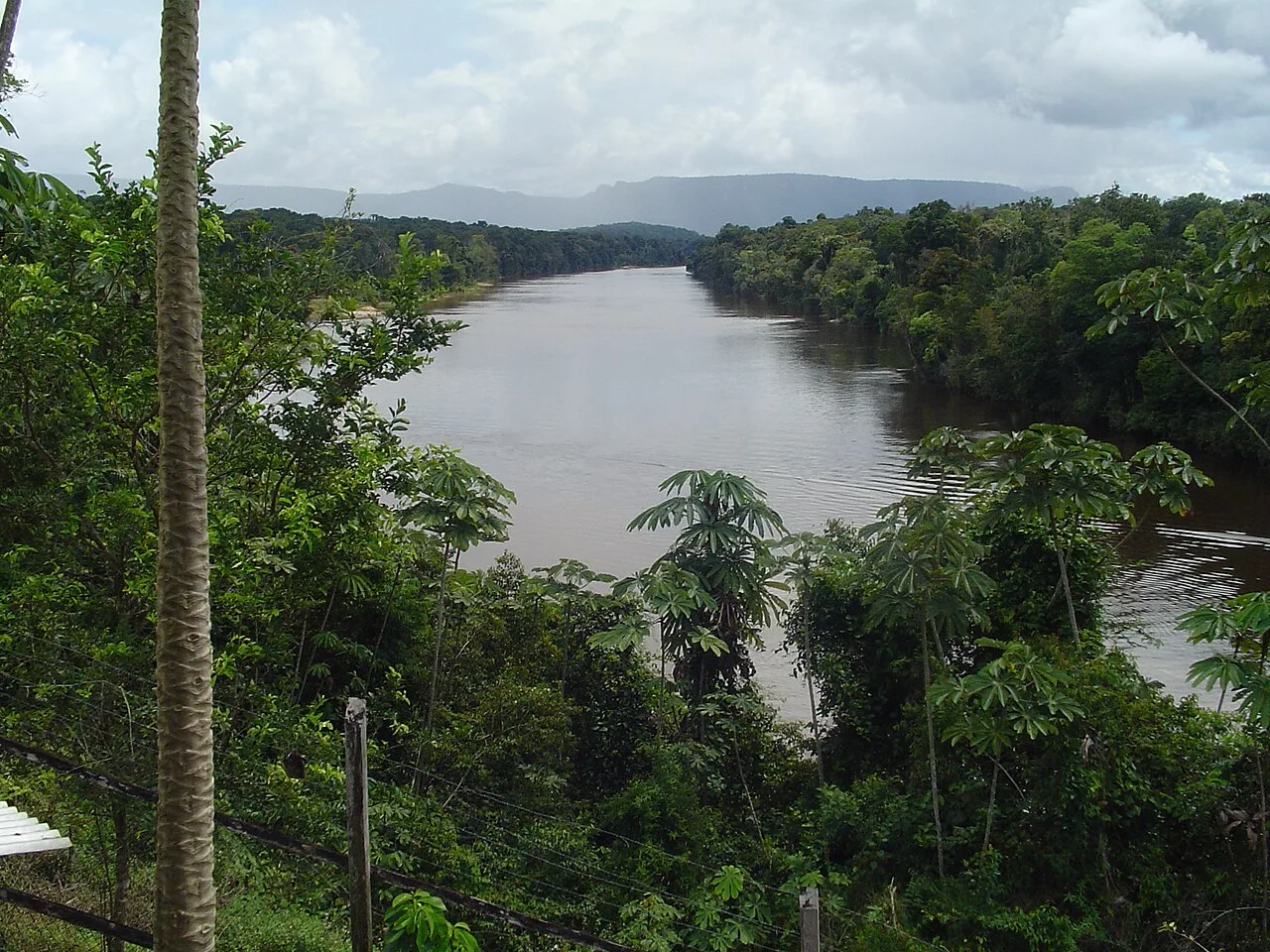
The Kaieteur Plateau in central Guyana is a prominent sandstone upland, world-famous primarily for the spectacular Kaieteur Falls. Geologically, the plateau belongs to the Roraima Supergroup and consists of resistant Precambrian quartz sandstones and conglomerates. The Potaro River plunges here over a massive ledge 226 meters deep into a gorge, making the falls one of the most powerful single-drop waterfalls on Earth. The vegetation on the plateau is adapted to sandy, nutrient-poor soils and includes specialized carnivorous plants as well as the rare Golden Rocket Frog. A large part of the plateau is protected as Kaieteur National Park, which was established as early as 1929, making it one of the oldest protected areas in South America. Historically, the area is closely linked to the legends of the Patamona indigenous people, who revere the plateau as a sacred site. The climate is characterized by high humidity and frequent rainfall, which sustains the dense cloud forest at the edge of the gorge. Its remoteness has helped keep nature here in a nearly pristine state.
- Location: Guyana
- Nearby: Paramakatoi (40 km)
Best time to visit & climate
The most pleasant time to visit is Feb, Mar, Oct.
| Jan | Feb | Mar | Apr | May | Jun | Jul | Aug | Sep | Oct | Nov | Dec | |
|---|---|---|---|---|---|---|---|---|---|---|---|---|
| Avg °C | 24 | 24 | 25 | 25 | 24 | 23 | 23 | 24 | 24 | 25 | 25 | 24 |
| Rain mm | 89 | 65 | 54 | 123 | 254 | 284 | 237 | 190 | 88 | 69 | 87 | 98 |
📋 Practical info
Geography
Facts
- Kaieteur Falls is approximately five times higher than Niagara Falls.
- The national park covers an area of 627 square kilometers.
- Brocchinia micrantha, a giant bromeliad, grows frequently on the plateau.
- The annual rainfall on the plateau can exceed 4,000 mm.
- The name Kaieteur comes from a chief named 'Kai' who sacrificed himself.
- The plateau lies at an average elevation of about 400 meters.
Explore nearby
Notable places around
Route planner — Car & Motorhome
Where do you start? We build the route here, with stops and country notes along the way.
© OpenStreetMap contributors · OpenRouteService
Sights nearby
Frequently asked questions
What is the main attraction on the Kaieteur Plateau?
How do you get to the plateau?
Are there special animals on the plateau?
Can you stand at the edge of the waterfall?
How long does a typical visit last?
Kaieteur Plateau: where is it located?
Kaieteur Plateau: when is the best time to visit?
Kaieteur Plateau: why is it worth visiting?

Nearby cities
History & landmarks
Nature
More places