Plizio Visual Lab
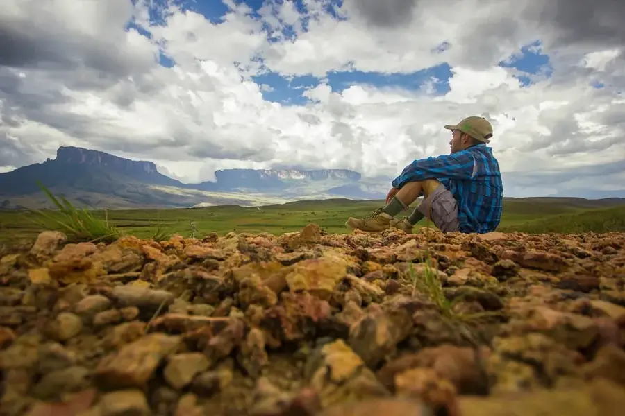
Mount Roraima
Weather…
Water temperature…
Mount Roraima is the most famous tepui (table-top mountain) in South America, marking the triple border point between Guyana, Brazil, and Venezuela. Standing at 2,810 meters at its highest point, the mountain features sheer vertical cliffs that rise dramatically from the surrounding savannah and rainforest. Geologically, Roraima is part of the ancient Guiana Shield, with its sandstone formations dating back over two billion years. This extreme isolation over millennia has created a unique biological environment, often referred to as a 'Lost World,' where a significant portion of the flora and fauna are found nowhere else on Earth. Notable endemics include the Roraima bush toad and various species of carnivorous plants. The mountain inspired Sir Arthur Conan Doyle's 1912 novel 'The Lost World' and remains a site of immense scientific interest. For the indigenous Pemon people, Roraima holds deep spiritual significance as the 'Mother of All Waters,' giving rise to numerous major rivers. Its summit is a surreal landscape of blackened rock formations, crystal-lined valleys, and perpetual mist, making it one of the most iconic natural wonders in the world.
- Location: Guyana
- Top sights: Valley of Crystals · Roraiminha viewpoint · La Fosa
- Nearby: Kamrang (74 km)
Best time to visit & climate
The most pleasant time to visit is Jan–Mar.
| Jan | Feb | Mar | Apr | May | Jun | Jul | Aug | Sep | Oct | Nov | Dec | |
|---|---|---|---|---|---|---|---|---|---|---|---|---|
| Avg °C | 21 | 22 | 22 | 23 | 22 | 21 | 21 | 21 | 22 | 22 | 22 | 22 |
| Rain mm | 51 | 39 | 41 | 121 | 252 | 290 | 238 | 202 | 103 | 71 | 84 | 67 |
📋 Practical info
Geography
Facts
- Mount Roraima is 2,810 meters (9,219 feet) high.
- The summit plateau is about 9 miles long and 31 square kilometers in area.
- It is the highest point in the Pakaraima chain of tepuis.
- The cliffs of the mountain are approximately 400 meters high.
- The mountain's name in the Pemon language means 'Great Blue-Green'.
- It is home to the Roraima bush toad, a species that cannot hop.
Explore nearby
Notable places around
Route planner — Car & Motorhome
Where do you start? We build the route here, with stops and country notes along the way.
© OpenStreetMap contributors · OpenRouteService
Sights in the town Mount Roraima (4)
El Elefante
Rock formation on Mount Roraima resembling an elephant.
Sights nearby
Frequently asked questions
How long does a trek to Roraima take?
Is a guide required?
What is special about the flora?
When is the best time to visit?
Where exactly is the mountain located?
Mount Roraima: where is it located?
Mount Roraima: what is there to see?
Mount Roraima: when is the best time to visit?
Mount Roraima: why is it worth visiting?

Nearby cities
Nature
More places