Plizio Visual Lab
Bartica
ℹ️Practical info — Bartica
▾
🌤 Weather — 5 days
📍 Nearby
Sights nearby
💡 Tips
- The quickest access is by speedboat from Parika; pack your belongings in waterproof bags as the ride can be wet.
- Explore the bustling waterfront area where miners and traders gather, especially bustling in the morning.
- Bring plenty of Guyanese dollars in cash, as ATM availability can sometimes be unreliable.
- Apply insect repellent, particularly in the evenings, due to the close proximity of the rivers and jungle.
🍽 Food
Try this spicy local staple at a simple waterfront eatery.
Look for local diners serving freshly caught and fried river fish.
A hearty traditional breakfast pastry available at local bakeries.
🛍 Shopping · 🧘 Quiet spots
Visit the lively daily market for fresh tropical fruits and local ingredients.
Local goldsmiths sell regional gold, but always verify quality before purchasing.
A sandy river beach that features a peaceful spot to relax during weekdays.
Find a quiet bench along the bank to watch the river traffic and sunset.
Water temperature…
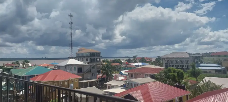
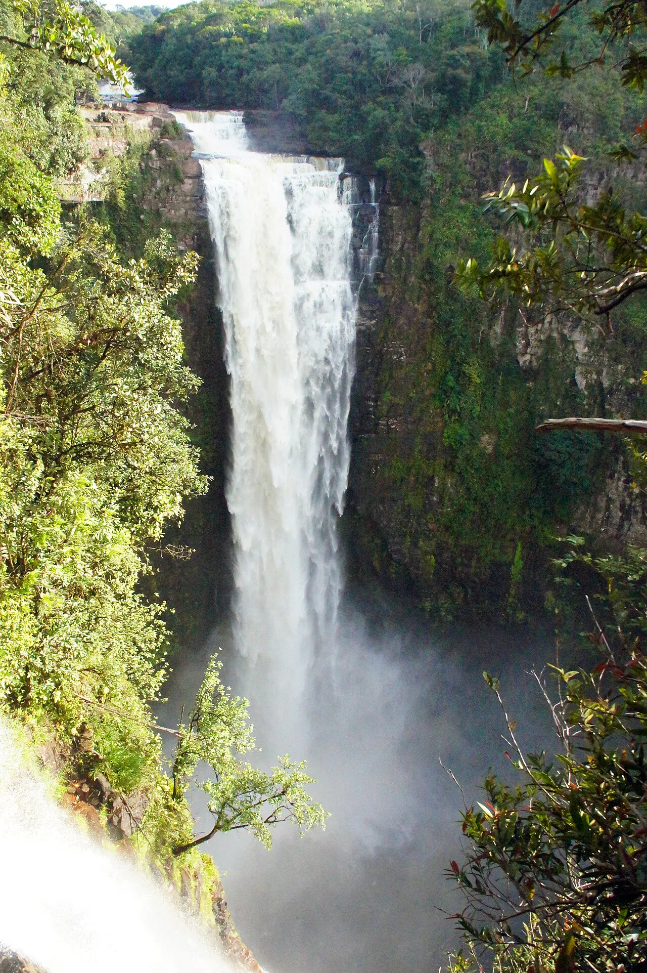
Bartica is widely known as the 'Gateway to the Interior' of Guyana, occupying a sweeping and strategic position at the confluence of the Essequibo, Mazaruni, and Cuyuni rivers. This unique geography has made the town the indispensable logistics and transportation hub for the nation's gold and diamond mining industries. The name Bartica is derived from an indigenous Amerindian word meaning 'red earth,' a nod to the distinct laterite soil found throughout the area. Founded in 1837 as an Anglican mission, Bartica was officially commissioned as a town as recently as 2016 and serves as the administrative capital of Region 7 (Cuyuni-Mazaruni). The town's lively, frontier-like atmosphere is fueled by the constant movement of miners, traders, and river commuters. Its waterfront is the heart of the community, lined with jetties where speedboats and ferries connect the town to Parika and the remote mining camps of the interior. Cultural life in Bartica peaks during the annual Bartica Regatta, a major national festival held during the Easter weekend featuring high-octane powerboat races and cultural pageants. Beyond its commercial role, Bartica is a burgeoning eco-tourism destination, providing access to natural wonders like the Marshall Falls and riverbound resorts. Historically, the town is near the ruins of Fort Kyk-Over-Al, the 17th-century Dutch seat of government for the Essequibo colony. Bartica is also a pioneer in sustainable development, having been designated as Guyana’s first 'Green Town,' an initiative focused on integrating renewable solar energy and eco-friendly infrastructure into urban planning. The town's multi-ethnic population is known for its hospitality and resilience, maintaining a bustling commercial center equipped with banks, schools, and hospitals that serve the entire riverine region.
- Location: Guyana
- Top sights: NDIA pump · Self acting door · Church of Christ
- Nearby: Baganara Island (5 km)
- Population: ~11.486 (2026)
Best time to visit & climate
The most pleasant time to visit is Mar, Sep, Oct.
| Jan | Feb | Mar | Apr | May | Jun | Jul | Aug | Sep | Oct | Nov | Dec | |
|---|---|---|---|---|---|---|---|---|---|---|---|---|
| Avg °C | 25 | 25 | 26 | 26 | 26 | 25 | 25 | 26 | 26 | 26 | 26 | 26 |
| Rain mm | 166 | 116 | 97 | 141 | 295 | 267 | 262 | 175 | 89 | 88 | 146 | 216 |
Geography
Facts
- Bartica is located at the junction of the Cuyuni, Mazaruni, and Essequibo rivers.
- The town was founded by the Anglican Church Missionary Society in 1837.
- It was officially proclaimed a town on May 7, 2016.
- The Bartica Regatta includes the prestigious 'Miss Bartica Regatta' pageant.
- It serves as the administrative center for Region 7 (Cuyuni-Mazaruni).
- The surrounding area is famous for its rich deposits of alluvial gold.
- Marshall Falls, a popular day-trip destination, is accessible by boat from Bartica.
- The town features a 1.5-megawatt solar farm as part of its green initiative.
Explore nearby
Notable places around
Route planner — Car & Motorhome
Where do you start? We build the route here, with stops and country notes along the way.
© OpenStreetMap contributors · OpenRouteService
Bartica is wonderful to explore on foot. Start at the busy waterfront where boats from the interior dock. A short walk leads you to the 2008 Tragedy Monument. Then visit the local market to see the diversity of the region. Enjoy lunch at one of the small restaurants right on the riverbank. Spend the afternoon at Golden Beach, the pride of the city. The sand and the warm river water will invite you to stay. It is a relaxed tour that brings you closer to the charm of this frontier town.
Exploring Bartica by bike gives you the freedom to see the lesser-known corners of the town. Start at the Regatta site for a great panoramic view. Cycle through the inner town trails to observe the daily life of the residents. The path leads you to the edge of the jungle, where trails to the falls begin. After a picnic in the greenery, slowly return to the town. The ride along the river is especially pleasant when the wind blows. It is a tour for explorers who want to see more than just the busy center.
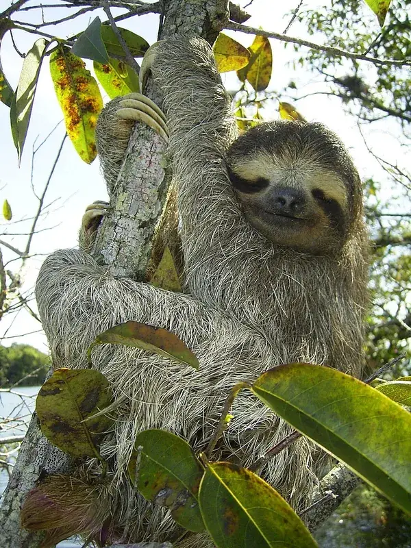
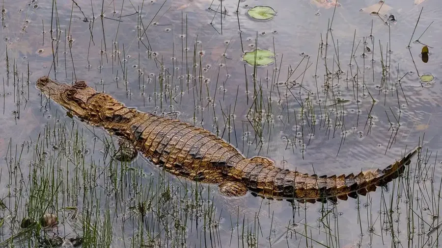
This car tour leads you to the highlights around Bartica. Start at the airstrip, the logistical hub of the region. From there, drive to the pier for Sloth Island. Spend the morning and lunch on the island, a paradise for animal lovers. The short boat ride is part of the experience. In the afternoon, drive to a viewpoint from where you can see the ruins of Kyk-Over-Al in the river. It is a place full of history. To wrap up, enjoy the sunset at one of the city's best viewpoints before returning to the center.
Sights in the town Bartica (7)
Frequently asked questions
Why is Bartica called the 'Gateway to the Interior'?
How do I get from Parika to Bartica?
When does the Bartica Regatta take place?
What can you visit in the surrounding area?
Are there internet and banking services in Bartica?
Bartica: where is it located?
Bartica: what is there to see?
Bartica: when is the best time to visit?
Bartica: why is it worth visiting?

Nearby cities
Nature
More places